
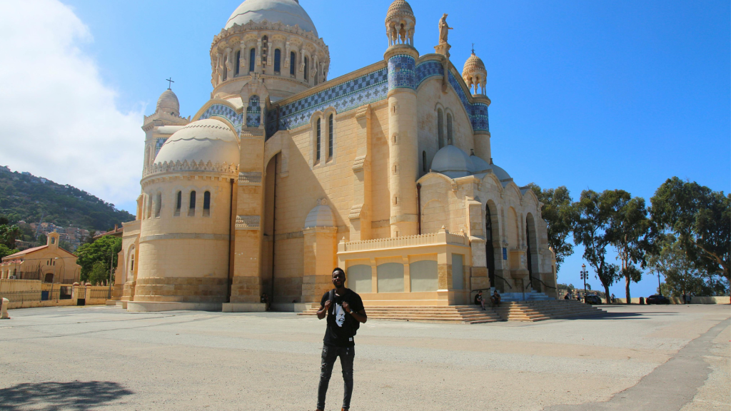

If you only have time for a few Algerian cities, start with Algiers, Oran and Constantine in the north, add Tlemcen or Annaba for history, and fly south to Ghardaïa in the M'zab Valley to see a Saharan town that is still lived in the way it was laid out centuries ago. Below are the ten cities and towns we suggest to first-time visitors, what to see in each, and how to get between them.
Algeria is big (about 2.38 million km²), so plan on at least one domestic flight. Think of this page as the city chapter of our complete Algeria travel guide, which covers visas and safety in more detail.
The Casbah, the bridges and the M'zab: where to start
For a first trip, give Algiers two or three days for the Casbah and the bay, then two days each in Oran (raï, the Santa Cruz fort), 4.5 to 5 hours away on the Coradia train, and Constantine (the bridges over the Rhumel gorge), about an hour away by air.
A flight of about 1 hour 15 minutes takes you from Algiers to Ghardaïa and the walled towns of the M'zab Valley, while Timimoun and Djanet are the Sahara choices, best from October to April. The northern cities are at their best in spring and autumn, and Djanet needs about a week.
1. Algiers: the capital and the Casbah
Algiers is the capital and the city where most international flights land. It climbs steeply from the bay: white apartment blocks and the old Casbah on the hillsides, the port and the arcaded seafront boulevards below.
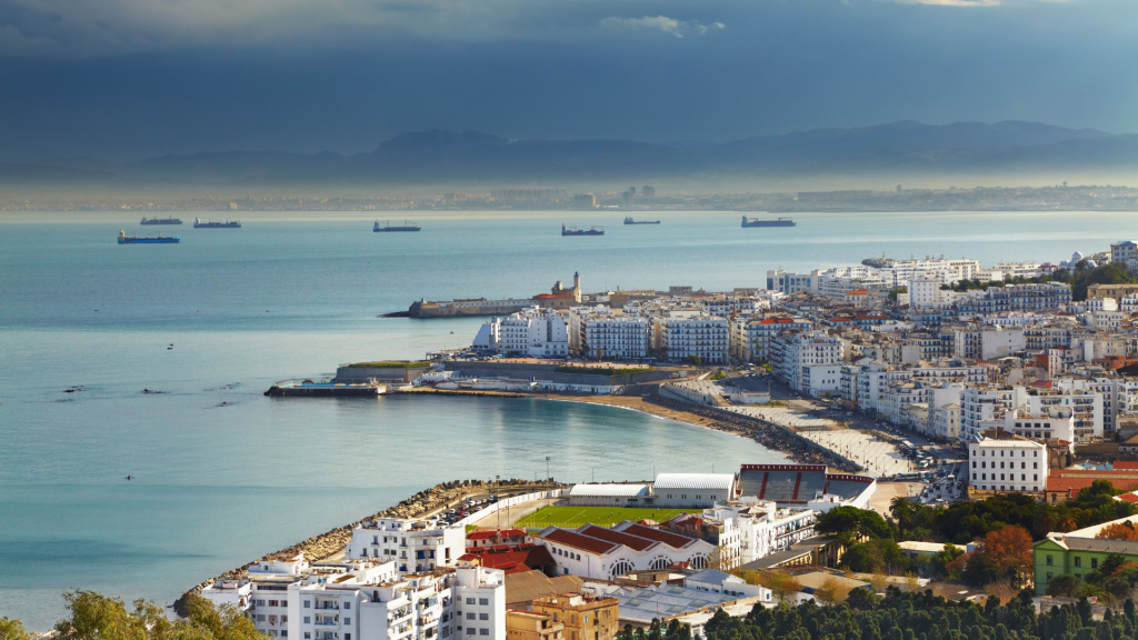
Walking it takes stamina, because many streets turn into stairs. What you get for the climb: Ottoman houses and mosques up in the Casbah, French-built boulevards below, and out on the bay east of the center Djamaa El Djazaïr, whose minaret, at 265 m, is the world's tallest. Our list of things to do in Algiers has fifteen ideas if you are staying more than a day.
Inside the Casbah
UNESCO put the Casbah on its World Heritage list in 1992. It grew from a town founded in the 10th century, and most of what you see today dates from the Ottoman period: the citadel at the top (built 1516 to 1592) and the tall houses built around inner courtyards. The lanes are narrow, steep and often stepped.
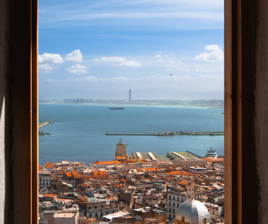
You can wander the lower streets alone, but a good local guide is worth it here: a guide knows which restored houses and palaces are open and can explain the district's part in the war of independence, above all the Battle of Algiers in 1956 and 1957. Many houses are in poor repair, so expect scaffolding and closed lanes.
In the lower Casbah, look for the small woodworking and copper workshops and the pastry shops. The Casbah is only one of several old towns in the country, and our guide to medinas in Algeria also covers Ghardaïa, Tlemcen and Nedroma.
Architecture of the White City
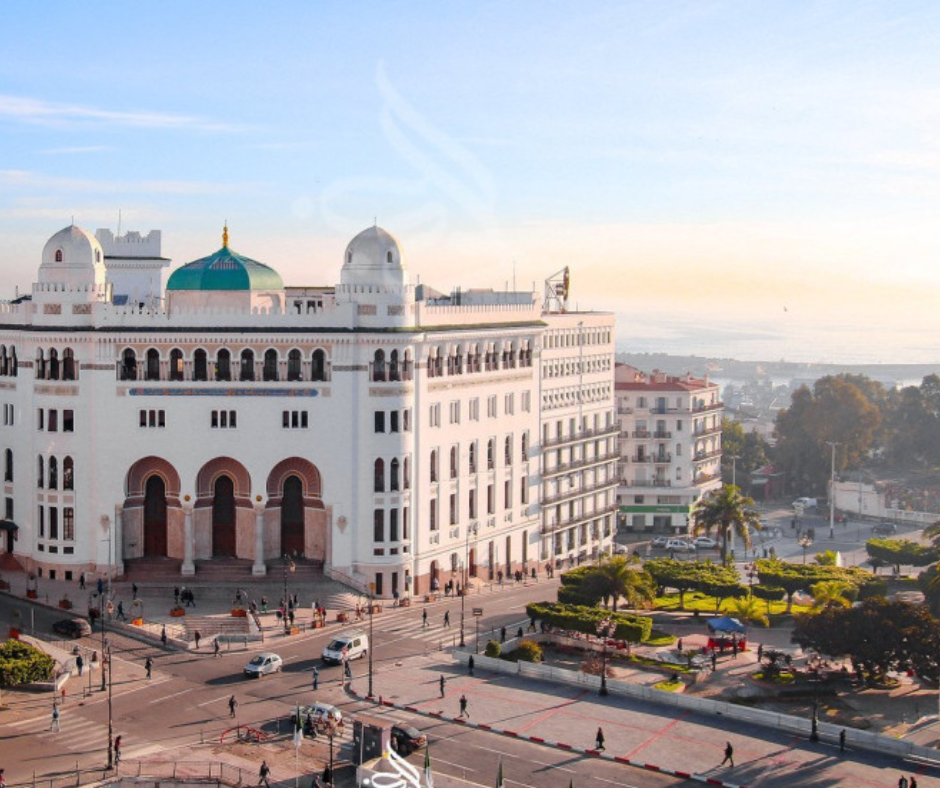
Below the Casbah, the French built a new center in the 19th and early 20th centuries. Start at La Grande Poste, the white neo-Moorish post office that opened in 1913 and is still the city's favorite meeting point. Its interior has been closed for restoration since 2019, so you see it from the square outside.
From there, the metro runs to Jardin d'Essai station for the Jardin d'Essai du Hamma, a botanical garden founded in 1832 that covers about 32 ha of palms, ficus and other exotic trees (entry is a small fee). Next to the garden, a short cable car (running in the latest reports) climbs to the Maqam Echahid, the 92 m Martyrs' Memorial inaugurated in 1982, with the Mujahid museum underneath and a view over the whole bay.
Tipaza, about 70 km west along the coast (allow an hour and a quarter by road), makes an easy day trip for its Roman ruins by the sea, and the best things to do in Tipaza include a seafood lunch at the port.
2. Oran: raï, Spanish forts and the seafront
Algeria's second city feels more relaxed than Algiers, especially in the evening. Two strands of its past show up quickly.
Spain held Oran for most of the years from 1509 to 1792 (with a break in the early 18th century), which is why Spanish forts stand beside Ottoman mosques in the old quarter, and the surrounding region is where raï grew up in the early 20th century, a music UNESCO put on its intangible heritage list in 2022. It is also one of the five coastal cities in Algeria we think deserve a few days of your trip.
The center is a grid of wide French-era boulevards with café terraces. Don't expect European-style nightlife, though: most evenings here are spent walking, eating and sitting in cafés.
Santa Cruz fort and the Spanish years
Oran's best-known landmark is the Santa Cruz fort, high on Mount Murdjadjo above the port. The Spanish built it between 1577 and 1604, and the chapel beside it, with a statue of the Virgin facing the city, was added in the 19th century. It's about 15 minutes up the mountain road by taxi. The city's cable car to the top of Murdjadjo went back into service in 2023 after nearly ten years out of action, but check that it is running before you count on it.
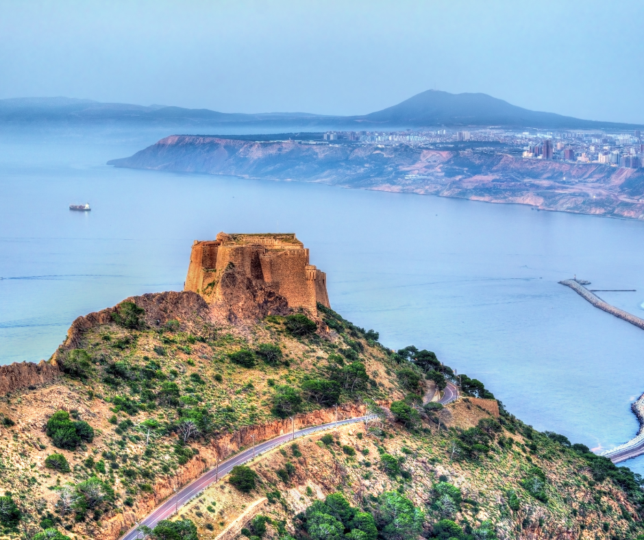
From the top you see the whole Gulf of Oran: the port, the old Sidi El Houari quarter by the water and the modern city spreading east along the coast. The light is best in the late afternoon.
The Front de Mer and Oran's street food
In the center, the Front de Mer is a long boulevard along the top of the cliff above the port, lined with early 20th-century apartment buildings. Around the center, look for karantika (also written calentica or garantita), a baked chickpea-flour flan sold by the slice, often in bread with cumin and harissa. Oran treats it as its own dish; the story that it came from the Spanish garrison is probably legend.
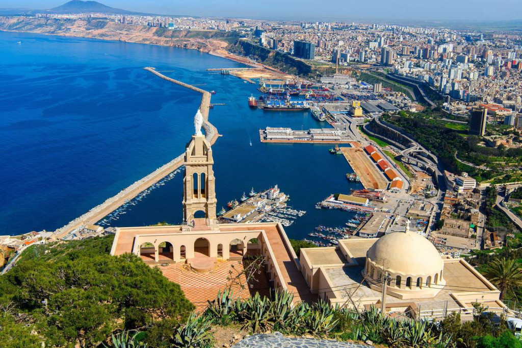
As evening comes, families and groups of friends walk the promenade for the sea breeze. Raï is wedding and party music as much as concert music, so live shows are easiest to find in summer; ask at your hotel what's on. The Bey's Palace, the old Sidi El Houari quarter and the Ahmed Zabana museum round out Oran's best sights.
3. Constantine: the city of bridges
Constantine is built on a block of limestone that the Rhumel river cuts off on several sides with a gorge close to 200 m deep at its deepest. Bridges and footbridges join the old town on the rock to the districts around it. As Cirta, it was the capital of Massinissa's Numidian kingdom in the 2nd century BC.
The rock made it a natural fortress: the French army failed to take it in 1836 and only succeeded on its second attempt, in 1837.
The bridges over the Rhumel
Walking the bridges is the main reason people come, and each gives a different view of the gorge. Sidi M'Cid is the one that makes people stop halfway: a suspension bridge opened in 1912, hanging about 175 m above the river, with the gorge dropping away beneath you and open countryside beyond.

The Mellah Slimane footbridge (1925) is the one locals cross on foot every day; you reach it by an elevator or stairs, and it leads into the old town. For scale, look at the Sidi Rached viaduct, finished in 1912: 447 m long, with 27 stone arches, the biggest spanning 70 m. The newest crossing, the cable-stayed Salah Bey viaduct, opened in 2014.
The Palace and the Great Mosque
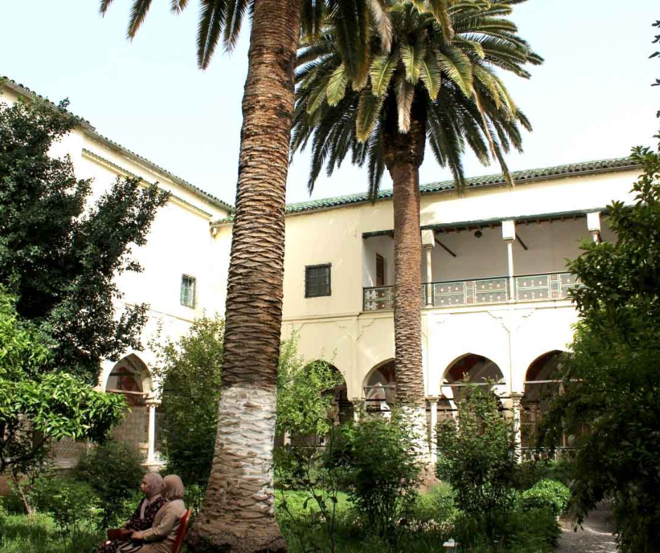
Back on the rock, the Palace of Ahmed Bey was built between about 1825 and 1835 for the last bey of Constantine. Its walls are covered in painted murals, and its courtyard gardens are a quiet break from the traffic and the cliffs outside.
Across town, the Emir Abdelkader Mosque, completed in 1994 beside the Islamic university of the same name, is one of the largest mosques in Algeria. Its two minarets, about 107 m tall, can be seen from much of the city, and the prayer hall is finished in marble. The Cirta Museum and the Mausoleum of the Numidian Kings are two more reasons to stay a second night, and we cover them with the rest of the things to do in Constantine.
4. Ghardaïa and the walled towns of the M’zab
Ghardaïa sits about 600 km south of Algiers where the Sahara begins, in a valley UNESCO inscribed on its World Heritage list in 1982. Its walled towns are still lived in much as they were planned, which is why architects and planners still come to study them.
The Mozabites, Amazigh Ibadi Muslims, founded the valley's five fortified towns, known together as the Pentapolis, between about 1012 and 1350. El Atteuf is the oldest; the others are Bounoura, Melika, Ghardaïa and Beni Isguen. They were built from local stone, lime and palm wood, with thick walls and small openings against the heat, and with strict rules for sharing scarce water.
The Geometry of the Ksour
Ghardaïa is the largest of the five and the valley's market town. Its houses climb a hill in rings around the mosque at the top, packed tightly but arranged so that each one gets light and air.
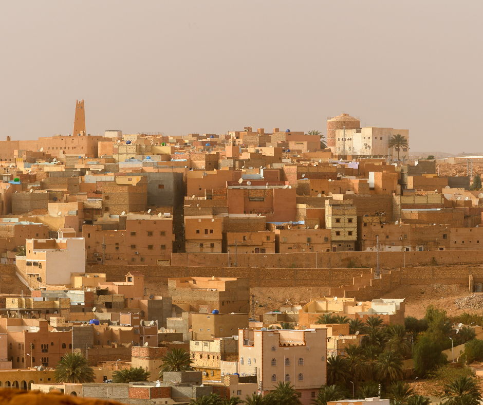
The forms are plain and geometric, painted in whites, ochres and pale blues, and Le Corbusier, who visited in the 1930s, took ideas from them. In the market square, traders sell dates, spices and the valley's hand-woven wool carpets.
Visiting the M'zab: rules and guides
The Mozabite communities keep strict rules for visitors, and Beni Isguen is the strictest: you go in only with a local guide from the main gate, visitors leave at sunset, and outsiders don't sleep inside. Cover shoulders and legs, don't smoke, and don't photograph people, especially women. Some areas are off-limits to cameras altogether. We'd take a guide in the other towns too.
A guide can also explain the water system that keeps the palm groves green with almost no rain: dams on the wadi catch the rare floods and share the water out through channels, and wells tap the water table those floods recharge. A night in a guesthouse in the palm grove is much quieter than a hotel in town. Summer is very hot, so we'd come between October and April.
5. Tlemcen: Andalusian heritage in the far west
Tlemcen is in the hills of the far northwest, about 140 to 170 km by road southwest of Oran (around two hours, depending on the route) and close to the Moroccan border, which has been closed since 1994. It was the capital of the Zayyanid kingdom from the 13th to the 16th century and a center of learning, and its mosques and palaces are in the same Moorish style as those of Andalusia and Fez.
At about 840 m it has cool, wet winters, but summer afternoons are as hot as on the coast, and olive groves cover the slopes around it.
The Mechouar and the Great Mosque
The center of Tlemcen's history is El Mechouar, the citadel of the Zayyanid sultans from the 13th century. The palace inside was rebuilt in 2010 and 2011, for Tlemcen's year as Capital of Islamic Culture, with new carved stucco and tilework in the Andalusian style. It is a reconstruction, not the original building, but it gives a fair idea of how the court looked.
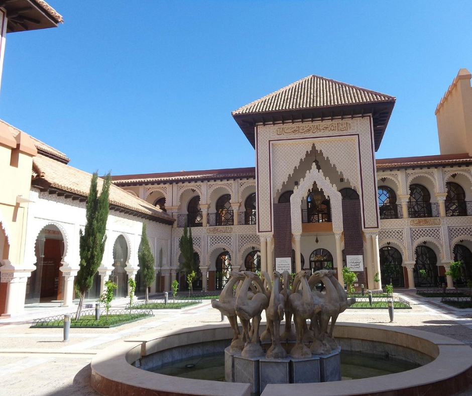
A short walk away, the Great Mosque of Tlemcen was founded in 1082 by the Almoravid ruler Yusuf ibn Tashfin and enlarged in 1136, the date inscribed in the dome in front of the mihrab; the Zayyanids added the minaret in 1236. That carved plaster dome is the thing to see, one of the finest pieces of Almoravid decoration still standing.
The Ruins of Mansourah and the Cascades
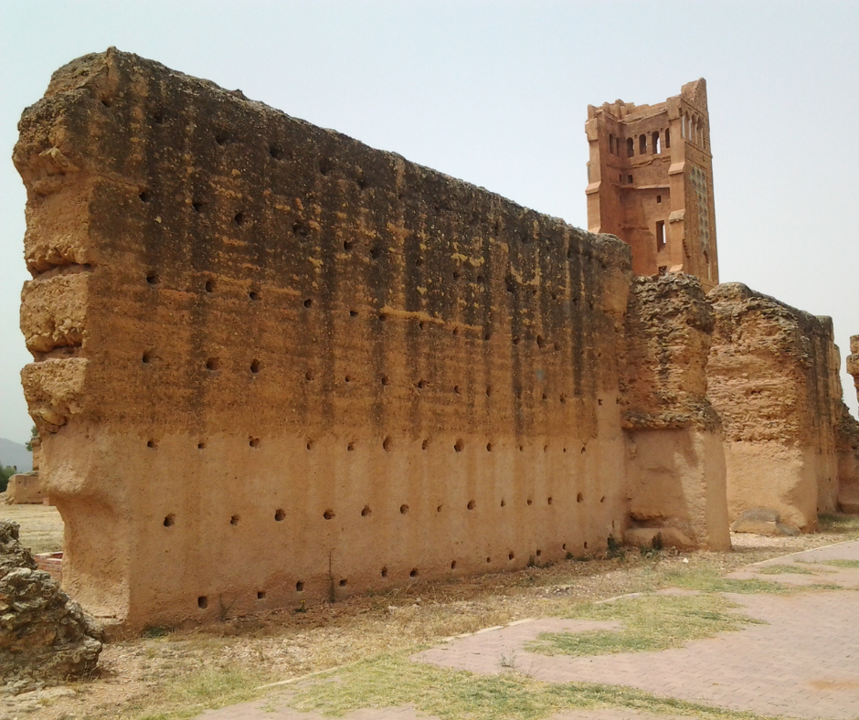
On the western edge of town are the ruins of Mansourah, the walled camp-city the Marinid sultans of Fez built while they besieged Tlemcen between about 1299 and 1307. The most striking piece left is the minaret of its mosque, about 38 m tall and partly collapsed, alone among the fields and the remains of the walls.
About 7 km east of town, the El Ourit waterfalls drop in steps down a pine-covered gorge inside Tlemcen National Park; they run best in spring. The railway viaduct over the gorge, built around 1890, is credited to Gustave Eiffel and known locally as the Eiffel bridge. The Sidi Boumediene complex and the Lalla Setti plateau, whose cable car reopened in July 2026, also rank among Tlemcen's top sights.
6. Annaba: Hippo Regius and the northeast coast
Up in the far northeast near the Tunisian border, Annaba is a port city with a Roman site on its edge and beaches along the coast north of the center. It is also where the train from Tunis arrives, three times a week since the line reopened in 2024.
In antiquity it was Hippo Regius, where Saint Augustine was bishop and where he died in 430, during the Vandal siege. Today it is a university town and an industrial port, with the El Hadjar steelworks just outside, and its town beaches start a few kilometers from the center.
The Ancient Ruins of Hippo Regius
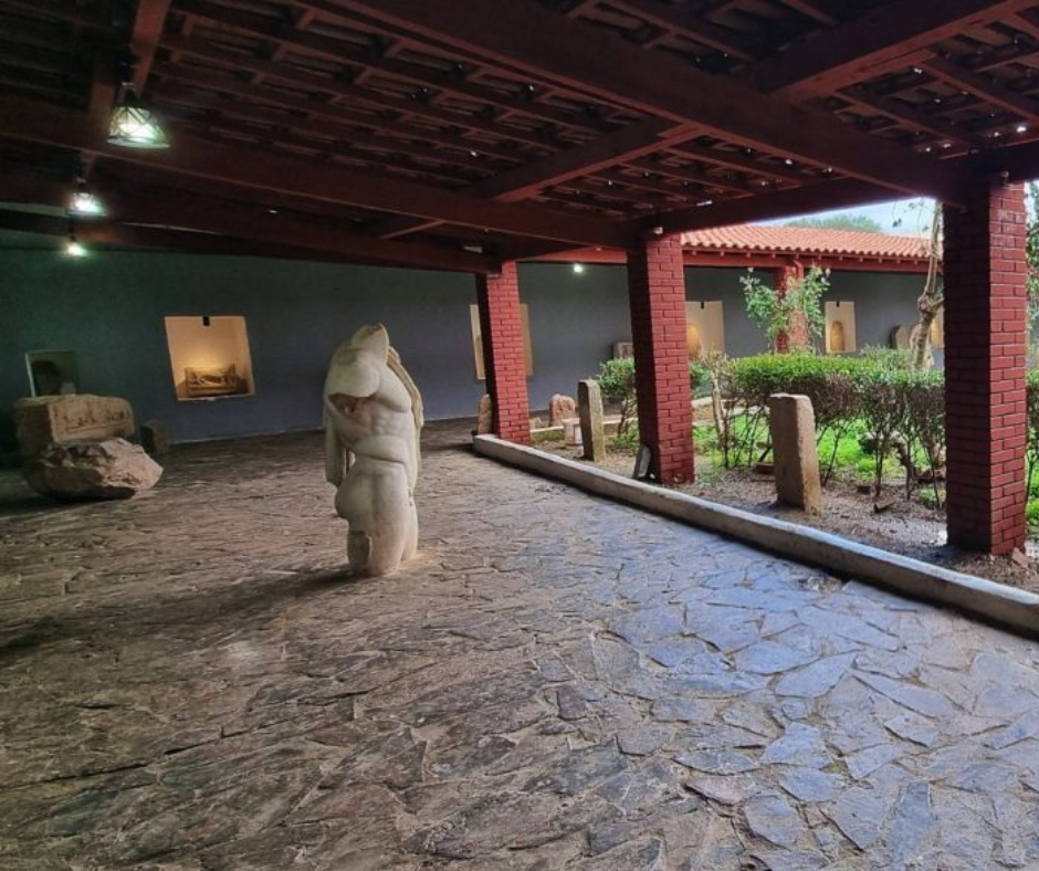
The ruins of Hippo Regius lie at the foot of a hill just south of the modern center. You can walk the old streets past the remains of villas, baths, a theater and a forum that is among the largest found in North Africa, and the small museum on the site holds mosaics found in the excavations.
The Basilica of Saint Augustine, built between 1881 and 1900, stands on the hill above the ruins. Its style mixes Roman-Byzantine and Moorish elements, and from the terrace you look over the ruins, the city and the sea.
Coastal Life at Cours de la Révolution
The center of social life in Annaba is the Cours de la Révolution, a wide promenade almost a kilometer long, laid out in the colonial era and lined with trees and café terraces. It fills up in the late afternoon, when people come out for a coffee or a walk before dinner.
For the sea, follow the Corniche north of the center: Saint-Cloud and Rizzi Amor (still often called Chapuis) are about 3 km out, and Aïn Achir, our pick for sand, about 7 km. For cooler air, go up to Seraïdi, a village at about 850 m in the Edough hills above the city, usually several degrees cooler than the coast. A cable car, back in service since July 2025, runs up to Seraïdi, one of the highlights in our guide on what to do in Annaba.
7. Béjaïa: Gouraya National Park and Cap Carbon
On a wide bay east of Algiers, Béjaïa is about four hours from the capital by bus or train (the train is often late), and its airport has domestic flights and links to France. In summer, ferries sail here from Marseille and Sète. It was the Hammadid capital from 1067, and the old town climbs the slope behind the harbor.
Most of what you come for is above the town. Gouraya National Park, created in 1984 and a UNESCO biosphere reserve since 2004, covers the headland. A trail climbs to the Yemma Gouraya fort at about 660 m, and Barbary macaques live on the slopes; at the end of the headland, the Cap Carbon lighthouse (1906) stands about 220 m above the sea. Our Bejaia guide covers the hike and the beaches below it.
Two days is enough: one for the park and the lighthouse, one for the beaches around the bay. June and September give you warm sea without the August crowds.
8. Jijel: caves and the corniche road
Further east, Jijel is a smaller port known for the coves along its coast road and for the Grottes Merveilleuses at Ziama Mansouriah, about 35 km west of town on the RN43 corniche. The caves were found in 1917 during road building and stay at about 18°C all year, a cool stop on a hot day.
The drive from Béjaïa is half the point: the RN43 follows cliffs and small beaches most of the way. Jijel gets crowded in July and August, when Algerian families fill the beaches, so June or September is calmer. One or two nights is plenty, and it pairs well with Béjaïa or with Constantine, inland to the southeast.
9. Timimoun: the red oasis of the Gourara
If you have time for the deep south, two Saharan towns complete our ten. Timimoun, under two hours by air from Algiers, is a red-ochre oasis town in the Gourara, at about 288 m. Its palm gardens are watered by foggaras, underground channels that carry groundwater to the plots, and the town is known for Ahellil singing, on UNESCO's intangible heritage list since 2008.
The big local event is the Sbuâ pilgrimage to the zawiya of Sidi El Hadj Belkacem in the week after Mawlid (UNESCO 2015), around 21 to 22 August in 2027, in full summer heat. Otherwise come between October and April and allow two or three days: one for the town and the foggaras, the rest for the ksour and dunes around it. Timimoun is one of the southern wilayas where an organized trip with an approved agency qualifies for the Sahara visa on arrival.
10. Djanet: gateway to the Tassili n'Ajjer
Djanet, in the far southeast, is a palm oasis below the cliffs of the Tassili n'Ajjer, a little over two hours by air from Algiers. Up on the plateau are about 15,000 rock engravings and paintings, on the UNESCO list since 1982. Southeast of town, the Tadrart Rouge adds orange dunes and rock towers reached by 4x4.
Plan on about a week: several days of 4x4 driving and short walks, or a trek up onto the plateau with donkeys carrying the gear. The season runs from about October to April. Trips here are run with an approved Algerian agency, which is also what makes you eligible for the visa on arrival for Sahara tours. Ours run with a licensed Algerian agency and local Tuareg guides; before you book one, read the official travel advice in force for your route and confirm that your travel insurance covers it.
Also worth a detour: Timgad, Djemila and the Hoggar
Two of Algeria's best Roman towns lie inland in the northeast, and both have been UNESCO sites since 1982. Timgad, founded by Trajan in AD 100 about 35 km east of Batna, still shows an almost complete street grid, and the Trajan Hotel is about 80 m from the gate. Djemila, the Roman Cuicul, is up in the hills at about 900 m, roughly 50 km northeast of Sétif. Sétif is on the Algiers to Constantine railway, so Djemila fits easily into a trip east, and entry to either site costs a few hundred dinars.
In the deep south, Tamanrasset is about two and a half hours by air from Algiers and the base for the Hoggar, inside the Ahaggar Cultural Park. Most visitors drive up to the Assekrem plateau (about 2,726 m) to watch sunrise over the peaks from beside the hermitage Charles de Foucauld built in 1911. Go between October and April with an approved agency; the same check on official travel advice and insurance applies as for Djanet.
Getting between Algeria's cities
Distances are long: Algiers to Oran or to Constantine is roughly 400 km by road, and Ghardaïa is about 600 km south. We usually combine domestic flights for the long hops with trains or a driver in the north.
Ghardaïa is about an hour and a quarter from Algiers by air and Timimoun under two hours, on Air Algérie or its subsidiary Domestic Airlines (formerly Tassili Airlines). In the north, SNTF's Coradia trains run from Algiers to Oran in about 4.5 to 5 hours and are often late; for Constantine, the one-hour flight is much quicker than the train.
Many travelers on our city trips say Algiers, Oran and Constantine turned out calmer and friendlier than they had imagined. Keep your passport on you, since hotels ask for it and so do the routine police checkpoints. A local SIM is worth having, with Mobilis strongest in the south, though the signal drops in the mountains and the desert.
Choosing your cities
Which city looks the most spectacular?
Constantine, on its rock above the Rhumel gorge with bridges in every direction. Algiers wins for the white city stacked over the bay, and Ghardaïa for architecture.
Which are the biggest cities?
Algiers by a long way, then Oran in the west and Constantine in the east, all three with international flights. Annaba, Béjaïa, Sétif and Batna are the other large northern cities you are likely to pass through.
Where should a first trip start?
Algiers. Most international flights land there, it has the Casbah, the museums and the bay, and it is the hub for domestic flights to the south. After two or three days, carry on to Oran or Constantine by train or plane.
Can I see all ten in one trip?
Only if you enjoy airports: you would spend most of the trip in transit.
Is it easy to get from one city to the next?
Yes, with some patience. Domestic flights link Algiers with most cities on this list, the Coradia train runs Algiers to Oran in about 4.5 to 5 hours, and coaches and shared taxis cover the rest. Trains are often late, so leave slack in your plan, and book flights to the south early in winter.
With a week, pick one region: Algiers plus Oran and Tlemcen in the west, or Algiers plus Constantine and Annaba in the east. With two weeks, add Ghardaïa or a Sahara trip from Timimoun or Djanet. Spring and autumn suit the north best, and the south is a winter trip. Tell us which cities you want to see and we will shape the route around them, with a driver at the airport, transfers between cities and a local guide in each one.


