


Most of what's worth doing in Jijel lies along the RN43 corniche west of town: the beach and islands at El Aouana (about 20 km), the Grottes merveilleuses and Red Beach at Ziama Mansouriah (35 to 40 km), and the oak forests of Taza National Park on the slopes above them, where Barbary macaques sit by the roadside. Give it two or three days, ideally in June or September, when the sea is warm and the July and August crowds have either not arrived yet or gone home.
From Algiers it's a 40-minute hop on Air Algérie to Ferhat Abbas airport. Once you're there, a car or a driver makes life much easier, because the sights are strung out along 40 km of winding coast road. Jijel tends to be one stop on a longer route, and our travel guide to Algeria is the place to plan the rest of it.
What does a Jijel trip take?
| Trip detail | In Jijel |
|---|---|
| Location | Northeast coast, about 98 km east of Béjaïa and 150 km northwest of Constantine |
| Time to allow | Two to three days |
| Swimming or hiking | June and September for swimming, April to June for hiking |
| Beaches | About 50, with lifeguards on the authorized ones from June to September |
| Wheels | Hire a car or a driver: the sights sit along 40 km of corniche |
Things to do on the Jijel coast
El Aouana Beach and Its Island
About 20 km west of town, El Aouana, called Cavallo in colonial times, ranks among the busiest beaches on this coast. The sand is pale, the water is clear, and pine-covered hills rise behind the beach. A small rocky island sits about 1 km offshore. In summer there are lifeguards, parking and food stalls, and boats take people out to the island and the sea caves under the cliffs.
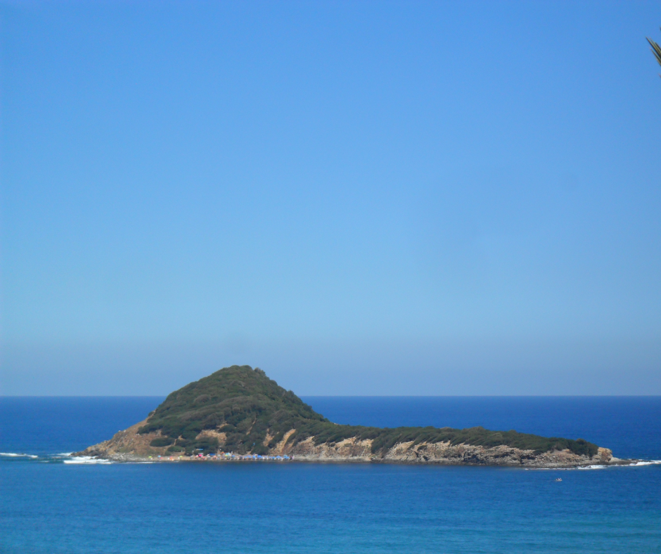
It is also packed in July and August, when families drive in from Constantine, Sétif, Batna and further afield, and the hotels fill early. Arrive before about 10:30 to get parking and space on the sand. Bring a hat, sunscreen and something to cover up with when you walk to the shops and cafés behind the beach.
Red Beach (Plage Rouge) and the Coves of Ziama Mansouriah
Red Beach, known locally as La Plage Rouge or La Terre Rouge, is in the Ziama Mansouriah municipality, on the corniche roughly 35 to 40 km west of Jijel. It takes its name from its reddish sand and rocks, and a small rocky islet sits just offshore. The water is shallow over the rocks, good for wading and photos. In July and August the corniche backs up with traffic, so get there early.
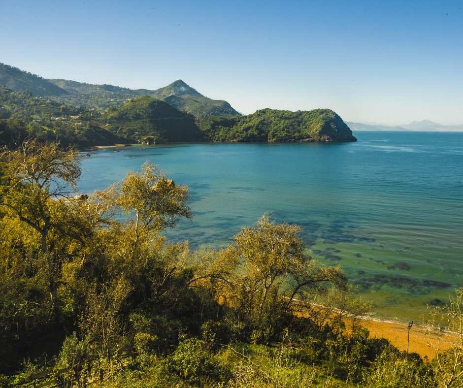
The smaller coves around Ziama Mansouriah are quieter, but most of them mean a short, steep scramble down rocky paths, so wear shoes with real grip. There are no facilities and no lifeguards. Carry your own water and food, and only swim when the sea is calm.
Other beaches around Jijel
The wilaya has about 50 beaches, and 23 of them are supervised in summer. These are the ones visitors ask about most, from the town outward.
| Beach | Where | What it's like |
|---|---|---|
| Kotama | Jijel town | The town beach: easy to reach, busy with families, cafés nearby |
| La Crique | Jijel town | A small beach in town, handy for a quick swim |
| Grand Phare | About 6 km west | About 2 km of sand below the lighthouse; exposed when the swell builds |
| El Aouana | About 20 km west | Pale sand, clear water, an island offshore; lifeguards, parking and boats in summer |
| Red Beach | 35 to 40 km west, Ziama Mansouriah | Reddish sand and rocks, an islet just offshore, shallow water |
| Ziama Mansouriah coves | Along the corniche | Quiet rocky coves, steep paths down, no facilities or lifeguards |
| Tassoust and Béni Belaïd | East of town | Sandy beaches on the flatter coast east of town, away from the corniche traffic |
Caves and Landmarks Around Jijel
The Grottes Merveilleuses (Marvelous Caves)
The Grottes merveilleuses are at Ziama Mansouriah, 35 km west of Jijel on the RN43. Workers found them in 1917 while building the road. About 650 m of passages are open to visitors, lined with stalactites, stalagmites and calcite formations that look like columns and sculpted figures. The air stays at about 18°C all year, which feels cold after an afternoon on the beach.
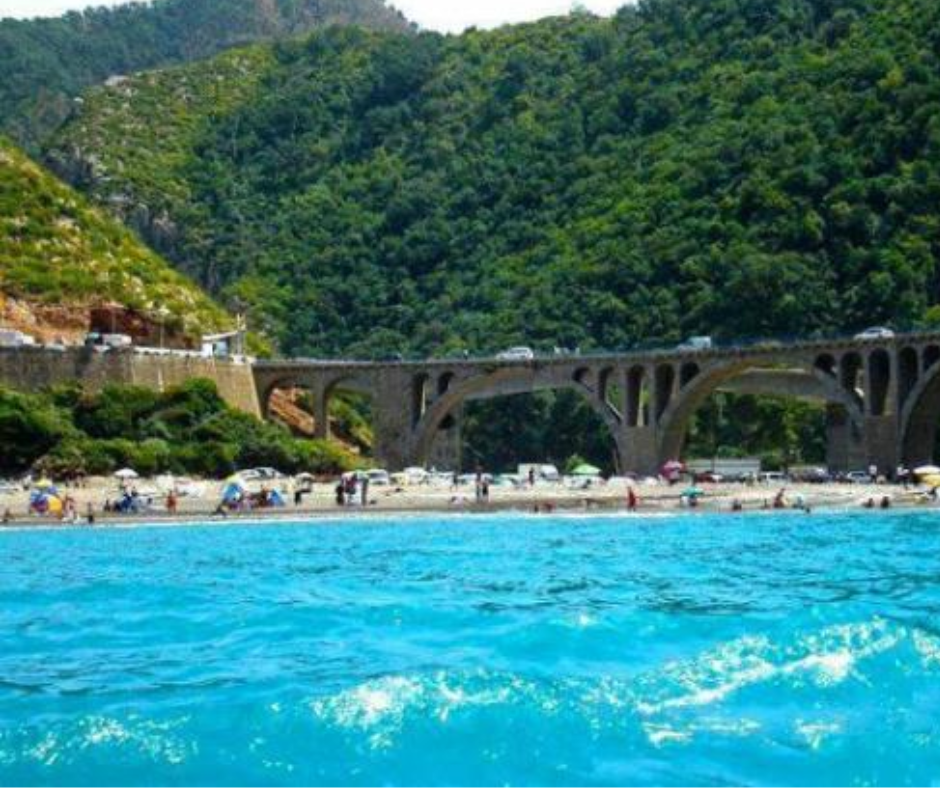
In summer the caves are one of the most visited sites in the province, so go early or late in the day to miss the queues. The floor is wet and slippery: wear closed shoes with rubber soles, not sandals, and bring a sweater. Opening hours and the entry fee change, so check locally, and bring cash.
The Grand Phare (Ras El Afia Lighthouse)
The Grand Phare, or Ras El Afia lighthouse, is on a rocky headland about 6 km west of the town center, on the road to Béjaïa. A light has marked this point since the 1860s or early 1870s (sources disagree on the year). The present white stone tower, about 17 m high, was built in 1907 by the stonemason Charles Salva, and it is still a working lighthouse.
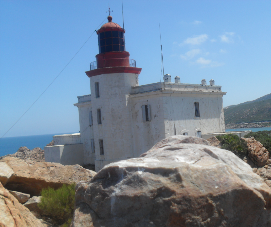
The tower is not open to visitors, but a narrow footpath leads out to the point, and it's a favorite spot with photographers at sunset. Below it runs about 2 km of sandy beach. Watch your footing on the wet rocks at the water's edge, because the swell can build quickly on this exposed point.
A short history of Jijel
Jijel began as Igilgili, a Phoenician trading post, and passed to Carthage and then Rome, which made it a municipal colony. Byzantines and Arabs followed. In 1514 the Barbarossa brothers made it their base before taking Algiers, and in 1664 a French expedition held the town for a few months before being driven out.
France took it for good in 1839. An earthquake in 1856 wrecked the old town, which is why so little of it survives: what you see today is mostly a 19th- and 20th-century grid by the port, with the waterfront and the market as its focus.
Hiking and Wildlife in Jijel
Hiking in Taza National Park
Taza National Park covers about 3,800 ha of forest, cliffs and coast west of Jijel, and UNESCO made it a biosphere reserve in 2004. The trees are mostly zeen oak and cork oak.
The best-known walking area is the Guerrouch forest on the heights above El Aouana and Ziama Mansouriah, where old forest roads run in the shade along the Oued Tboula. Higher up, the steeper paths look out over the Gulf of Béjaïa. The city of Bejaia itself, with Gouraya National Park and Cap Carbon, is about two hours west along the same coast.
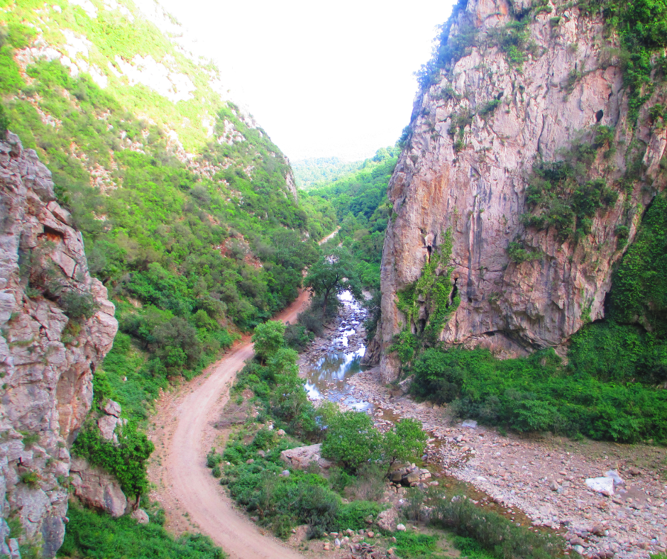
Stay on the main tracks and download offline maps before you set out, since phone signal drops under the trees. Carry at least 2 liters of water per person and start in the morning, before any afternoon fog rolls in. On anything longer, a local guide earns the fee by knowing which tracks connect, and either way, let your hotel know your route.
Barbary Macaques and Marine Life
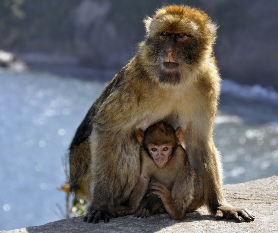
Taza's forests are home to the Barbary macaque, an endangered species and the only wild primate in Africa north of the Sahara. Some troops come down to the corniche road, where people stop to feed them.
Please don't: it makes them bold around cars and people. On a trail, keep your distance, keep food zipped inside your bag and don't stare at them, which they read as a threat. Birders also come to Guerrouch for the Algerian nuthatch, a small bird found only in a few forests of this part of Algeria.
Dolphins are sometimes seen off this coast. If you bring a mask and snorkel, the clear, rocky shallows of the coves are full of Mediterranean fish and are easy to explore close to shore.
In summer, boats leave from El Aouana beach for the island and the sea caves under the cliffs. Agree the price per person before you board, ask for life jackets, and go in the morning, when the sea is usually calmer.
Markets and Food in Jijel
Jijel Central Market
For a look at everyday life, spend a morning at the old market in the town center. It dates from the colonial era and still draws thousands of shoppers a day. It is mainly a food market, with seasonal fruit and vegetables, spices and household goods, so don't expect a souvenir bazaar. Bring cash, as stalls don't take cards.
Open with a greeting ("salam alaykum" works everywhere) and ask before you photograph a stall holder or their stall. Some bargaining is normal, but keep it friendly and don't push hard on small sums.
Fresh Seafood at Jijel's Fishing Port
Jijel's fishing boats, including a big sardine fleet, work out of the Boudis port in town, and Ziama Mansouriah has a small fishing port of its own. Seafood restaurants in Jijel are mostly simple places with a short menu, and most don't serve alcohol.
The grilled fish of the day is the safe order. Start with hmiss, grilled peppers and tomatoes crushed with garlic and olive oil, a common starter across eastern Algeria. In cooler months and during Ramadan, look for chorba frik, a soup made with green cracked wheat. You'll also find bourek, the fried rolled pastry, filled with shrimp instead of the usual minced meat.
Planning Your Trip to Jijel
Best Time to Visit Jijel
For hiking, we'd pick April to June, when the forests are green, the days are mild and the beaches are still empty. September and early October are the best beach months: the water is still warm and the summer holiday crowds have gone.
July and August are peak swimming season, with lifeguards on the authorized beaches, but also humid heat, full hotels and jams on the corniche. If you are combining several towns along the sea, our guide to Algeria's coastal cities helps you choose. Winter is quiet and green, but Jijel is one of the wettest parts of Algeria, with roughly 900 to 1,200 mm of rain a year, most of it in winter. Pack waterproofs.
Getting to Jijel and getting around
The quickest way in is the Air Algérie flight from Algiers to Ferhat Abbas airport, about 40 minutes. By road, Jijel is about 98 km from Béjaïa along the coast, 135 km from Sétif and 150 km from Constantine. Intercity buses and shared taxis (taxis collectifs) leave from the bus station.
Once there, you'll want a car or a driver. Shared taxis run along the corniche, but they don't stop at the caves, the viewpoints or the forest tracks, and summer traffic is slow. If you hire a car, agree the insurance terms before you sign and book ahead for July and August.
Where to stay in Jijel
Most hotels are in Jijel town, close to the market and Kotama beach, which is the best base without a car. El Aouana has seafront hotels and holiday rentals, handy for the beach and the caves but busy in summer. Around Ziama Mansouriah, options are fewer and simpler.
Book well ahead for July and August, when families from across eastern Algeria fill the town and prices rise. Outside the summer, rooms are easy to find and cheaper. Bring cash: many smaller hotels and rentals don't take foreign cards.
Jijel in two or three days
Day 1, the town. Morning at the central market and the fishing port, a grilled-fish lunch, then out to the Grand Phare for the late-afternoon light and back to Kotama beach at sunset.
Day 2, the corniche. Drive west early: a swim at El Aouana and a boat to the island, then the Grottes merveilleuses at Ziama Mansouriah, and Red Beach for the end of the afternoon.
Day 3, the forest. A morning walk in the Guerrouch forest in Taza National Park, watching for Barbary macaques, then a slow drive back along the coast. With only two days, combine days 2 and 3.
Local Customs and Safety in Jijel
Swimwear is fine on the sand, but cover up when you leave it: in town and in the villages, shoulders and knees should be covered. Bikinis are not illegal, but the public beaches here are family beaches, and a one-piece or a swim shirt draws less attention.
Swim on the authorized beaches, which have Civil Protection lifeguards from June to September. The wild coves have nobody watching, so don't swim alone there and stay out of the water when there's a swell. Away from the beaches, Jijel is an easygoing family holiday town, and visitors are often surprised by how relaxed it feels. Outside July and August, it makes a quieter alternative to the big names among the top cities to visit in Algeria.
Is Jijel worth the trip?
Which Jijel beach should I pick?
For an easy day with lifeguards and facilities, El Aouana, about 20 km west of town, with clear water and an island offshore. Red Beach at Ziama Mansouriah is the one everyone photographs. The small coves along the corniche are quieter, but they have no lifeguards and steep paths down.
Is Jijel a long way from Algiers?
Not if you fly: the Air Algérie flight to Ferhat Abbas airport takes about 40 minutes. By road it is a long day's drive, usually via Béjaïa and the coast. Constantine is closer, about 150 km away by road, and Béjaïa about 98 km along the coast.
Is Jijel worth it outside summer?
Yes, for hiking and quiet beaches. April to June is green and mild, with empty sand, and September and early October still have warm sea and far fewer people. Winter is wet, with most of the region's 900 to 1,200 mm of yearly rain, but the forests and the caves are at their quietest.
Is the sea still warm enough in October?
Yes. It averages about 23°C in October, warmer than in June. Lifeguards usually finish at the end of September, though, so stick to calm days and well-used beaches, and don't swim alone in the coves.
What would I miss if I skipped Jijel?
The RN43 corniche west of town, with its beaches, coves and cliffs, and the Grottes merveilleuses, found in 1917 while the road was being built. Then there are the oak forests and Barbary macaques of Taza National Park, and in summer the cheerful crush of Algerian families on holiday.
Want Jijel built into a longer trip? Email info@wildyness.com with your dates, or we can help you create the perfect itinerary, with a driver waiting at Ferhat Abbas airport and a local guide for the Taza forest walks.


