
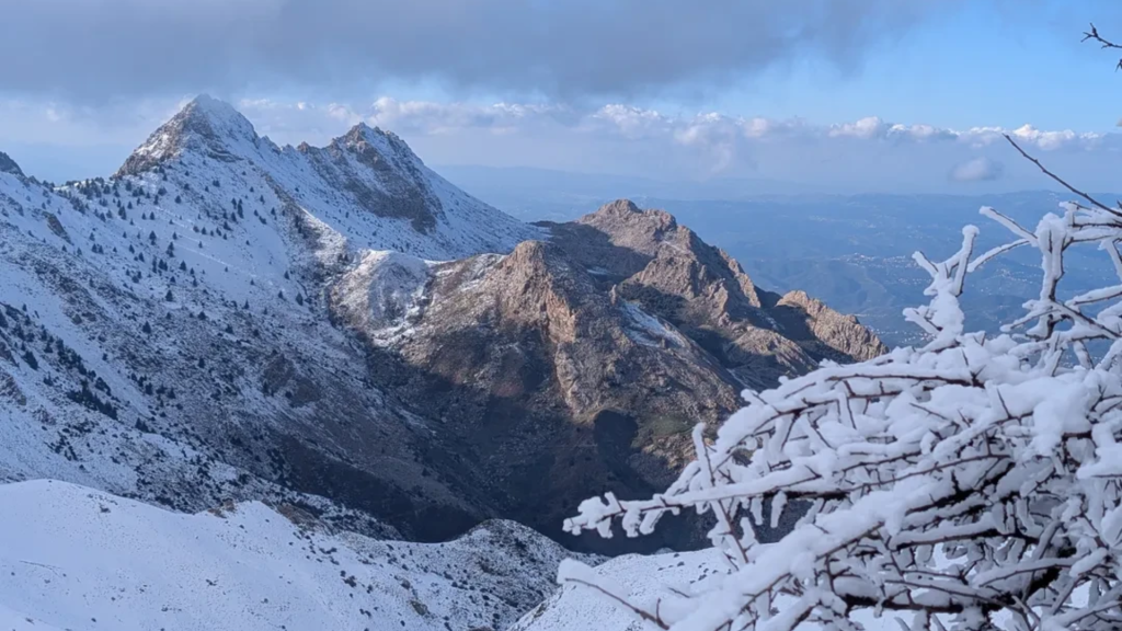

Algeria has two very different kinds of hiking: desert trekking in the Sahara, mainly on the Tassili n'Ajjer plateau above Djanet and in the Hoggar around Tamanrasset, and mountain walking in the north, mainly in the Djurdjura range in Kabylie. The Sahara season runs from about October to April, the high northern ridges are best from May to October, and in the south you can only trek with an approved Algerian agency.
Below we cover the main treks, what each one asks of you physically, the visa and permit rules (checked October 2026), and what to pack. Our Algeria travel guide is a good primer if this is your first trip to the country.
The highest you can go is Mount Tahat in the Hoggar, about 2,908 m; in the north the tops are Djebel Chélia (2,328 m) in the Aurès and Lalla Khedidja (2,308 m) in the Djurdjura. Waymarked trails are rare everywhere, so routes depend on local knowledge. That's why, even in the north, where nobody requires a guide, we strongly advise taking one. For the paperwork you need either a consulate visa or, on an organized Sahara trip, a visa on arrival.
Sahara or Atlas: which kind of hiking?
Your choice of terrain settles most of the rest: when you go, what paperwork you need and what you carry. Sahara treks run in the cool months, need an agency and a southern itinerary, and usually come with a support crew and 4x4s or donkeys. The Djurdjura and the other northern ranges can be walked on a standard tourist visa with a local guide, but they hold snow in winter.
Sahara Hiking in Algeria
Southern Algeria is built on a huge scale: gravel plains, dune seas and rocky sandstone or volcanic plateaus. Water points are far apart, and landmarks are easy to misread if you don't know the ground.

The ground changes quickly from soft sand that drains your legs to hard gravel and broken rock that is rough on ankles. Summer is too hot for trekking: Djanet averages highs of about 38°C in June and July and has recorded 48.5°C. We plan desert hikes between October and April, when the days are manageable and the nights are cold (Djanet's average January low is about 3.5°C, and it's colder up on the plateau).
Read also: Algerian Sahara Travel Guide: Routes, Visas & Safety Tips
Atlas Mountain Hiking in Algeria
The northern ranges are a different job. In the Djurdjura and the Aurès you get steep climbs, rocky paths and cedar forest on the lower slopes. Lalla Khedidja, the top of the Djurdjura, is 2,308 m and Djebel Chélia in the Aurès is 2,328 m, the highest point in northern Algeria, so you'll feel the climbing more than the altitude.
On the lower trails, spring (March to May) and autumn (September to November) bring mild temperatures. The high ridges are another matter: snow often lingers into spring, so the usual season for summits such as Lalla Khedidja is May to October. Weather changes fast up there, and a clear morning can turn to wind or fog by midday. The footing is often loose rock on narrow paths, so wear sturdy boots.
Is Algeria Worth Visiting? What to Know Before You Go
Algeria's mountain ranges and their highest peaks
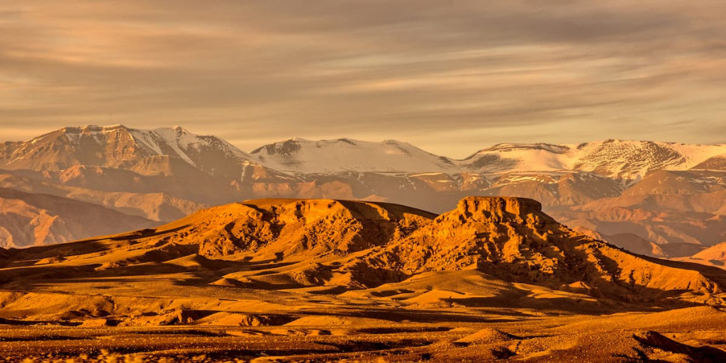
The Atlas Mountains do run through Algeria, in three main chains, and the Sahara has its own high massifs:
Tell Atlas, along the coast: the Djurdjura in Kabylie, topped by Lalla Khedidja (2,308 m), the highest point of the whole Tell Atlas; the Blidean Atlas around Chréa; and the Babors east of Béjaïa.
Aurès, in the east around Batna and Khenchela: Djebel Chélia (2,328 m) is the highest point of northern Algeria.
Saharan Atlas, running from the Moroccan border toward Tunisia along the edge of the desert: its highest peak is Djebel Aïssa (2,236 m).
Hoggar, around Tamanrasset: volcanic mountains with Mount Tahat, Algeria's highest peak at about 2,908 m.
Tassili n'Ajjer, above Djanet: a sandstone plateau rather than a peak range, cut into canyons and rock "forests".
Algeria's main treks compared
| Trek | Base | Typical length | Height or climb | Difficulty | Best season | Guide |
|---|---|---|---|---|---|---|
| Tassili n'Ajjer plateau | Djanet | About 5 days on the plateau, 4 to 5 hours' walking a day | 600 to 700 m climb up the Akba Tafilalet pass | Moderate; day one is the hardest | October to April | Approved agency required |
| Tadrart Rouge | Djanet | Several days, mostly by 4x4 with walks between sites | Dunes and sandstone, no big climbs | Easy | October to April | Approved agency required |
| Hoggar and Assekrem | Tamanrasset | Several days; Assekrem is 3 to 4 hours by 4x4 from town | Assekrem about 2,726 m | Moderate, with freezing pre-dawn starts in winter | October to April | Approved agency required |
| Lalla Khedidja, Djurdjura | Tikjda | One long day to the summit | 2,308 m | Moderate to hard | May to October | Local guide strongly advised |
| Djebel Chélia and Ghoufi, Aurès | Batna or Khenchela | Day hikes | 2,328 m at Chélia | Easy (Ghoufi) to moderate (Chélia) | Spring and autumn | Local guide advised |
Trekking the Sandstone Forests of Tassili n'Ajjer
Tassili n'Ajjer, the sandstone plateau above Djanet in Algeria's far southeast, is the country's main desert-trekking destination. UNESCO added it to the World Heritage list in 1982, mostly for the rock art: more than 15,000 paintings and engravings by its count, spanning roughly 10,000 BC to the first centuries AD, when the Sahara was much greener. The scenes move from wild animals and hunters to cattle herds and, later, horses and camels, so you can follow how people adapted as the climate dried.
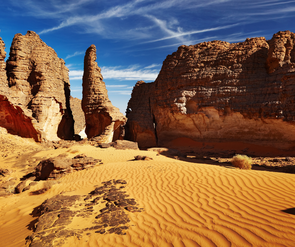
The classic trek climbs onto the plateau by the Akba Tafilalet pass, about 600 to 700 m of ascent over roughly 7 km and usually the hardest day of the trip, then crosses to Tamrit, with its ancient Saharan cypresses, and on to Sefar. Donkeys carry the bags, you walk around 4 to 5 hours a day, and most itineraries spend about five days on the plateau. There's no viewpoint you can drive to.
You walk between rock shelters and through corridors the wind has cut in the sandstone, the "sandstone forests" of the heading. Start early and walk steadily: much of the art sits under overhangs or on flat slabs that are easy to pass without noticing.
The rules at the sites are simple. Never touch the paintings or splash water on them to make the colors stand out in photos; it damages the pigment.
Don't lean packs against the panels, stay on the paths and carry out all your rubbish. Don't pocket flints, arrowheads or potsherds either: smuggling antiquities out of Algeria can mean prison, and old-looking objects can be confiscated when you leave. For a slower version of these treks, some yoga retreats in Algeria combine Djanet hikes with morning and evening sessions.
The Tassili and the Tadrart, southeast of Djanet, are Tuareg country, and the welcome is part of the trip: sweet tea by the fire in the evening, and local guides who know which rock shelters hold the best paintings. Trekkers on our trips often tell us the south felt far more relaxed than they had expected from what they had read.
All foreign visitors come here through an approved agency, and where the authorities assign a police or gendarmerie escort to a route, the agency sorts it out. For a trek here or in the Hoggar, look up the current official travel advice for that route before you book, and check that your policy covers it.
A 5-day Tassili plateau trek, day by day
Agencies vary the route with the season and the group, but most plateau treks follow this shape. You camp every night, and donkeys carry the bags.
Day 1: Drive from Djanet to the foot of the Akba Tafilalet pass and climb about 600 to 700 m over roughly 7 km. Camp on the plateau.
Day 2: Walk to Tamrit and its ancient Saharan cypresses, stopping at rock shelters along the way.
Day 3: Cross the sandstone corridors toward Sefar, with painted shelters on the way.
Day 4: A day among the shelters at Sefar, the best-known rock-art area of the trek.
Day 5: Walk back to the edge of the plateau and down to Djanet.
Trekking the Hoggar Mountains Around Assekrem
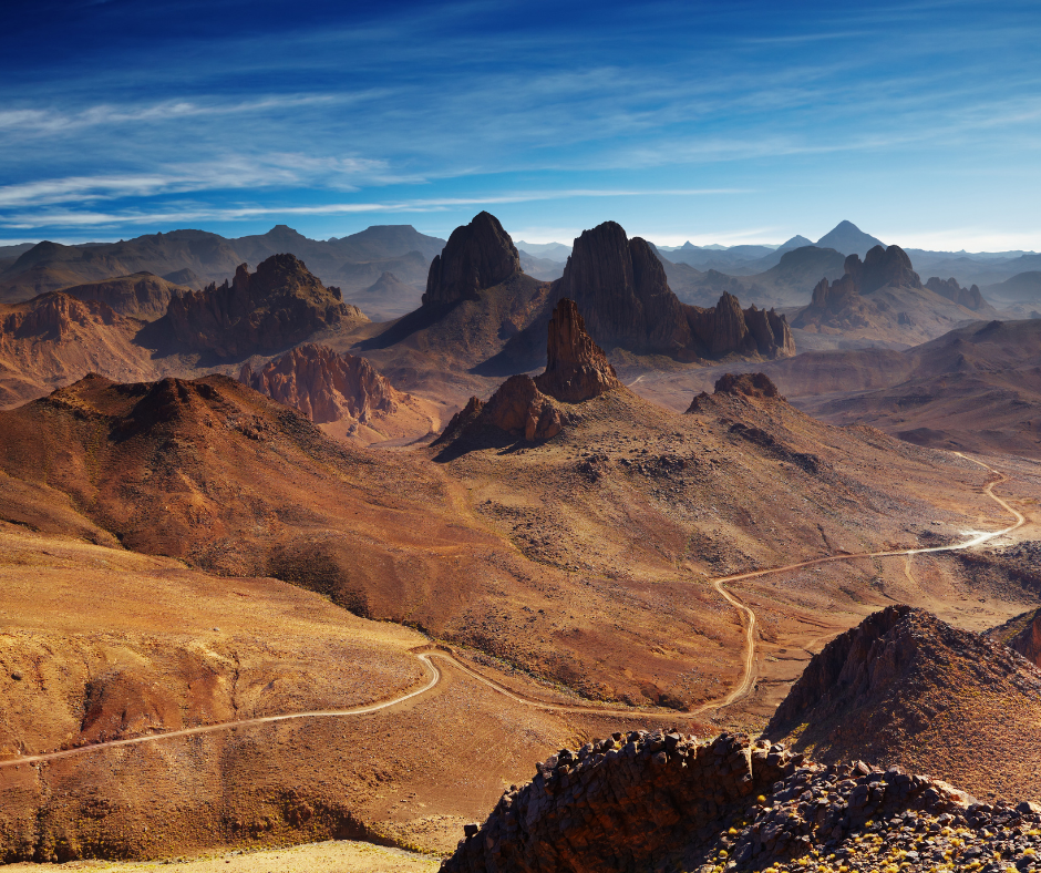
For a higher, rockier desert trip, go to the Hoggar (Ahaggar). Here the Sahara rises into volcanic mountains, and most treks head for the Atakor massif around the Assekrem plateau, about 80 km from Tamanrasset, or 3 to 4 hours by 4x4 on a rough track. Assekrem is at about 2,726 m. Charles de Foucauld's hermitage, built in 1911, is a 15 to 20-minute climb from the base, and most groups go up for sunrise.
Mount Tahat, Algeria's highest peak, is usually given as 2,908 m (some sources say 2,918 m). The rock is volcanic, darker and sharper underfoot than the Tassili sandstone, and the mornings are much colder than most visitors expect: winter nights at this altitude often drop below freezing, so bring a down jacket or heavy fleece for the pre-dawn starts. From the top of Assekrem you look out over a field of volcanic plugs with almost no sign of people.
Our Hoggar treks stick to well-tried routes, with a licensed agency and local Tuareg guides and drivers, and none of our trips there has had an incident. Expect a gendarmerie checkpoint or two on the track out of Tamanrasset, and on some routes an escort organized by your agency. Both are routine, and your guide does the talking.
Food on southern treks is simple and filling. Tuareg crews often make taguella, a flat bread baked under the sand and embers of the campfire, then broken into a vegetable or meat sauce. It's heavy, which is what you want after a long day on your feet. Expect strong, sweet tea brewed over the fire several times a day too.
Hiking the Green Peaks of the Djurdjura Range
The Djurdjura, in Kabylie east of Algiers, is the north's main hiking range: limestone ridges, deep valleys and cedar forest, with Kabyle villages on the lower slopes. It's a national park (created 1983) and a UNESCO biosphere reserve, and Barbary macaques live in the forest. Tikjda, a small mountain resort at over 1,400 m, is the usual base, and from there trails range from easy forest walks to exposed ridge scrambles.
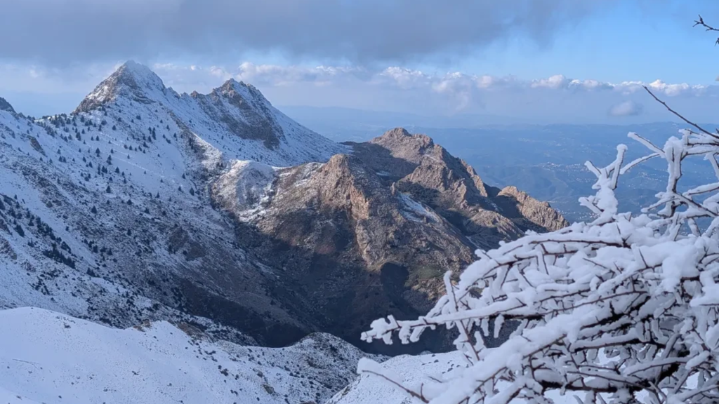
The best-known objective is Lalla Khedidja (2,308 m), the highest peak of the Djurdjura and of the whole Tell Atlas. The path climbs through cedar forest and then above the tree line onto rock and scree, and on a clear day you can see the Mediterranean to the north. Allow a full day, start early, and expect snow patches until late spring.
Djurdjura Hiking Guide: Trails, Seasons and Tips
You'll pass shepherds and villages on the lower trails, and an invitation to coffee is common. Some trekkers extend that welcome into a night or two with a host family, and our Algeria homestay guide explains how it works.
One tip for the Djurdjura: go with a local guide rather than heading up alone. Paths are rarely waymarked, fog can close in on the ridges by midday, and a guide from the villages below knows which trails are open and where the springs are. Villagers are used to walkers, and a guide makes it easier to accept the coffee that tends to follow.
A 3-day Djurdjura trip from Algiers
Day 1: Drive from Algiers to Tikjda and take an afternoon walk in the cedar forest. Sleep in Tikjda.
Day 2: Climb Lalla Khedidja with a local guide. Start early and allow the whole day.
Day 3: An easier walk to Lac Agoulmime, then back to Algiers, or on to a village homestay in Kabylie.
Day hikes near Algiers and on the coast
These national parks work as day trips or easy weekends, and none needs an agency, though paths are poorly marked.
Chréa National Park, above Blida: The closest mountain walking to Algiers, in the Blidean Atlas. Trails run through Atlas cedar forest where Barbary macaques live, and in winter the small ski station gets natural snow.
Gouraya National Park, Béjaïa: A UNESCO biosphere reserve on the cliffs above the city. Walk up to Yemma Gouraya (about 660 m), with its fort and shrine, or out toward Cap Carbon, whose 1906 lighthouse sits about 220 m above the sea.
Taza National Park, Jijel: Cork oak forest running down to coastal cliffs and coves on the corniche west of Jijel, also home to Barbary macaques. Combine a walk with the Grottes merveilleuses at Ziama Mansouriah.
Ghoufi, Aurès: An easy walk along the balconies above the Oued Abiod canyon, past a troglodyte village that was lived in until the 1970s.
Visas and route paperwork for southern treks
UK, EU, US and Canadian citizens, like most Western visitors, need a visa. For a trek around Djanet or Tamanrasset there are two routes. The first is a standard tourist visa from an Algerian consulate before you travel; London's consulate, to take one example, will take an invitation and itinerary from an Algerian travel agency as the supporting paperwork.
Or you can use the visa on arrival for Sahara tourism: an approved Algerian agency files your request on the Tourism Ministry platform in advance, you board with a QR-code authorization, and you pay the fee on arrival (commonly reported at about EUR 110, depending on nationality). It's valid for up to 30 days, matched to the trip, and only covers organized trips that include the southern wilayas.
It isn't limited to the southern airports: many travelers land in Algiers. There's no general e-visa (October 2026).
Your passport needs at least six months' validity from arrival and two blank pages. Keep a paper copy and a digital copy of your passport and visa in separate bags. For southern itineraries the authorities want a clear plan of your route and where you'll sleep each night, and your agency files it. Once it's filed, stick to it.
Visa details in full: Algeria Visa: Requirements and Visa on Arrival
Before you leave home, print everything. You need your passport to check into hotels and to board domestic flights, and roads in the south have regular police and gendarmerie checkpoints, where you should slow down and have ID ready. Paper copies of your itinerary, travel insurance and bookings make these stops quicker. Don't leave the agreed route without talking to your guide: some zones near the borders are closed to visitors.
Why You Need a Local Guide
In the south a guide isn't optional, since foreigners travel with an approved agency. In the north the rules are looser, but we'd still hire one. Trails are rarely waymarked the way they are in Europe or North America, and a local guide knows the real trailheads and the seasonal detours that don't show up on digital maps. If you would rather book the whole trek as a package, our guide to organized tours in Algeria explains your options.
Safety is the biggest reason. A good guide reads the weather: the haze that comes before a sandstorm, or rain upstream that can send a flash flood down a dry wadi or mountain gully. Guides plan water stops and pacing, and they know who to call when something goes wrong, which matters in the remote south, where the FCDO describes phone coverage as patchy or unavailable.
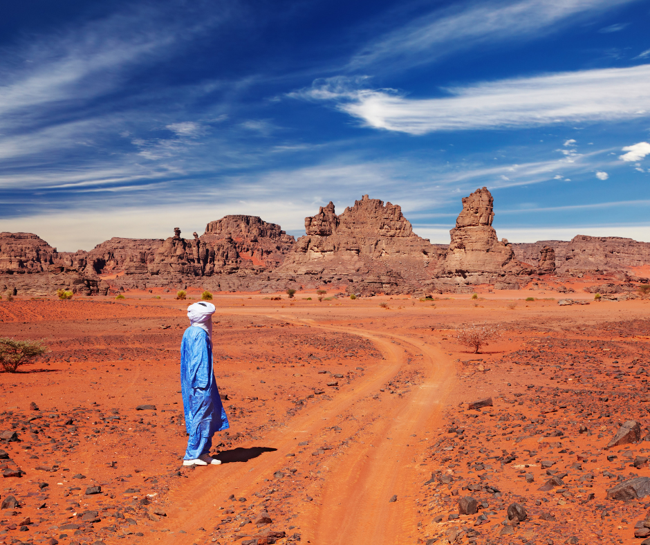
Guides also explain the villages you pass and the local customs: where photos are unwelcome, how to behave at a mosque or shrine, and what to do when prayer time comes round mid-hike.
Packing and Preparation for Desert and Mountain
Pack for big temperature swings. Desert days are warm while winter nights can drop to freezing, and in the mountains the weather can go from sun to wind and rain within an hour. Bring a quick-dry base layer, a warm fleece or down jacket for the evenings and a light waterproof shell. In the mountains add thin gloves and a warm hat; in the desert, light long-sleeved shirts and long pants keep the sun off.
Footwear matters most. Bring hiking shoes with a well-stitched, non-slip sole that you've already broken in. For rocky ground like the Hoggar or the Djurdjura, we recommend higher-cut boots to support your ankles. Don't bring brand-new boots on a multi-day trek: blisters can end a trip early.
A fuller packing list: What to Wear in Algeria
For a full day on the trail, three liters of water is the minimum, and the desert needs more. A hydration bladder makes it easy to sip often; keep a hard bottle as a backup. Electrolyte tablets help in dry heat, where you lose salt faster than you notice. On supported desert treks the donkeys, camels or 4x4s carry the camp water, but you carry your own for the day.
Combining History with the Trail: Timgad and Djemila
If you like history, it's easy to add Roman sites to a northern hiking trip. In the east, the Aurès has good walking, from the Ghoufi balconies above the Oued Abiod canyon to Djebel Chélia, and Timgad is 35 km east of Batna. Trajan founded it in AD 100 as a military colony, and its grid of streets is still almost complete (UNESCO-listed since 1982). It's open-air: you walk the paved streets past the colonnades, Trajan's Arch and the theater.
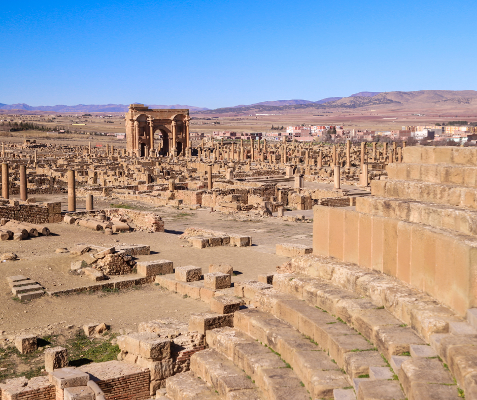
We suggest hiking in the cool morning air of the Aurès and visiting the ruins later in the day. In summer, wait until late afternoon: Timgad has almost no shade.
Read also: Timgad Day Trip Guide: Pompeii of Africa
Djemila (ancient Cuicul), also a UNESCO site since 1982, is another mountain Roman town. It sits at about 900 m on a narrow triangular spur where two rivers meet, and seeing the whole site takes a fair amount of walking.
Cultural Etiquette and Trail Hospitality
Respect for local customs gets you a warmer welcome than anything else, and many hiking areas are rural and conservative. Start every exchange with a greeting: "Salam alaykom" is the standard way to open a conversation or ask for directions, and in Kabylie "Azul" (the Amazigh hello) goes down well. A friendly tone matters more than perfect pronunciation.
Dress modestly in villages: covered shoulders, and long pants or skirts rather than shorts. Women should carry a light scarf, useful against the sun and for covering the head in a mosque.
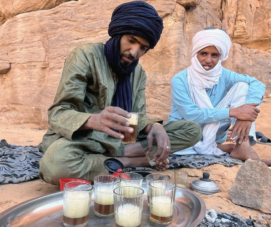
If someone offers you tea or food, it's usually a sincere welcome. You don't have to accept everything; decline with a smile and a "Merci" or "Inshallah, next time." If you do accept, a sip of tea or a small bite is the polite way to thank your host.
Practical Tips for Your Daily Hike
Start at sunrise. In the Sahara the temperature climbs fast after about 10 a.m., and an early start gets you to the next camp or a shady rest stop before the worst of the heat.
Tell someone your plans: share your route and expected return time with your host or a contact at home. On a guided tour your operator handles this with the local authorities. Be honest about your fitness too.
Algerian trails run from gentle valley walks to rough scrambles, and a trek that matches your level is one you'll enjoy rather than struggle through. Treks like these also suit corporate groups, alongside the quad-biking and kayaking ideas in our guide to team building trips in Algeria.
Keep your gear organized and your electronics charged. Pack a power bank, because desert treks can go several days without electricity and long stretches have no phone signal at all; in the south, Mobilis gets the best coverage. Download offline maps as a backup, but let your guide do the navigating.
Peaks, permits and trail markings
How high do Algeria's mountains actually go?
To about 2,908 m at Mount Tahat in the Hoggar (some sources say 2,918 m). The north peaks at 2,328 m on Djebel Chélia.
Can I just walk the Djurdjura on my own?
Yes, nothing stops you in the north, though with poor waymarking and fast-moving fog we'd take a local guide. The Sahara is different: foreigners travel with an approved Algerian agency, which supplies the guide and files your route.
Do I have to get a trekking permit for the Tassili myself?
No. Your approved agency handles the paperwork, including the route plan filed with the authorities, and can arrange a visa on arrival. Day walks in northern parks such as the Djurdjura need no permit.
Will I find waymarked trails like in the Alps?
Rarely. Some forest paths around Tikjda and Chréa are well trodden, but paint marks and signposts are scarce and digital maps miss many trails.
I only have a weekend in Algiers. Where can I walk?
Chréa National Park above Blida is the closest, with cedar forest and Barbary macaques. With a bit more time, drive to Tikjda and climb Lalla Khedidja between May and October, or walk the Gouraya trails above Béjaïa, where a summit fort comes with sea views.
Which trek, then? For a first desert trek at moderate fitness, we'd pick the Tassili n'Ajjer between October and April, and allow eight to ten days including the flights. For altitude and volcanic scenery, the Hoggar in the cool months, with warm layers for the pre-dawn starts. For a shorter trip without the southern paperwork, the Djurdjura between May and October, which works in three or four days from Algiers.
If you have questions about a specific route or want help choosing a trek, tell us your dates and fitness level and we'll suggest an itinerary. For southern treks we arrange the agency invitation or the visa-on-arrival request through licensed Algerian partner agencies, a driver at the airport, and Tuareg guides, cooks and drivers in the desert. You can send us your trip details to start planning.


