
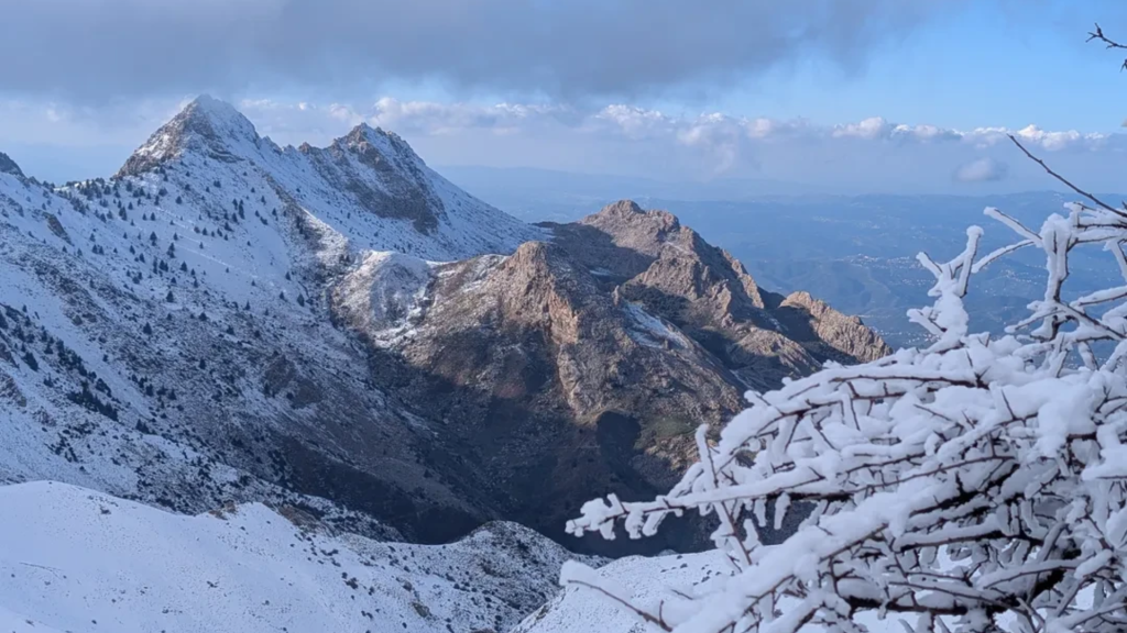

The Djurdjura is a limestone range in Kabylie, about 120 km east of Algiers, that tops out at 2,308 meters on Lalla Khedidja. Most hikes start from Tikjda on the Bouira side, and the terrain is proper mountain country: loose scree, snow into spring and few waymarks.
A local guide makes a real difference here: the shepherd paths aren't marked, and a guide also knows the Kabyle villages and where the macaques are feeding (more on that below). This guide covers the main walks, when to go, how to get there and what to pack, checked in October 2026. For the rest of your trip, from Algiers to the Sahara, see our Algeria travel guide.
Djurdjura numbers and bases
- Location: Kabylie, about 120 km east of Algiers, between Tizi Ouzou on the north side and Bouira on the south
- Top of the range: Lalla Khedidja, 2,308 m, also the high point of the whole Tell Atlas
- Where to sleep: Tikjda (about 1,480 m) on the Bouira side, or Tala Guilef (about 1,600 m) on the Tizi Ouzou side
- Hiking months: late April to June, then September and October; snow lies on the high ground from December to February and often into March
- Protection: about 185 km² of national park, first created in 1925 and re-created in 1983, and a UNESCO biosphere reserve since 1997
- Getting there: train or shared taxi from Algiers to Bouira or Tizi Ouzou, then a taxi up the mountain road
The name and a little history
Djurdjura comes from the Berber Jerjer, usually explained as "the one in the middle" (some read it as "pile of stones"). The Romans called the range Mons Ferratus, the iron mountain.
The French authorities first declared a national park here by decree on 8 September 1925. Algeria re-created it in 1983 over 18,550 hectares, and UNESCO added it to its network of biosphere reserves in 1997.
Climbing Lalla Khedidja, the highest peak in the Djurdjura
Lalla Khedidja is 2,308 meters high, the highest point of the Djurdjura and of the whole Tell Atlas. Most hikers sleep at Tikjda and get a lift up the mountain road to the Tizi n'Kouilal pass (about 1,585 m), where the usual path starts.
From there it's roughly 4 to 5 km and 750 to 800 meters of climbing to the summit. Allow 2.5 to 3.5 hours up and 5 to 6 hours for the round trip with stops, more if old snow is still lying on the upper slopes in spring.
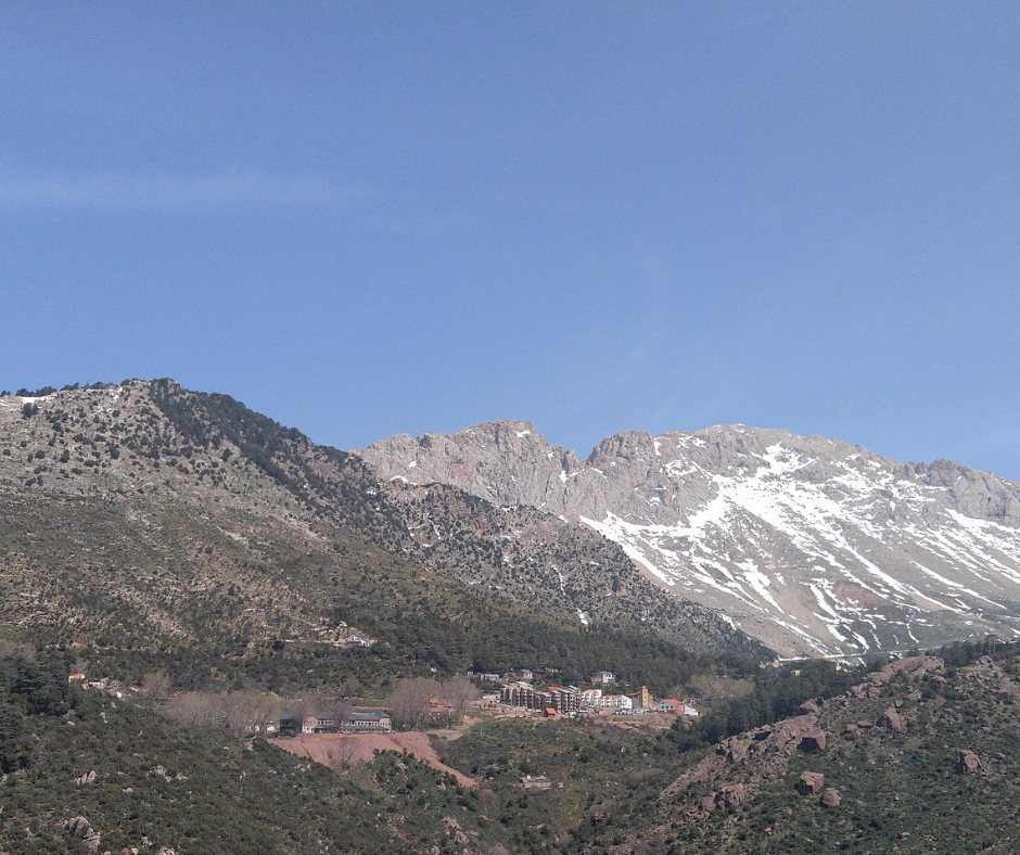
The path starts on fairly clear ground, then climbs over steep limestone scree. Stay on the worn line and follow the cairns rather than cutting corners: the scree slides underfoot and the rock is sharp.
The summit is usually much windier and colder than the pass, so keep the break short and head down before the afternoon cloud that often builds over the range. A few rocky steps need both hands, so carry everything in a backpack.
Main peaks of the Djurdjura
| Summit | Height | Where |
|---|---|---|
| Lalla Khedidja | 2,308 m | Eastern Djurdjura, climbed from the Tizi n'Kouilal pass above Tikjda |
| Ras Timedouine | 2,305 m | Central summit of the Akouker massif, on the Tizi Ouzou side |
| Haïzer | about 2,120 to 2,164 m (sources differ) | Western Djurdjura, above the Bouira plain |
| Azrou n'Thor | about 1,860 to 1,885 m (sources differ) | Northern side, in Tizi Ouzou wilaya |
Tikjda and the cedar forests of the Djurdjura
Tikjda, a ski station at about 1,480 meters on the southern side of the range (Bouira wilaya), is where most visitors stay. It's the base for Lalla Khedidja and for walks in the cedar woods of Tigounatine and Taouialt, and shepherd paths cross the Tizi n'Kouilal pass to the At Ouabane forest on the northern side.
The cedar woods are cooler than the open slopes, and the walking there is mostly gentle, with more distance than climbing. Further east, the Aurès Mountains have cedar forests of their own on the slopes of Djebel Chélia.
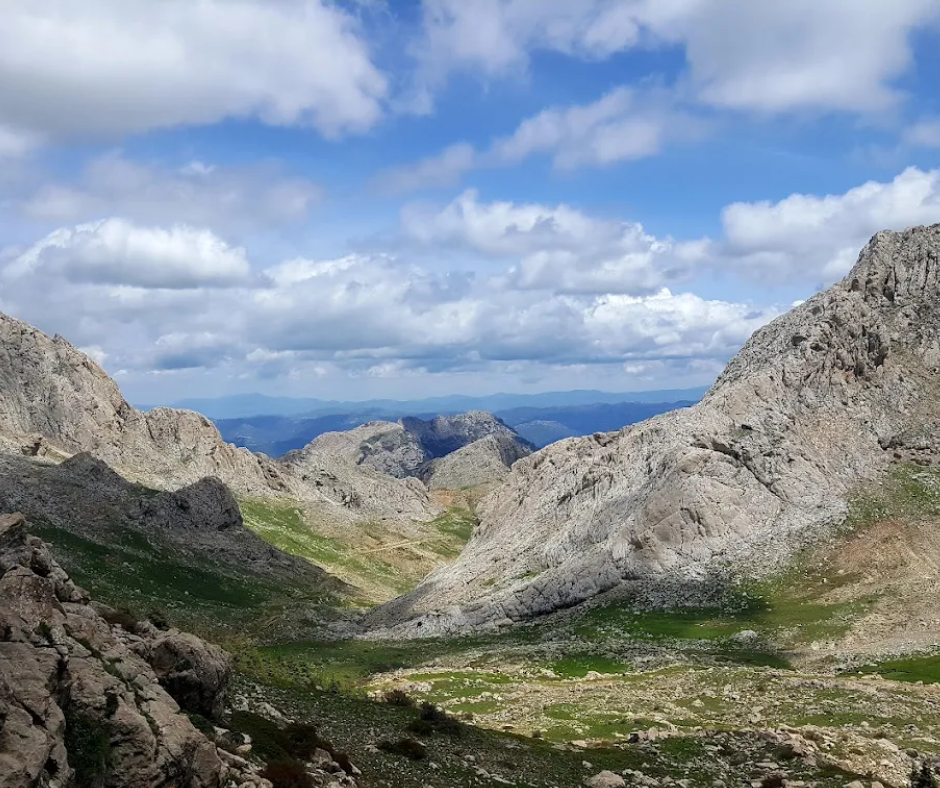
Start early. The light in the cedars is best then, and the ground (packed earth and limestone outcrops) stays slippery until the dew dries.
Close to Tikjda the paths are easy to follow, but further out they split into unmarked shepherd tracks. Download an offline map before you leave town, because the phone signal drops out in the deeper valleys.
Trekking to Lac Agoulmime from Tikjda
Lac Agoulmime is a small, shallow lake at about 1,700 meters in a karst basin above Tikjda. The walk crosses typical karst ground, with sinkholes and limestone fissures where you need to watch where you put your feet.
The lake shrinks a lot over the summer, so late spring (May and June, once the snow has gone) is the best time to see it full.
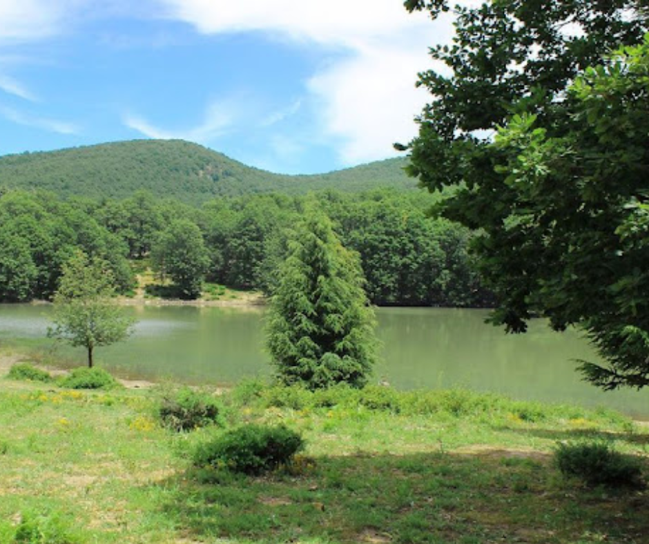
Depending on the route you pick, the round trip from Tikjda is roughly 9 to 18 km, so plan on half a day to a full day. The slopes are open and there's no shade at all: bring a hat, sunscreen and more water than you think you need. You may meet shepherds and their flocks at the shore, which is also the obvious place for a long lunch.
If you have energy left, climb one of the low ridges above the lake for a view over the whole basin.
This experience might be what you're looking for: Lake Agoulmime Hike & Nature Escape
The northern side: Tala Guilef
Tala Guilef is the Djurdjura's other base, on the northern slopes in the commune of Boghni (Tizi Ouzou wilaya). It sits at about 1,600 m, inside the national park, and is reached by the RN30B. From Algiers, take the train or a shared taxi to Tizi Ouzou, then a taxi via Boghni for the last climb.
The north side faces the sea and is generally greener and wetter than the Bouira side. The forest comes right up to the station, and walkers, paragliders and, in a good winter, skiers on a small slope at about 1,500 m all use it.
For a bed, the El Arz hotel reopened in January 2024, and two more hotels in the same complex, El Arz Cosy (75 rooms) and El Arz Resort (30 rooms), opened in 2025. The complex is more comfortable than Tikjda's lodges, but further from the classic Lalla Khedidja route, which starts on the south side.
The three classic walks side by side
| Walk | Distance | Climb | Time | Level | Best months | Guide? |
|---|---|---|---|---|---|---|
| Lalla Khedidja from Tizi n'Kouilal | 8 to 10 km return | 750 to 800 m | 5 to 6 h | Hard (scree, a few hands-on steps) | May, June, September, October | Recommended |
| Lac Agoulmime from Tikjda | 9 to 18 km return | Moderate | Half a day to a full day | Moderate (karst ground) | May and June | Useful |
| Tigounatine and Taouialt cedar woods | Your choice | Small | As long as you like | Easy | April to October | Not needed near Tikjda |
Barbary macaques in the Djurdjura: where to look and how to behave
Djurdjura National Park is one of the best places in Algeria to see the Barbary macaque, the only macaque living outside Asia and an Endangered species on the IUCN Red List. Troops live along the edges of the cedar and oak forests, where they forage for seeds, roots and insects, and the woods around Tikjda are a good place to start looking. They're most active in the early morning and late afternoon.
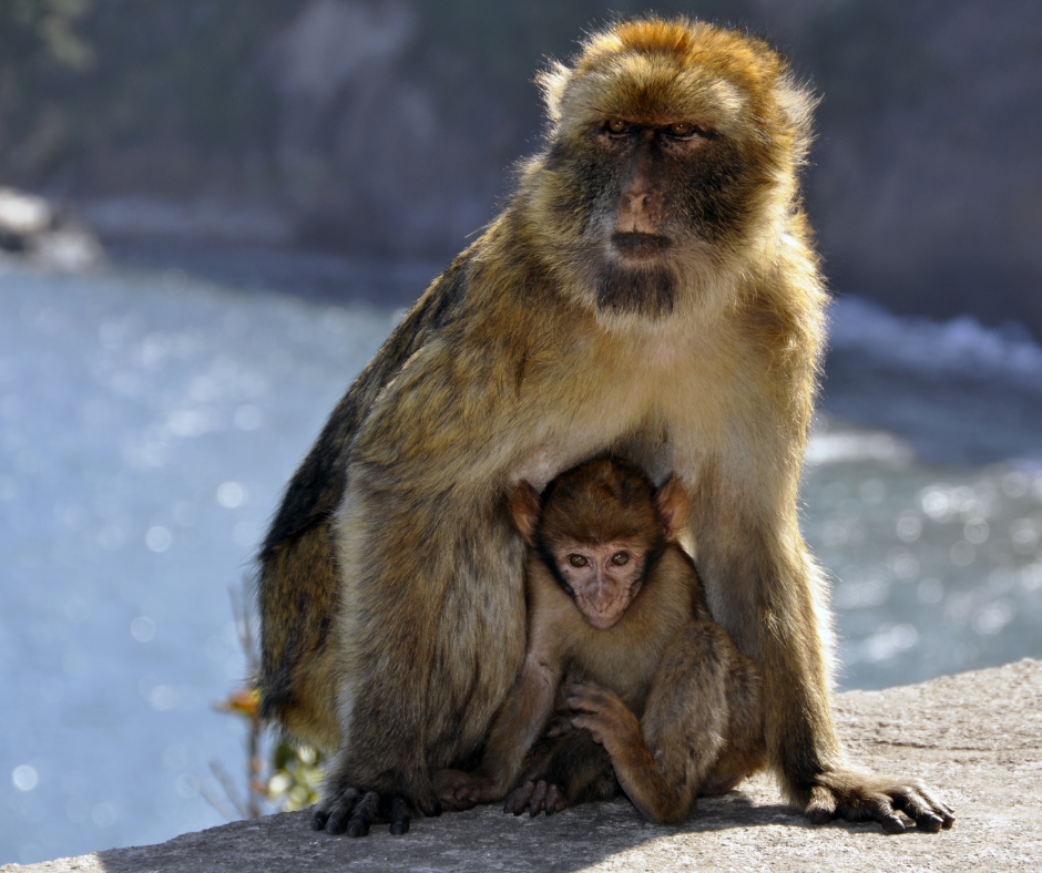
Keep your distance and never feed them. Macaques that get used to snacks become pushy and forage less for themselves. Binoculars will get you a better look than creeping closer for a photo. If one comes toward you, stay calm, back away slowly and don't smile at it: to a macaque, bared teeth are a threat.
Wildlife beyond the macaques
The macaques are the animals you're most likely to see, but the park also shelters wild boar, golden jackals, crested porcupines, genets, weasels and the striped hyena. Most are nocturnal, so look for signs: ground turned over by boar at the forest edge, or porcupine quills on the path.
Look up, too. Golden eagles, Bonelli's eagles, griffon vultures and the rare bearded vulture all hunt over the ridges, and the open limestone above the tree line is the best place to watch them.
Best Seasons for Hiking in the Djurdjura
The best months for hiking are late April to June and September to October. In late spring the meadows are full of wildflowers and the streams run high with snowmelt. Earlier in spring, snow still covers the upper slopes and hides parts of the paths.
Winter, from December to February and often into March, is for experienced hikers with winter gear. Tikjda gets heavy snow for the Mediterranean, trail markings disappear, and mountain roads such as the Tirourda pass can close after storms. Expect sub-zero nights and the chance of being snowed in at your lodge for a day or two.
Tikjda has been a ski station since the 1930s and has chairlifts and drag lifts, but they have spent long spells out of service, and reports from recent winters disagree on what runs. If you want to ski, check with the CNSL, which runs the resort, before you go. Snowshoeing and winter walks in the cedars need no lifts, only boots, gaiters, warm layers and a car that can handle a snowy road.
July and August are hot in the valleys and exposed above the tree line, where there's no shade on the limestone. August is also wildfire season in Kabylie. In summer, hike early and keep to the forest in the afternoon. If you'd rather be by the sea in midsummer, our Oran beach guide includes walks at Cap Blanc and Cap de l'Aiguille.
Cultural Etiquette in the Kabylie Region
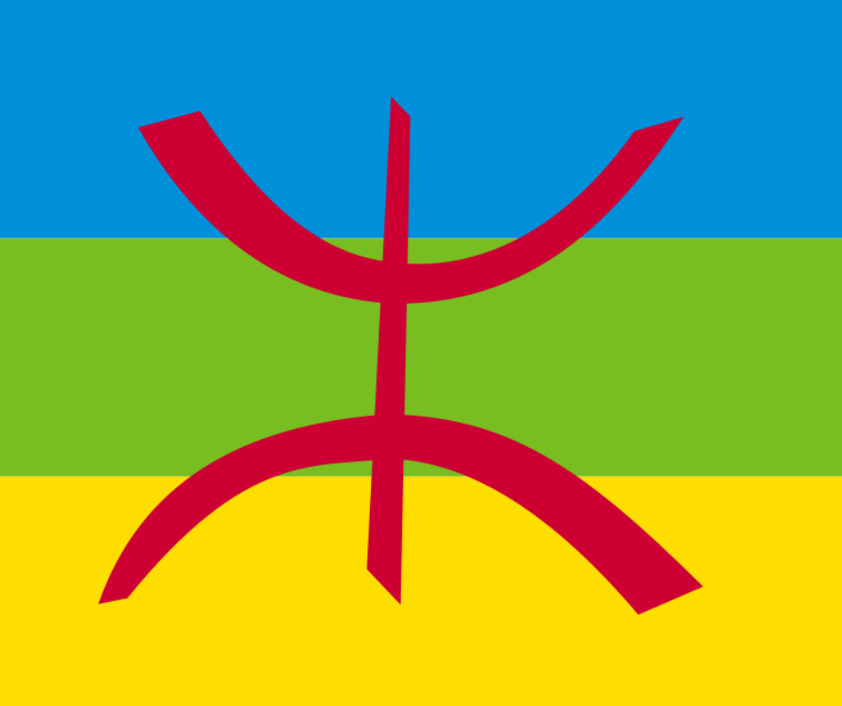
The Djurdjura is in Kabylie, where people speak Kabyle (Taqbaylit), one of the Tamazight languages; Tamazight has been an official language of Algeria since 2016. The region also features on our list of the top landmarks and historical sites in Algeria. The mountain villages are welcoming but conservative, so wear long trousers and keep your shoulders covered, even when it's warm.
If you stop in a village you'll probably be offered coffee, and it's polite to accept at least one cup even if you're in a hurry. Ask before photographing anyone, especially women and older people. A greeting in Kabyle goes a long way: "azul" is hello and "tanemmirt" is thank you.
Limestone gorges, sinkholes and other karst hazards
The Djurdjura is mostly limestone, which means karst: sinkholes, fissures, caves and underground rivers. The Anou Ifflis shaft, which opens at about 2,150 meters below the Akouker crests, goes down some 1,170 meters and is the deepest cave known in Africa. In spring, snow can bridge holes and fissures, so don't take shortcuts across rocky ground away from the path.
Don't go into any cave without caving equipment and a guide who knows that particular system; many are vertical shafts that need rope work. In the gorges, watch for rockfall after heavy rain or a sharp change in temperature, and get out of narrow canyons when a storm builds, because they can flood with little warning.
Logistics: Reaching the Trailhead
Public transport doesn't reach the trailheads. The two gateway towns are Bouira, for Tikjda on the southern side, and Tizi Ouzou, for Tala Guilef on the northern side. Both have trains and intercity shared taxis from Algiers. From either town you'll need a private taxi or a local van for the last stretch up the mountain.
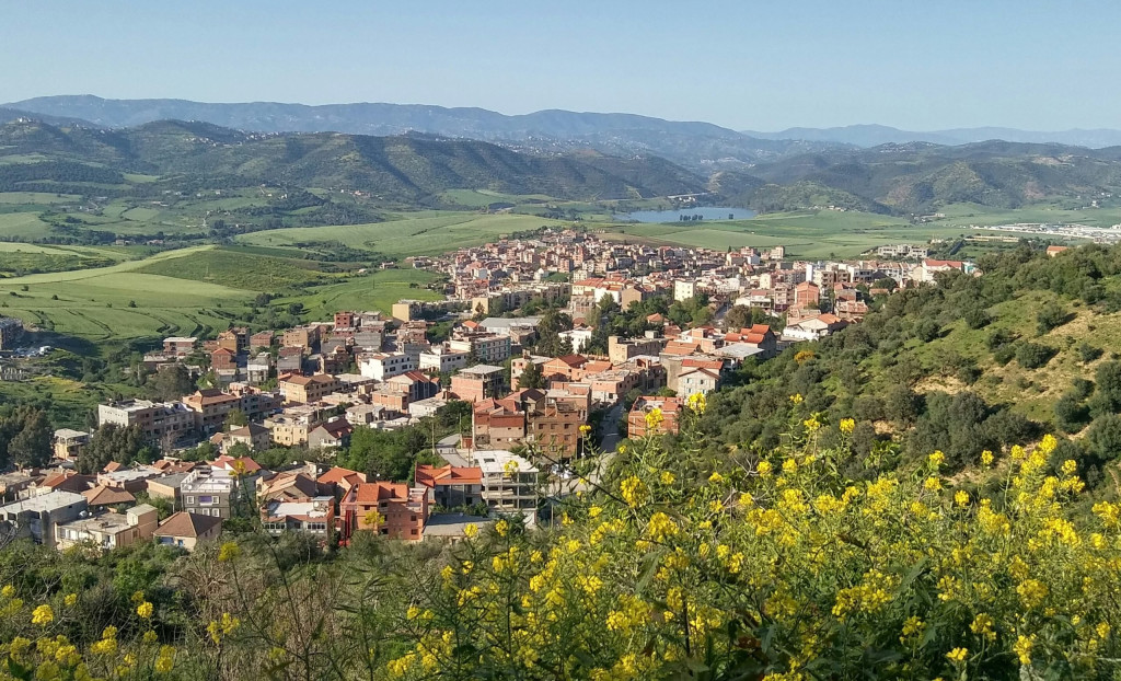
At Tikjda, the National Center for Sports and Leisure (CNSL), which comes under the Sports Ministry, runs the Hôtel Djurdjura, an auberge and the Chalet du Kef. Book ahead in summer and in the snow season, and arrange your lift up before you arrive or come early in the day, when local drivers are around. Renting a car in Algiers gives you more freedom. The mountain roads are paved but full of hairpins and steep grades, so check the brakes before the way down.
Essential gear, safety and local guides
Wear sturdy boots with deep lugs, because the limestone is loose on most trails. Trekking poles save your knees on the long descent from Lalla Khedidja. Pack a base layer, a warm fleece and a good windproof jacket: the weather on the ridges changes quickly.
Carry at least three liters of water for a full day. There are springs, but their flow is seasonal, so filter what you drink. Bring a first-aid kit, a whistle and a headlamp, since a sprained ankle can turn a morning walk into an evening one. Tell your hotel which route you're taking and when you expect to be back.
Then there's the guide question. Around Tikjda the classic paths are easy to follow in season, and the resort fills with Algerian holidaymakers, so you won't be alone on them.
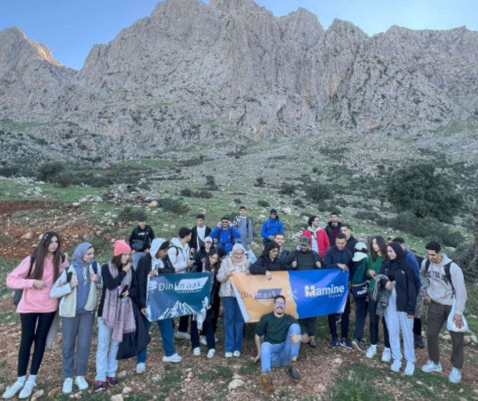
Beyond that, the trails split into unmarked tracks, and a local guide makes the difference: they know which routes are clear of snow, which villages welcome walkers for coffee, and where the macaque troops are feeding that month. We'd hike the Djurdjura with one, and we can put you in touch with a local guide and arrange the transfer from Algiers. Carry your passport too, as gendarmerie checkpoints on the mountain roads may ask for ID.
Phone signal and offline maps
Signal is patchy, so a local SIM is worth having as a safety net. You can buy one from Mobilis, Djezzy or Ooredoo at Algiers airport or at their shops in Tizi Ouzou and Bouira; bring your passport, because registration requires it. Whichever network you choose, expect dead zones in the deep gorges and on north-facing slopes.
Don't count on live Google Maps. Download offline maps in an app such as Maps.me or AllTrails before you set off, charge your phone fully and carry a small power bank. In an emergency, call the Protection Civile on 14 or the Gendarmerie on 1055.
Djurdjura FAQ
Where is the Djurdjura? In Kabylie, about 120 km east of Algiers, running east to west between Tizi Ouzou and Bouira some 60 km inland from the Mediterranean.
How high is the Djurdjura? Its highest point is Lalla Khedidja at 2,308 m, which is also the highest summit of the Tell Atlas. Ras Timedouine, in the Akouker massif, is almost as high at 2,305 m. Snow usually lies on the upper slopes from December to March, sometimes later.
Can you ski at Tikjda? Sometimes: the lifts depend on snow (about December to March) and have often been out of service, so ask the CNSL, which runs the station's lodges, before you plan a ski trip.
Do you need a guide to hike in the Djurdjura? Not for the classic paths around Tikjda in good weather, which are well trodden in season. For Lalla Khedidja in spring snow, longer routes on unmarked shepherd tracks, or the north side, we'd take a local guide. Carry your passport either way, for gendarmerie checkpoints on the mountain roads.
How do you get to Tikjda from Algiers? Take the train or a shared taxi from Algiers to Bouira, then a private taxi or local van up the mountain road to Tikjda; public transport does not go all the way. If you drive, rent a car in Algiers and follow the A1 east to Bouira. We can arrange the transfer and a guide.
Protecting the Mountain Ecosystem
Djurdjura National Park, created in 1983 and a UNESCO biosphere reserve since 1997, is under pressure from visitor numbers and climate change. We follow Leave No Trace and ask our travelers to do the same: carry out everything you bring in, including orange peel and nut shells, which take a long time to break down at this altitude.
Don't cut switchbacks; it strips the soil, which then washes away in the rainy season. Leave the wildflowers alone and don't damage the cedars. Hiking is only one side of the country. When you are ready for the Casbah, the Roman ruins or the Tassili, start with the best things to do in Algeria.
You might also like this experience in Djurdjura: Into the Wild: Djurdjura Nature Escape


