

The Aurès is the mountain block between Batna and Biskra in eastern Algeria, and it packs four very different trips into a small area: the cliff villages of Ghoufi Canyon, the Roman town of Timgad, a day hike up Djebel Chélia (2,328 m, the highest point in northern Algeria) and the palm groves of M'Chouneche, where the mountains drop to the Sahara. We'd allow four or five days to see all four without rushing, using Batna and Biskra as bases.
Timing shapes the trip more than anything: April, May and October suit the whole route, the Chélia hike is a May to October outing, and from roughly late November to February the summits are under snow. This guide takes the four in order, then covers food, etiquette, transport, safety and what to pack. The region gets far fewer foreign visitors than the coast, so expect little English, cash-only villages and long drives on mountain roads.
Ghoufi Canyon and its cliff villages
The Aurès is the eastern end of the Saharan Atlas, and the range spills over from Batna and Biskra into Khenchela, Oum El Bouaghi, Tébessa and Souk Ahras wilayas. South of Batna (about 1,050 m) the road crosses high passes and plateaus, then follows the Oued Abiod valley down toward Biskra and the desert.
Villages cling to the slopes above the river, and within a couple of hours you go from bare ridges to palm gardens. Ghoufi, in the commune of Ghassira in Batna wilaya, is the best-known stop on that road.
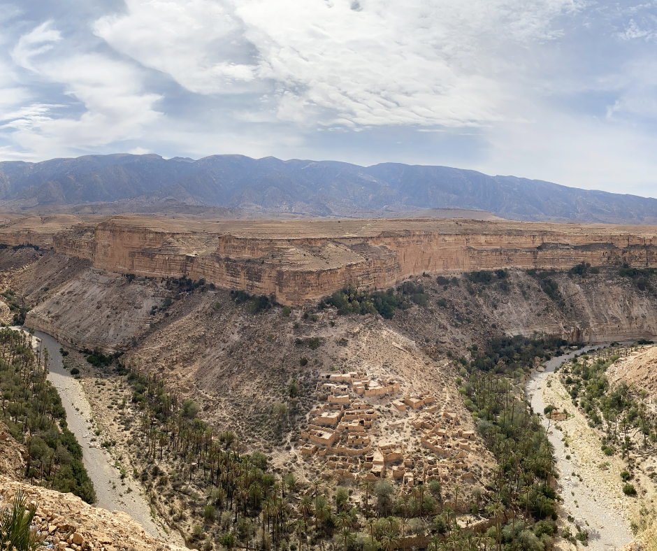
At Ghoufi the Oued Abiod has cut a canyon about 3 to 4 km long, with walls up to roughly 200 m high. Palms and fruit trees fill the floor along the river. On the ledges above sit the old houses of several hamlets, built of roughly dressed stone, local mortar and palm trunks, some of them around four centuries old. People lived in these cliff villages until about the 1970s. Today the houses are empty.
Access and Best Viewing Points
Ghoufi is on the Batna to Biskra road through Arris, about 90 km from Batna and 60 km from Biskra, so it fits into a day's drive between the two. The "balconies" (les balcons de Ghoufi) are lookouts beside the road where you can park and walk to the edge for the full view of the palm groves below.
Go early in the morning: the light on the canyon walls is softer, and from late spring the canyon floor gets hot by midday. On the way down from Arris the road passes the Tighanimine gorge, where an attack on a bus on 1 November 1954 was one of the first acts of Algeria's war of independence.
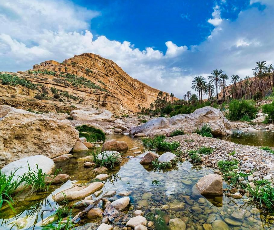
With more time, you can walk down into the canyon on the paths villagers use. They're steep and loose in places, there's little shade, and the climb back up in the afternoon is hard work, so take water and start early. At the bottom you walk between the palms along the Oued Abiod and can see the small channels that carry its water to the gardens.
The hamlets around Ghoufi
The valleys around Ghoufi are Chaoui country, with small villages built from the same stone as the mountain. Look out for the old collective granaries, called taqliath or guelaa in Tachawit: fortified stores where families kept grain and valuables, and where they could shelter in times of conflict. Most were abandoned during the 20th century. A slow drive along the valley, with stops, shows you more than racing between the two big viewpoints.
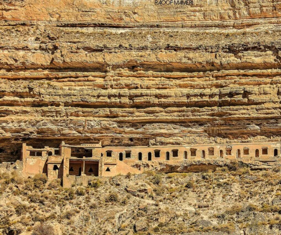
Building on slopes this steep meant stacking houses. In the older villages the roof of one house is often the terrace of the one above. The same layout turns up across the Aurès, wherever the canyon walls leave little flat ground.
Timgad Roman ruins: what to see
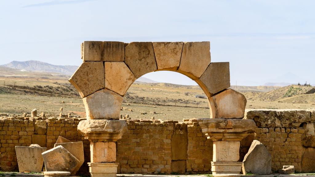
Timgad (Roman Thamugadi) sits at about 1,000 m on the northern edge of the Aurès, 35 km east of Batna. It began around AD 100 as a colony founded by Emperor Trajan and settled largely by army veterans; UNESCO added it to the World Heritage list in 1982. What makes it famous is the plan: a near-perfect grid of streets laid out from scratch, which you can still follow on the ground. The two main axes are the cardo (north-south) and the decumanus (east-west).
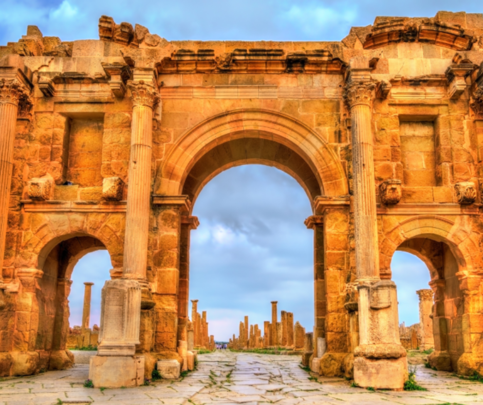
The site is big, so have a plan. Start at the Arch of Trajan, a 12 m triple arch at the western end of the decumanus, then walk east along the paved street to the forum, the center of public life, and the theater just south of it, which seated about 3,500 people.
In summer, Timgad also hosts an international music festival, one of the best-known cultural festivals in Algeria. Since around 2010 it has been held in a modern open-air theater built next to the ruins, to protect them; the 43rd edition ran from 9 to 13 July 2026.
Timgad's library, baths and Capitol
The public library is one of the few Roman libraries whose layout survives. A local notable, Julius Quintianus Flavius Rogatianus, paid for it, and it probably dates from the late 3rd or 4th century.
The alcoves along its walls held the book cupboards. Timgad also had several public baths, including large complexes north and south of the original grid. Even in ruins they show how much a frontier town spent on comfort.
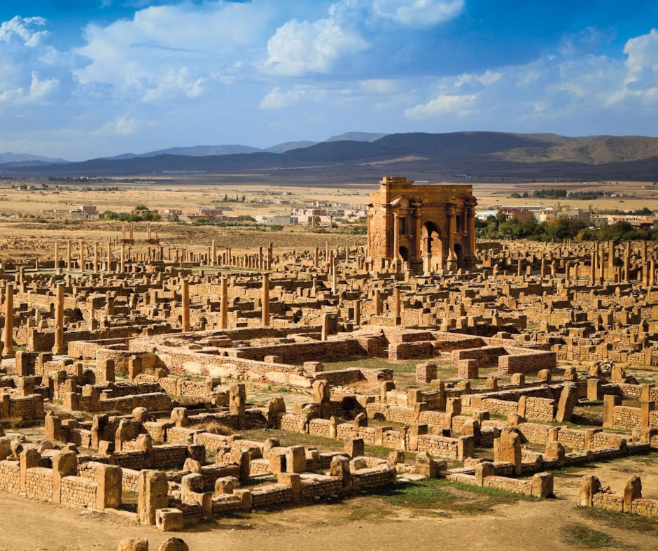
The Capitol, the temple of Jupiter, Juno and Minerva, stands on a raised platform southwest of the center. Most of it has fallen, but two re-erected columns give you its height. Leave time for the site museum: it reopened in 2018 after more than 20 years of closure and displays over 80 mosaics, from mythological scenes to geometric floors. A parliamentary visit in 2024 reported cracks in the building, so ask at the gate whether it's open.
Read also: Timgad Day Trip Guide
Practical Tips for Visiting Timgad
The site has almost no shade. Bring a wide-brimmed hat and more water than you think you need, and go early or late, because in summer the stones heat up fast after midday. Wear shoes with grip: the Roman paving is uneven and worn smooth in places. Entry is cheap (around 200 DZD in 2026, though some visitors report paying more) and cash only.
From Batna, Timgad is an easy half day. From Constantine it makes a long day trip.
Either way, give the ruins three to four hours: the town spread well beyond its first grid, and the Byzantine fort to the south is a fair walk from the arch. If you're combining the Aurès with other regions, our Algeria travel guide covers the rest of the country. At Timgad itself, the Trajan Hotel is right next to the site if you want to be there at opening time.
Hike to the Summit of Djebel Chélia
Djebel Chélia is the highest peak of the Aurès at 2,328 m (the summit is known as Ras Keltoum) and the highest point in northern Algeria; only the Hoggar peaks in the far south are higher. It sits on the boundary between Batna and Khenchela wilayas. On a clear day the view runs across the ridges of the Aurès to the plains beyond, and the top is noticeably cooler than the valleys, which is welcome in summer.
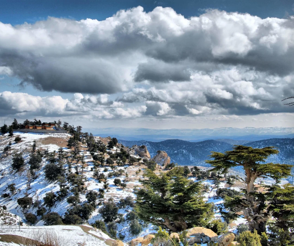
The mountain is known for its Atlas cedar forest, which shades the lower part of the climb. If you enjoy cedar forests and high trails, the Djurdjura Mountains in Kabylie offer a greener counterpart further north. On Chélia, the cedars thin out as you climb, and the last stretch is open ground with low shrubs and rock.
Preparing for the Ascent
Plan a full day. The usual approach is from the Khenchela side, around Bouhmama, and from the trailhead the summit is roughly three hours' walk. The hike isn't technical, but it's long and steady and you're working above 2,000 m, so you need decent fitness.
Start at dawn, as clouds can build over the summit in the afternoon. Snow usually covers the top from late November to February or early March, which turns it into a winter mountaineering trip, so for an ordinary hike go between May and October.
Pack layers. It can be warm at the base and cold and windy on the summit. Carry at least three liters of water and snacks like dates and nuts. Go with a local guide: the route isn't always obvious, and a guide can tell you about the villages and the mountain's history on the way up.
The Summit Experience and Descent
From the top the ridges of the Aurès stretch away in layers, with the plains beyond them on a clear day. Most hikers stop here for photos and lunch before heading down.
Take the descent slowly: loose scree on some sections is slippery, and trekking poles save your knees. Back in the cedars, keep an eye out for birds. You'll also see dead and dying trees among the healthy ones. The Aurès cedars have suffered from dieback since the 1980s, mainly from drought, and on Chélia it's worst on the ridges and south-facing slopes.
Belezma National Park and its cedar forests
Belezma National Park covers 26,250 hectares of the Belezma range, the north-western end of the Aurès, just outside Batna. It was created in November 1984 and became a UNESCO biosphere reserve in 2015. Atlas cedar covers about 5,680 hectares, a fifth of the park, and the range's summits reach about 2,178 m.
From Batna it makes an easy half day, and it pairs well with Timgad on the same day. The same cedar dieback you see on Chélia shows here too. Some forest tracks are closed at times, so a local guide earns their fee here: they'll know which ones are open and lead you to the finest stands of cedar.
A short history of the Aurès
For two thousand years the Aurès was a refuge for Berber tribes and a base of resistance against outside powers: Romans, Vandals, Byzantines and later the Arab armies. Rome ringed its northern edge with towns and forts, Timgad among them, and kept its legion headquarters at Lambèse, near Batna.
The best-known figure of that resistance is Dihya, called al-Kahina ("the priestess") by her opponents. In 698 she defeated the Arab general Hassan ibn al-Nu'man in the Meskiana valley, in what is now Oum El Bouaghi wilaya. She ruled from the Aurès until her death around 703, by tradition at a well in these mountains that still bears her name.
The Aurès also opened Algeria's war of independence. On the night of 31 October to 1 November 1954, fighters led by Mostefa Ben Boulaïd, who was born near Arris, launched the uprising here, including the attack in the Tighanimine gorge.
Chaoui Berber culture and village life
The Aurès is the heartland of the Chaoui, an Amazigh (Berber) people who speak Tachawit. Tamazight has been an official language of Algeria since 2016, and in the Aurès you'll hear it alongside Algerian Arabic. Expect to be offered tea, particularly if your guide knows the family; guests are taken seriously here.
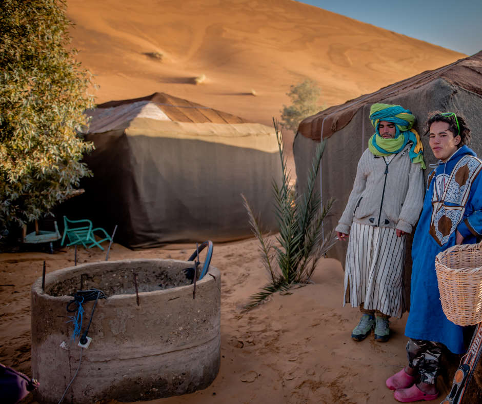
Village life runs at its own pace, and showing real interest goes a long way. Ask about weaving: the region is known for wool rugs, the best known being the Babar rugs of neighboring Khenchela wilaya. Ask, too, about transhumance: families traditionally moved their flocks down to warmer lowland valleys for the winter and farmed the mountain terraces the rest of the year. A guide who speaks Tachawit or Arabic makes these conversations possible, since few people in the villages speak English (French helps more).
Food in the Aurès
Chaoui food is built for cold winters. The dish to try is aïch (also called berkoukes): large hand-rolled semolina grains cooked in a soupy sauce. The Batna version, aïch el har, comes in a spicy red sauce with gueddid, meat salted and dried in the sun, and it's a winter staple. Chakhchoukha, torn pieces of thin semolina flatbread in a spiced tomato and meat sauce, is the other eastern classic, common across the Aurès and around Biskra.
Bread comes with everything. Kesra, a round semolina flatbread, is usually served warm, with olive oil or honey for dipping. In Batna's markets and at village stalls you'll also find dates from the Biskra side. Bring small notes, because it's all cash.
Cultural Etiquette and Traditions
Ask before photographing anyone, especially women and older people. Many will say no, and that's normal. Cover your shoulders and knees, which is what people expect in the villages. A greeting in Tachawit goes down well: "Azul" means hello.
If you're invited for tea, accept if you can, even for a short visit. It's the easiest way to hear about the region from the people who live there, and you don't need a shared language to sit down over a glass.
Walking the M'Chouneche oasis
M'Chouneche, about 30 km east of Biskra, is where the Oued Abiod leaves the mountains and the Aurès meets the Sahara. The river runs through a narrow, steep-sided valley here, and its water feeds a long strip of date palms and orchards beneath bare rock. The shade under the palms is welcome after the heat of the road.
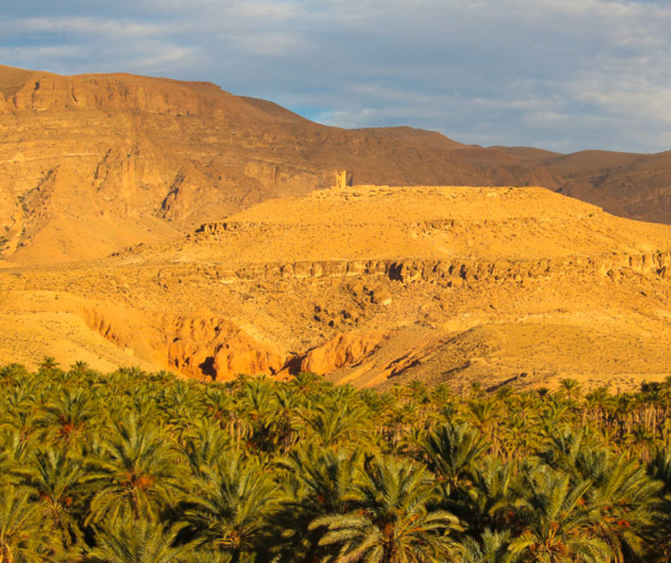
The gardens run on water-sharing rules that families still follow, with each plot taking its turn from the channels. Walking the narrow paths between the plots, you'll see pomegranates, figs and apricots growing under the taller palms.
Walking the palm groves
The groves are best seen on foot, ideally with someone from the village, since the gardens are private land. The date harvest is in autumn, roughly October and November, when the palms are at their busiest. Biskra wilaya is Algeria's main date region (the prized Deglet Nour comes from around Tolga, west of Biskra), so buy a box before you leave.
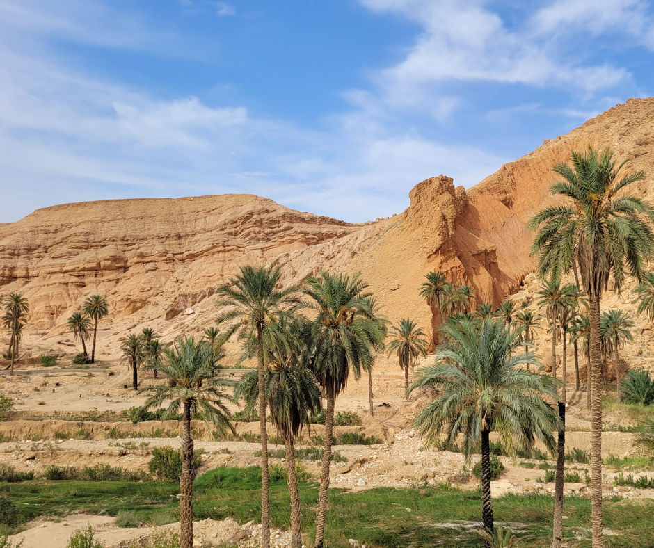
There are small streams where you can sit and cool your feet. The green strip of palms against the dry rock around it shows plainly how much here depends on the river.
The Village of M’Chouneche
The village sits on the edge of the oasis. Its older part is divided into family quarters, and like the villages around Ghoufi it has a collective granary. In 1844 the village fought a French column, a battle later painted by a French artist. Tourist services are few, so bring what you need from Biskra.
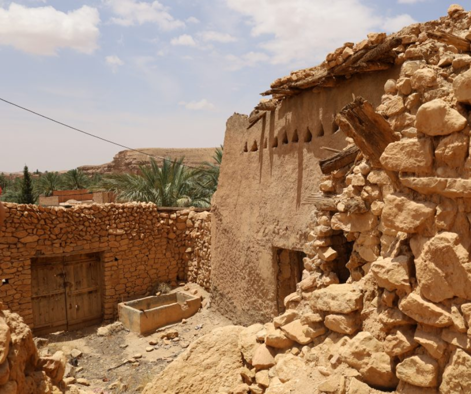
Ask in the village whether someone can walk you through the old quarter; people are usually glad to talk about where their families came from. Half a day here pairs well with a night in Biskra, before you head south into the desert or back north to Batna.
El Kantara, the gateway to the desert
El Kantara sits on the road between Batna and Biskra, about 62 km from Batna and 52 km north of Biskra. Here the mountains split in a gorge only about 40 m wide, with walls up to 120 m high. Locals call it Foum es-Sahra, "the mouth of the Sahara": north of the gorge you are in the mountains, south of it the palms begin.
Roman soldiers of the Third Augustan Legion called the gorge Calceus Herculis, "Hercules' kick". The town's Arabic name means "the bridge", after the crossing in the gorge that dates back to Roman times. Stop for an hour on the way between Batna and Biskra, ideally in the late afternoon light. From 2027 El Kantara becomes the seat of one of Algeria's new wilayas.
Planning: bases, seasons and safety
The Aurès takes more planning than the coast. Distances between sites are long, mountain roads are slow, and public transport to the villages is thin. Independent travel works if you drive or hire a driver, but most first-time visitors find it easier with a local guide.
Visitors are often surprised by how quiet and easygoing the Aurès feels compared with what they had read online, and the welcome in the villages is what most of them talk about afterward. We plan routes here with local Chaoui guides who know the valleys, and our trips have never had an incident.
Expect gendarmerie checkpoints on mountain roads and carry your passport; they are a normal part of driving in Algeria. In some wilayas the police may also offer to accompany foreign visitors for part of the way, which your guide or driver sorts out with them.
We'd use Batna as the base for the northern side (Timgad and Djebel Chélia) and Biskra for M'Chouneche; Ghoufi works from either. Both cities have hotels from basic to mid-range.
Seasons matter here. Batna sits at about 1,050 m and has cold, sometimes snowy winters, while Biskra often passes 40 °C in July and August. Spring (April and May) and autumn (October) suit the whole route best.
A five-day route through the Aurès
This loop uses two bases and keeps the drives short. Distances are by road.
| Day | Sleep in | Sights | On the road |
|---|---|---|---|
| 1 | Batna | Timgad in the morning, Belezma cedars in the afternoon | Batna to Timgad 35 km each way |
| 2 | Batna | Djebel Chélia summit hike with a guide, from the Khenchela side | Early start to the trailhead near Bouhmama |
| 3 | Biskra | Arris, the Tighanimine gorge and the Ghoufi balconies | Batna to Ghoufi 90 km, Ghoufi to Biskra 60 km |
| 4 | Biskra | M'Chouneche palm groves and old village | Biskra to M'Chouneche 30 km each way |
| 5 | Batna or onward | El Kantara gorge on the way north, or fly or take the train from Biskra | Biskra to El Kantara 52 km, on to Batna 62 km |
Transportation and Getting Around
Air Algérie flies from Algiers to Batna several times a week, and Biskra also has an airport. By rail, the SNTF train from Algiers to Batna takes about seven hours (summer 2026 timetable: Agha 13:15, Batna 20:04), and the overnight Algiers to Touggourt train stops at Biskra. Long-distance buses run from Algiers too.
Once in the region, a rental car gives you the most freedom. Main roads are generally in good condition, but the mountain stretches are narrow, winding and steep.
If you'd rather not drive, shared taxis (taxis collectifs) run between the main towns. They're cheap but leave only when full, so allow time. For Djebel Chélia and the villages off the main road you'll need a private driver or a guided trip.
What to Pack
Bring broken-in hiking boots with ankle support. The ground in the Aurès is rocky and loose, and you'll want them for the Ghoufi descent as well as Chélia. Add a daypack big enough for three liters of water, food and the layers mentioned above.
Add a power bank, offline maps (the signal drops out in the canyons and on high ridges) and a small first-aid kit. Leave the drone at home. Bringing one into Algeria without authorization is illegal, and customs confiscate them.
Before you go: cash and trip planning
The Aurès rewards slow travel: walking the canyon instead of only looking down into it, and stopping for tea when it's offered. If you'd rather not organize the driving and the guides yourself, we can arrange a driver and local guides and put you in touch with host families for a night or two in the villages.
Bring cash in small notes: the villages run entirely on it, and cards work only in a few larger hotels, at the official rate of about 150 DZD to the euro, as of autumn 2026. The informal market gives roughly 275.
Strictly speaking it is not allowed under the exchange-control rules, but it works openly, so in Batna or Biskra ask your guide or host to set you up with a changer they have dealt with before. If you declared over EUR 1,000 on arrival, change some at a bank too and keep the receipts for customs.
Getting to know the Aurès
Where are the Aurès Mountains?
In eastern Algeria, between Batna in the north and Biskra in the south, at the eastern end of the Saharan Atlas; Batna is about seven hours from Algiers by train.
What is the highest peak in the Aurès?
Djebel Chélia, at 2,328 m, on the boundary between Batna and Khenchela wilayas. It is also the highest point in northern Algeria; only the Hoggar peaks in the far south are higher. Djebel Mahmel, at 2,321 m, comes a close second within the Aurès.
Who are the Chaoui people?
The Amazigh (Berber) people of the Aurès, who speak Tachawit, one of the Tamazight languages, as well as Algerian Arabic. Their villages are known for stone houses, collective granaries and wool weaving.
Why are the Aurès important in Algerian history?
The mountains sheltered Berber resistance for centuries, from the Roman era to Dihya, who defeated an Arab army here in 698. On 1 November 1954 the Aurès was where Algeria's war of independence began, under Mostefa Ben Boulaïd, a native of the Arris area.
Can you visit the Aurès Mountains independently?
Yes, with a rental car or a hired driver. For the Chélia hike, the Ghoufi canyon floor and village visits, though, a local guide makes the trip much easier and opens doors.
Is there snow in the Aurès?
Yes. Snow usually covers the Chélia summit from late November to February or early March, and Batna, at about 1,050 m, has cold winters with occasional snow. For hiking, go between May and October; for the whole route, April, May and October are the most comfortable.
If you have questions about a trip to the Aurès, tell us your dates, your fitness level and what you most want to see, and we'll suggest a route. You can send us your trip details and we'll build the itinerary with you.
To fit the Aurès into a wider trip, see Algeria Off the Beaten Path: Sahara, M'Zab and Quiet Cities and Things to Do in Algeria: Casbah, Roman Ruins and the Sahara. The paperwork is in Algeria Visa: Requirements and Visa on Arrival, and if you're still weighing the trip, Is Algeria Worth Visiting? What to Know Before You Go (2026).


