
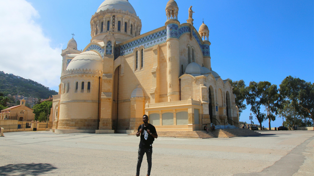

Algeria's quieter places are far apart: the Tassili n'Ajjer and the Hoggar are deep in the Sahara, Timimoun and the M'Zab in its northern half, and Djémila and Gouraya in the mountains near the coast. Getting there is most of the work, which means domestic flights, long drives and, in the south, an approved local agency.
Below are the places that see few foreign visitors, how to reach each one and how trips in the south are organized. If this is your first trip to the country, our Algeria guide covers the better-known places too.
Planning for remote Algeria: distances, visas and safety
Algeria is the largest country in Africa and over four-fifths of it is Sahara. Algiers to Tamanrasset is roughly 2,000 km by road. With one or two weeks, pick one southern region and one northern stop, or you'll spend most days in transit. The desert season is October to April; in summer, oasis afternoons are often above 40°C.
In practice, ten days means one Saharan region plus one northern stop. The Tassili n'Ajjer needs five to seven days from Djanet, the Hoggar and Assekrem three to five from Tamanrasset, and Timimoun, Taghit with Béni Abbès, or the M'Zab two to four; all of them are a flight from Algiers and best between October and April.
The southern ones run with an agency and Tuareg or local guides, while the M'Zab only asks for a gate guide in Beni Isguen. Constantine with Djémila and Timgad, Tlemcen and the Béjaïa coast you can do on your own, in spring and autumn (the coast from April to October).
Paperwork and flights south
Expect to need a visa from an Algerian consulate before you travel if you hold a UK, EU, US or Canadian passport, as most Western visitors do. Apply a month ahead: London quotes about 10 working days in person, 15 or more by post, and you need proof of where you'll stay (a hotel booking, a certified invitation, or an itinerary from an Algerian travel agency).
For organized tours of the southern wilayas booked through an approved agency, a visa can also be issued on arrival; the agency files the request before you fly. There is no general e-visa (October 2026).
Your passport needs six months' validity, and you'll show it at hotels, checkpoints and on domestic flights, so carry a paper copy and a scan. Long north-south legs are flights: Djanet, Tamanrasset, Ghardaïa and the other southern airports all have services from Algiers on Air Algérie or Domestic Airlines, its subsidiary that used to be Tassili Airlines. Algiers to Ghardaïa in the M'Zab Valley is about 600 km, 7 to 8 hours on the N1, against roughly 1 h 15 in the air.
The south is why most people make this trip: Tuareg country, rock art thousands of years old and camps with nothing but stars overhead. Travelers on our desert trips often tell us it felt calmer and far more welcoming than they had imagined.
Down there, foreign visitors go with an approved Algerian agency and local guides, and if the authorities put a police or gendarmerie escort on a route, the agency arranges it. We keep to routes we have run many times, and not one of our trips has had an incident. Read the official travel advice for your route while you're still planning, and get insurance that explicitly covers it.
Dress, alcohol and local customs
Outside central Algiers and Oran, cover shoulders and knees (men and women alike), and more so in the M'Zab and the south. Women will want a light scarf for mosques and Beni Isguen; everyone will want one against sun and sand.
Holding hands in public is fine; anything more draws stares and can bring police attention. Alcohol is sold in licensed hotels, bars and some restaurants, but drinking in a public place is illegal, and most restaurants outside the big cities don't serve it.
Darja (Algerian Arabic) and French get you furthest; English is rare outside big hotels and agencies.
Clothes for the Sahara in December are not the clothes for Constantine in May; What to Wear in Algeria sorts it by region and season.
Tassili n'Ajjer and the Stone Forests of Djanet
Tassili n'Ajjer is a sandstone plateau in the far southeast, above the oasis town of Djanet. Erosion has cut the rock into towers, arches and narrow corridors that look like the streets of a ruined city. UNESCO listed it in 1982 as a mixed natural and cultural site, and it is also a national park.
Getting onto the plateau
You can't visit independently. Agencies in Djanet run the trips with local Tuareg guides, and the classic rock-art sites on the high plateau (Tamrit, Sefar, Jabbaren) are reached only on foot, up a pass such as the Akba Tafilalet (about 600 to 700 m of climbing), with donkeys carrying the camp. Allow five to seven days for a proper trek; 4x4 trips cover the dunes and lower areas. Most travelers arrange this through one of the Sahara tours in Algeria that bundle the permits, the vehicle and the camping.
The Tadrart, the red-dune area southeast of Djanet that many tours add, is quieter still: orange sand, sandstone arches and rock engravings, with few other groups around. Your agency plans the route and the permits, so ask them where each day goes before you book.
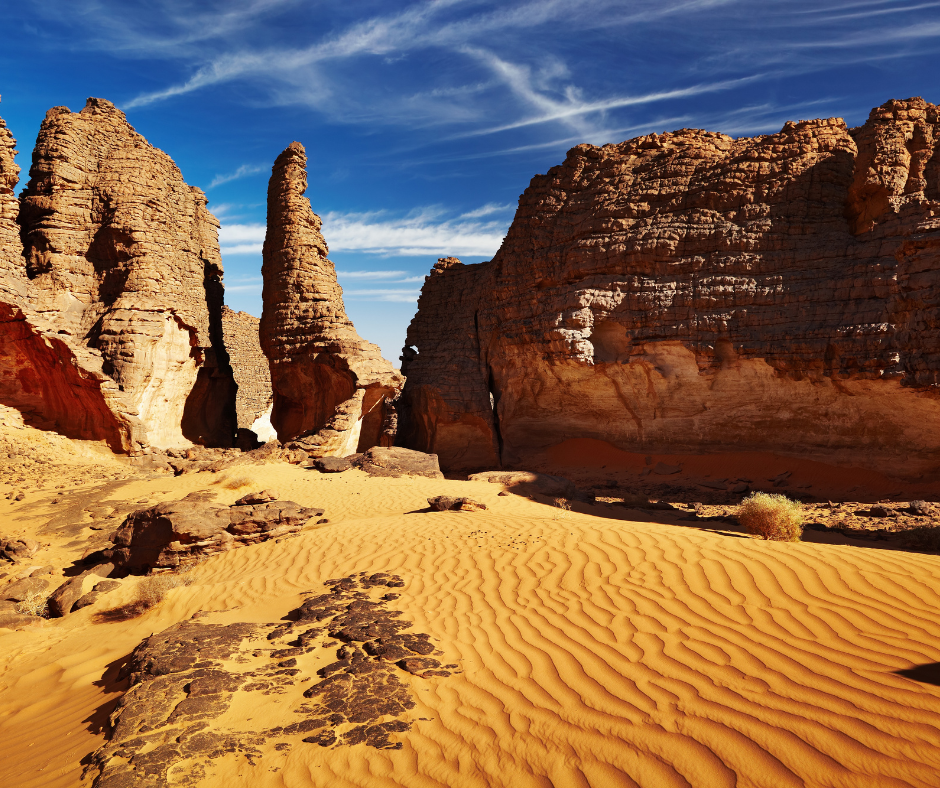
Days are spent walking through canyons and over bare rock, nights in camp with no light pollution at all. Expect five or six hours on foot a day over uneven ground, and cold nights from December to February.
Painted shelters and engravings
By UNESCO's count the plateau holds more than 15,000 drawings and engravings. The oldest show elephants, giraffes and hippos from a time when the Sahara was green savanna. After them come cattle herders, then horses, then camels, a sequence running roughly from 10,000 BC to the first centuries AD.

Most paintings are in rock shelters, where the overhang kept the sun off the pigment. Don't touch or wet them to brighten the colors, and leave flints and potsherds where they lie: taking antiquities out of Algeria can lead to prosecution.
Read also: Djanet, Algeria: Things to Do and Tassili Treks
The Volcanic Peaks of the Hoggar Mountains
The Hoggar (Ahaggar) massif rises north of Tamanrasset, inside the Ahaggar Cultural Park. Its core, the Atakor, is a field of dark volcanic peaks and old lava flows, and Mount Tahat, usually given as 2,908 m, is the highest point in Algeria.
Reaching the Assekrem Plateau
Assekrem is about 80 km from Tamanrasset, roughly 30 km of tarmac and then a rough 4x4 track: allow 3 to 4 hours each way. The plateau rises to about 2,726 m, with the hermitage Charles de Foucauld built in 1911 at the top. Groups go up for sunrise or sunset, when low light picks out the volcanic plugs of the Atakor.
You go up with a licensed agency from Tamanrasset and local Tuareg guides, and the agency also handles the police or gendarmerie escort the authorities put on some routes. If you can, spend the night up top: you get both the sunset and the sunrise without driving the track in the dark.
Life in the High Desert
The Hoggar is a stone desert, higher and steeper than the sand seas further west: plateaus, gravel plains and peaks, with gueltas (rock pools) in some gorges.
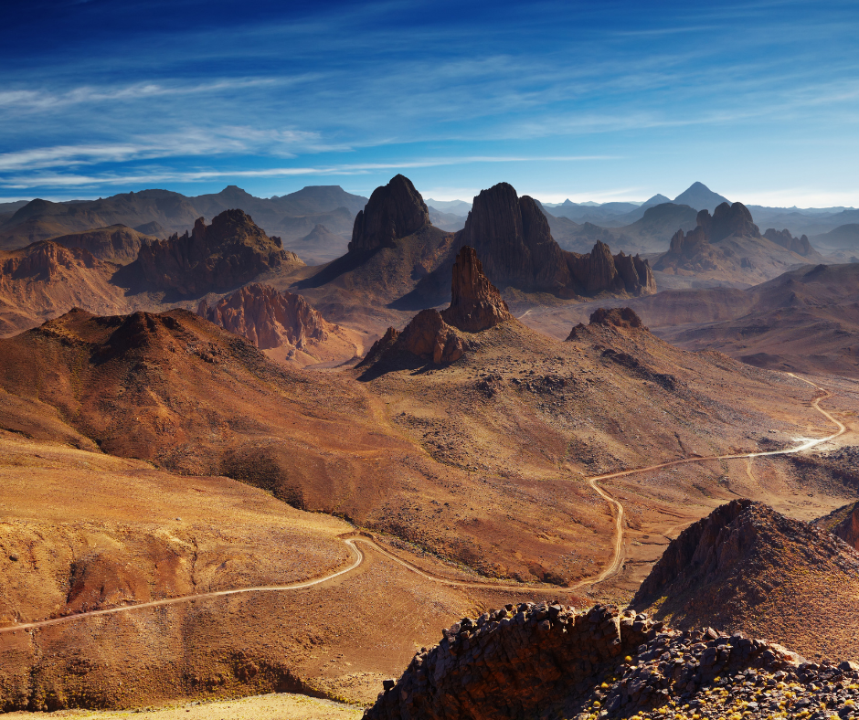
From December to February, nights at Assekrem drop below freezing, so bring warm layers and a proper sleeping bag. Boots with ankle support matter more here than in the dunes, because the paths are loose volcanic scree.
Read also: Algeria Hiking Tours 2026: Sahara & Atlas Treks
Timimoun, the Red Oasis, and the Gourara
Timimoun's nickname, the Red Oasis, comes from its ochre earth buildings. It sits at about 288 m beside a sebkha (salt flat) in the Gourara, with ksour (fortified earth villages) scattered through the palm groves and dunes around it. As elsewhere in the south, you travel with an approved agency. Go between October and April.
The Architecture of the Ksar
The old ksar of Timimoun is built of mud brick, with thick walls that keep the rooms cool through summer afternoons above 40°C. The lanes are narrow and partly covered, so they stay in shade most of the day.
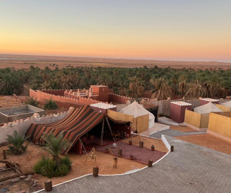
The spiky crenellations and raised geometric patterns on the main street are neo-Sudanese, a style brought in during the French colonial period and built by local masons with Zenata Berber motifs. The best example is the former Hôtel Oasis Rouge (1917), now a protected monument housing CAPTERRE, Algeria's center for earthen architecture.
The Foggara Irrigation System
Timimoun's palm groves still depend on foggaras: underground channels dug into the slope that carry groundwater to the gardens by gravity. Lines of access shafts mark their route across the ground.
In the gardens you can see the kesria, comb-shaped stone distributors that split the flow into a channel for each owner, whose share is gauged by a water measurer, the kiel el ma. UNESCO added the foggara water measurers of neighboring Touat and Tidikelt to its Urgent Safeguarding list in 2018; many foggaras have dried up as pumped wells lower the water table.
Taghit and Béni Abbès in the Saoura
For a shorter desert trip than Djanet or the Hoggar, fly to Béchar and head for the Saoura valley. Taghit, 93 km south-east of Béchar, is an oasis on the Oued Zousfana with a palm grove more than 20 km long. Right behind its houses rise the dunes of the Grand Erg Occidental; the ksar was made a national historical monument in 1999, and prehistoric rock engravings are scattered through the surrounding valleys.
Béni Abbès, about 250 km south of Béchar by road, is the "white oasis" on the Oued Saoura, with its old ksar in the middle of the palm grove. Both towns are in wilayas covered by the visa on arrival for organized trips, and two or three days is enough for either. Taghit holds a date festival in late October.
Ghardaïa and the M'Zab pentapolis
Five fortified hilltop towns make up the M'Zab Valley pentapolis: El Atteuf, Bounoura, Melika, Ghardaïa and Beni Isguen, founded between 1012 and 1350 and listed by UNESCO in 1982. Ghardaïa is the largest and busiest. Beni Isguen, next door, is where Mozabite rules are most visible.
Beni Isguen's visitor rules
Beni Isguen is the strictest of the five towns. Visitors go in only with a local guide, whom you engage at the main gate, and they leave at sunset, when the town closes to outsiders; non-residents never stay the night inside the walls. It is a working religious community, so treat it like someone's neighborhood.
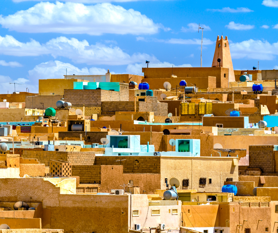
Smoking is banned inside the walls. Cover shoulders and legs, and don't photograph people, especially women; your guide will tell you where cameras are fine.
The late-afternoon auction in the market square
Every day except Friday and public holidays, from late afternoon until shortly before sunset, Lalla Achou square in Beni Isguen holds a public auction, the vente à la criée. It is run for locals under the town's council of elders, and what changes hands is everyday stuff: furniture, carpets, crafts, household goods.
Auctioneers walk the square holding up each item and calling the latest bid, and buyers answer with small gestures. Stay at the edge with your guide and keep your camera down unless they say it's fine.
Read also: Algeria Group Trips 2026: Routes, Visas and Planning Tips
Djémila: Roman ruins in the mountains near Sétif
Timgad is better known, but Djémila (Roman Cuicul), about 50 km northeast of Sétif, has the better setting. The town sits at about 900 m on a narrow spur between two ravines, so its builders bent the usual Roman grid to fit the slope. That adaptation is why UNESCO listed it in 1982.
The forums and the theater
Cuicul was founded at the end of the first century AD and has two forums: the original one and a larger one added in the third century under Caracalla, next to the arch that carries his name. The arches, temples and paved streets are in good condition, and on most days you share them with few other visitors.
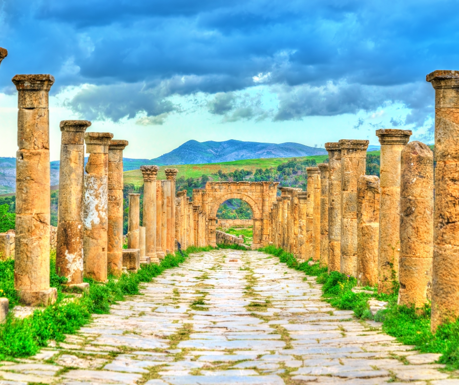
The theater, built into the hillside outside the old town walls, looks out over green hills, very different from the desert sites in the south.
The mosaic museum
Leave time for the museum by the entrance. Its walls and floors are covered with about 1,700 m² of mosaics from the town's houses, with hunting scenes and mythological subjects. It has its own ticket and opening hours.
Most visitors come on a day trip from Sétif. With the museum, plan on at least half a day at the site.
Read also: Discovering Algeria’s Ancient Wonders: The Roman Heritage Tour
Constantine, the city of bridges
Constantine, ancient Cirta and once the capital of Numidia, stands on a rock plateau cut by the gorge of the Rhumel. The bridges are the reason to come: the Sidi M'Cid suspension bridge of 1912, its deck about 175 m over the river, and the Salah Bey viaduct of 2014, a cable-stayed span about 1.1 km long. In the old town, the Palace of Ahmed Bey (built 1825 to 1835) has painted walls and garden courtyards.
Constantine is about 390 km east of Algiers, a short domestic flight or a long day on the road, and two days covers the city. It also makes the base for a loop of Roman sites: Sétif, the town for Djémila, is 130 km west, and Batna, the town for Timgad, 119 km to the south-south-west.
Timgad and the canyons of the Aurès
Timgad, 35 km east of Batna, is the Roman town Trajan founded in AD 100, on the UNESCO list since 1982. Its streets still follow an almost perfect grid. The Arch of Trajan, the market halls and a theater of about 3,500 seats stand on a bare plateau with the Aurès mountains behind.
Entry is a few hundred dinars. Allow half a day, and go early, as there is almost no shade.
In the Aurès, the balconies of Ghoufi look down into the canyon of the Oued Abiod. A 3 to 4 km stretch of cliff is lined with troglodyte houses, lived in until the 1970s, above a ribbon of palm gardens. Batna is the base for both; give each its own half day.
Gouraya National Park on the Béjaïa coast
Gouraya National Park (created 1984, a UNESCO biosphere reserve since 2004) covers the headland behind Béjaïa: limestone cliffs, pine woods, scrub and sea views. It is the easiest place here to reach: Béjaïa has an airport and a ferry port, and the trails start at the edge of town.
Hiking the Cap Carbon Trails
The classic loop climbs a paved zigzag path to Yemma Gouraya (about 660 m), with its fort and the shrine of Lalla Gouraya, follows the ridge to the Pic des Singes (about 430 m), then drops toward Cap Carbon and Les Aiguades. The Cap Carbon lighthouse, built in 1906, stands about 220 m above the sea. Locals call it the highest lighthouse in the world; we couldn't confirm that.
Carry at least 1.5 liters of water each and sunscreen: the sea breeze hides how strong the sun is on the open ridge.
Meeting the Barbary Macaques
Barbary macaques live wild only in Algeria and Morocco (Gibraltar's were introduced), and the species is listed as Endangered. In Gouraya, groups stay around the Pic des Singes and the ridge path to Cap Carbon. Don't feed them, even if others do: it makes them aggressive and harms their health.
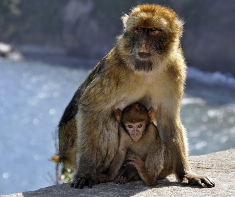
Watch from a few meters away and keep food out of sight. The park sits directly above the city, so you can walk up from town and be on the ridge early, before the midday sun.
Read also: Djurdjura Hiking Guide
Tlemcen and the far west
Tlemcen, 141 km south-west of Oran, is the place for medieval Islamic architecture. The Great Mosque was founded in 1082, with a mihrab dome dated 1136. The Sidi Boumediene mosque and madrasa were built by the Marinids in the 1330s next to the tomb of the Sufi saint Abu Madyan.
Outside town stand the walls and the 38 m minaret of Mansourah, a Marinid siege city of about 1299 to 1307. Tlemcen has its own airport, 22 km north-west of town, and two days is about right.
The quiet east coast: Jijel and El Kala
East of Béjaïa, the RN43 corniche runs along cliffs and coves toward Jijel. At Ziama Mansouriah, 35 km west of Jijel, the Grottes merveilleuses were found in 1917 during road building; inside, the stalactite caves stay at a constant 18 °C.
Further east, El Kala National Park (a UNESCO biosphere reserve since 1990) protects lakes Tonga and Oubeïra and Lake Mellah, the only lagoon in Algeria connected to the sea. The park has recorded 64 species of freshwater birds. Since the park runs up to the Tunisian border, read the official travel advice for that area and make sure your insurer will cover it before you go.
Gear, cash and practical tips
Algeria runs on cash, the south almost entirely so, and ATMs there are scarce, so carry enough dinars for the whole southern leg.
Exchange, water and the sun
Banks, cards and ATMs give roughly 150 DZD per euro (autumn 2026), and the informal changers about 275. That market is strictly speaking outside the exchange-control law but used openly by nearly everyone, so have your guide or host take you to one they trust, keep bank receipts for customs if you declared more than EUR 1,000 on arrival, and spend your last dinars before you fly, as visitors may not export them.
For the Sahara, pack a wide-brimmed hat, a light scarf for sun and sand, and layers for the cold winter nights. When walking in the desert, plan on at least 3 liters of water a day.
Slowing down, and taking photos
The slow parts are often the best: an afternoon in a café in Ghardaïa, tea on the fire in a Tassili camp. Build a free half-day into each stop, because flights, escorts and checkpoints rarely run exactly to plan.
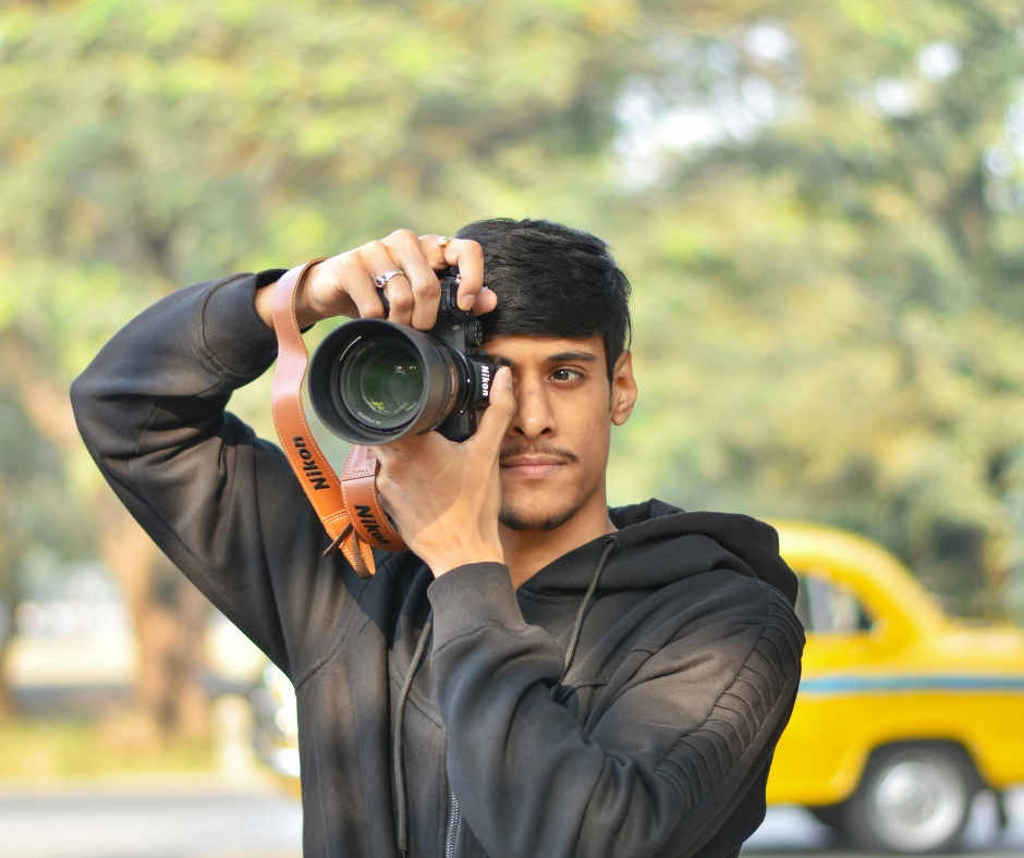
Don't photograph police, soldiers, checkpoints, airports or government buildings, ask before photographing people, and leave the drone at home: customs confiscate drones brought in without an authorization tourists can't realistically get. If photography is more your thing, our Algeria photography tour guide covers the main spots and when the light is best.
Before you leave Algiers for the quiet places
Can you travel Algeria independently? In the north, yes. Algiers, Constantine, Tlemcen, Béjaïa and the Roman sites can be done on your own with trains, buses, shared taxis and domestic flights, though little is written in English. The Sahara is agency country: foreign visitors go with an approved Algerian agency and local guides, and that agency is also the only way to get the visa on arrival for southern trips.
How many days do you need for Algeria? Ten days for one desert region and one northern stop beyond Algiers (say Constantine and Djémila, then Djanet or Timimoun), two weeks if you add the M'Zab or Tlemcen.
What is the best time of year to visit the Algerian desert? October to April. We'd pick November or March, with warm days and cool nights. December to February bring cold nights, below freezing at Assekrem. From May to September, oasis afternoons often pass 40 °C, and most desert trips stop for the summer.
How do you get around Algeria without a car? By air between regions (Air Algérie and Domestic Airlines) and by Coradia train in the north, where Algiers to Oran takes about 4.5 to 5 hours; buses and shared taxis fill the gaps, Yassir and Heetch work in cities, and in the south your agency's 4x4s do the driving.
The trade-offs
The price of all that quiet: basic camps, long transfers, cash-only days, checkpoints and a fixed agency itinerary in the south. If you want to wander on your own, the north (Béjaïa, Djémila) gives you more freedom. For the desert, aim for October to April and book the agency early, since the visa on arrival depends on it.
If you want help matching these places to your dates, the WildyNess team can build the route with you, put you in touch with local agencies and Tuareg guides in the south, and help with the visa, from the invitation letter for the consulate to the visa-on-arrival request for Sahara trips.
All you have to do is reach out to us.
Two more reads before you book: Is Algeria Worth Visiting? What to Know Before You Go (2026), and, for what to eat on the road, Algerian Street Food: What to Eat and Where.


