
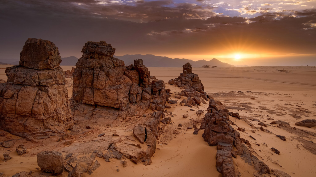

People go to Tassili n'Ajjer, the sandstone plateau above Djanet in Algeria's far southeast, for the rock art: more than 15,000 drawings and engravings by UNESCO's count, made from roughly 10,000 BC to the first centuries AD, on a site listed in 1982. The main sites are reachable only on foot, with an approved agency and an official guide, so plan a trek of a week or more between late October and April.
Before any trek, read the desert health tips in our Algeria travel guide, from high-SPF sunscreen to a full supply of your prescriptions.
Tassili n'Ajjer in numbers
| Planning point | What it means for your trip |
|---|---|
| Location | A sandstone plateau in southeast Algeria, above the oasis of Djanet, toward the borders with Libya and Niger |
| Area | About 72,000 km² for the UNESCO property, inside a cultural park of about 138,000 km² |
| Status | National park since 1972, UNESCO World Heritage site (natural and cultural) since 1982, biosphere reserve since 1986 |
| Flying in | Djanet's Tiska airport, about 30 km south of town, a little over two hours from Algiers |
| When to go | Late October to April |
| Paperwork | An official guide is compulsory; park and photo permits come through an approved Algerian agency |
You will also see it written Tassili N'Ajjer, and many Algerians still call it the Tassili National Park, though since 2011 it has officially been the Tassili Cultural Park.
How to Reach the Tassili Plateau: Djanet, Visas and Permits
Every trip starts in Djanet and runs through an approved Algerian travel agency. Visitors may only enter the sites with an official guide, and the park permits (plus a separate photo permit) come through approved agencies, so agency, guide, crew and paperwork are one package. Most itineraries spend the first night near Djanet and start walking the next morning.
The agency can also arrange the Sahara visa on arrival (about EUR 110 is the figure most often reported, depending on nationality; valid up to 30 days). Otherwise, it's a tourist visa from an Algerian consulate, arranged before departure.
Djanet is part of the draw: a palm oasis under the dark cliffs of the plateau, with Tuareg guides who know every pass and rock shelter above town, and travelers on our treks here regularly tell us the region felt calmer and more welcoming than anything they had read before coming. Some desert routes come with a police or gendarmerie escort; the agency sets it up, and it's simply part of the trip. Read the latest official travel advice covering Djanet, and check that your insurance policy covers the area, before you commit to dates.
Flights and Ground Transport
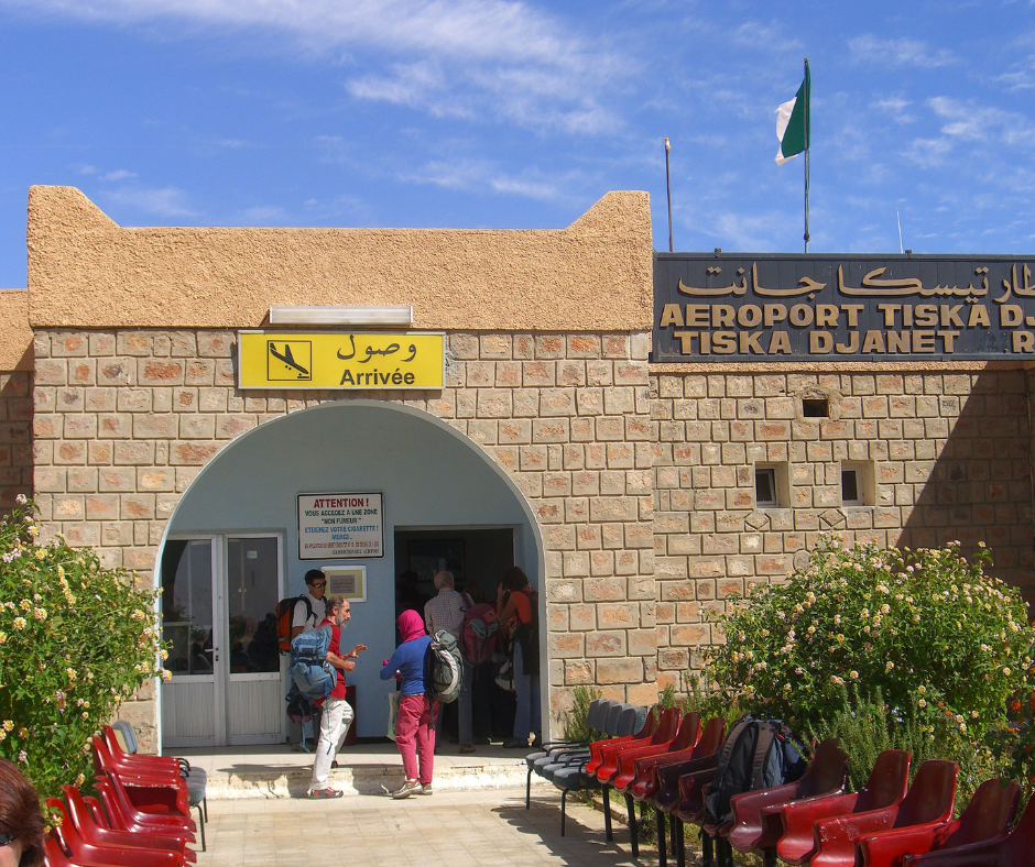
The usual way in is a flight from Algiers on Air Algérie or its subsidiary Domestic Airlines, which replaced Tassili Airlines in 2025. The flight takes a little over two hours, some departures are late at night or very early, and schedules change often, so leave a buffer after your international flight. Some recent Saharan seasons have also had direct Air Algérie flights from Paris CDG to Djanet, worth checking against your dates. Your agency meets you at Tiska, Djanet's airport, about 30 km south of town.
The plateau has no roads. A 4x4 drops you at the foot of a pass such as the Akba Tafilalet, and from there you walk while donkeys carry the water, food and camping gear. Our Algeria desert road trip shows how to fit the plateau into a longer route through Taghit and Timimoun.
Read also: Djanet, Algeria: Things to Do and Tassili Treks
Cash, Exchange and Phone Signal
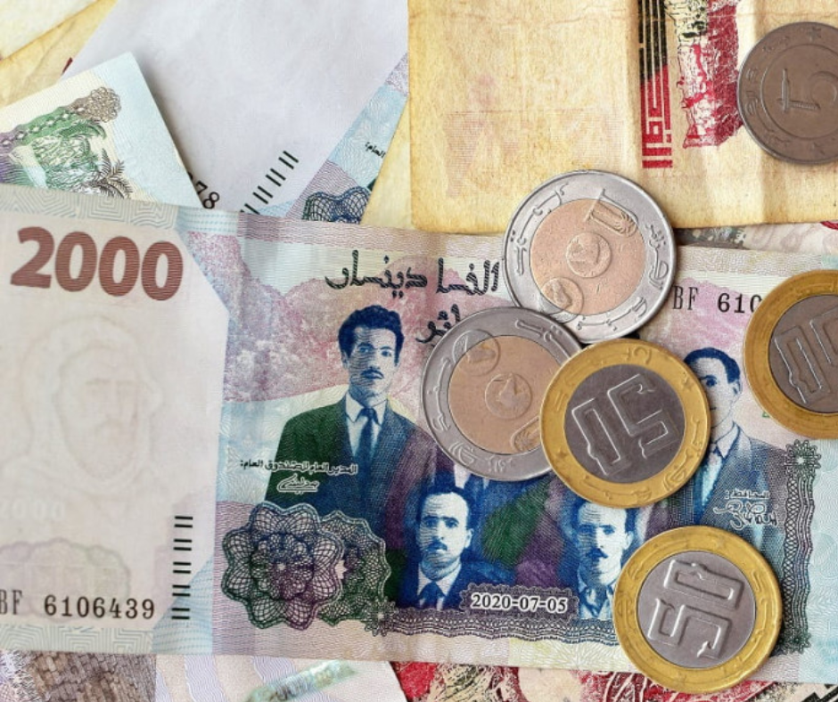
Djanet and the plateau run on cash, and foreign cards are close to useless in the south, so arrive with enough dinars for the whole trip, tips for your guide and crew included, changed through your agency with a changer it trusts on the informal market (against the currency rules on paper, but it pays about 275 DZD to the euro against about 150 at banks, autumn 2026).
Signal fades soon after you leave town (Mobilis reaches furthest), so download offline maps and give family your agency's number. Ask your agency before packing a satellite phone or messenger: some equipment needs authorization in Algeria, and satellite phones are regulated.
The Tassili's Prehistoric Rock Art Phases
UNESCO ranks the Tassili among the world's most important groupings of prehistoric rock art, most of it on the walls of rock shelters. Archaeologists sort it into five overlapping traditions: Archaic (Wild Fauna), Round Head, Pastoral (Bovidian), Horse and Camel. Their dates are still argued over, and the “12,000 years old” you'll see quoted fits only the earliest work.
How the Tassili art became known
The paintings were first reported in 1910, but they reached a wider public through the sketches of Charles Brenans, a French officer who crossed the plateau in the 1930s. In 1956 and 1957 the ethnographer Henri Lhote led a long expedition to copy them, and the copies were shown in Paris. The area became a national park in 1972, joined the World Heritage list in 1982 and was named a biosphere reserve in 1986.
The Hunter and Round Head Periods
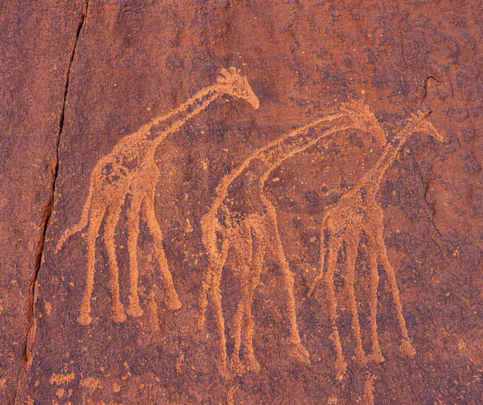
The oldest layer, the Wild Fauna or Bubaline period (named after an extinct giant buffalo), is mostly engraved, not painted: elephants, giraffes and rhinos long gone from the region. Next came the Round Head period, the Tassili's signature style: painted human figures with round, featureless heads that seem to float.
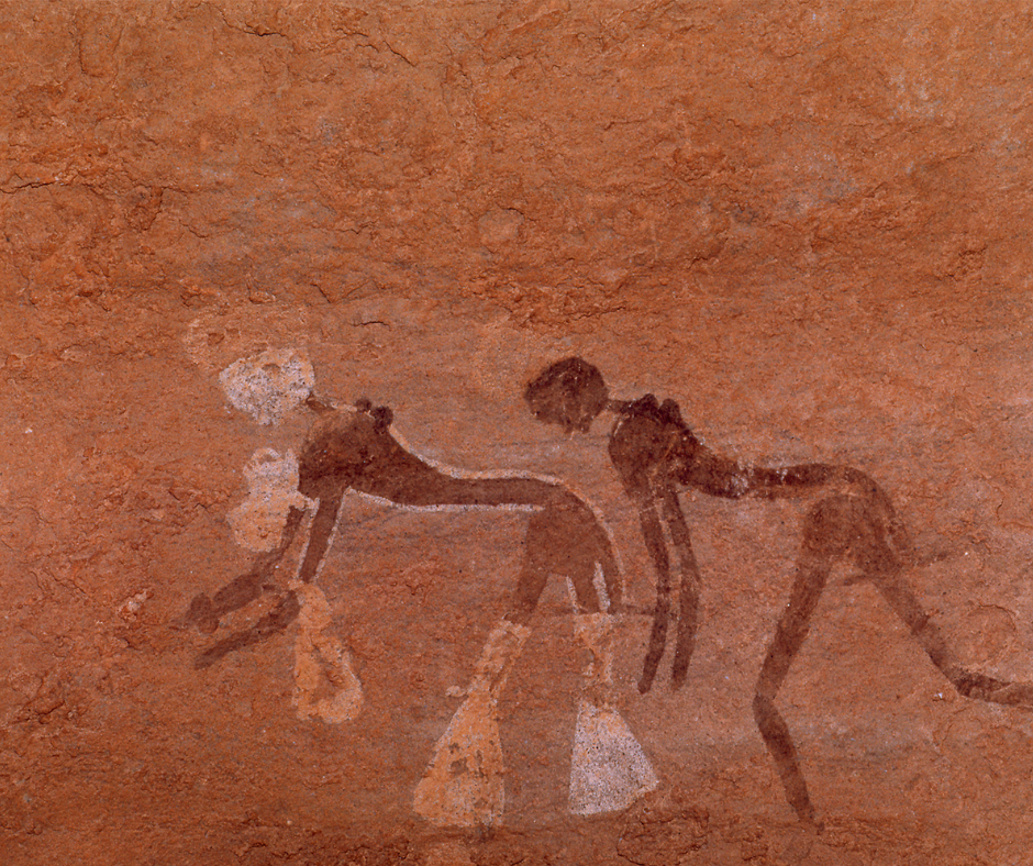
Some Round Head figures are huge, and the scenes are usually read as ritual, though nobody knows for sure. The best-known are at Sefar and Jabbaren (“the giants” in Tamahaq). Lhote nicknamed one Jabbaren figure the “Great Martian God.” It most likely shows a person in a ritual mask.
The Bovidian and Horse Periods
As the climate dried, people turned to herding, and the art followed: Pastoral (Bovidian) paintings show cattle herds, camp scenes, hunting and dancing. Long-horned cattle also star in the best-known engraving near town, the “Crying Cows” of Tegharghart, about 25 km from Djanet: a half-hour stop, no trek needed.
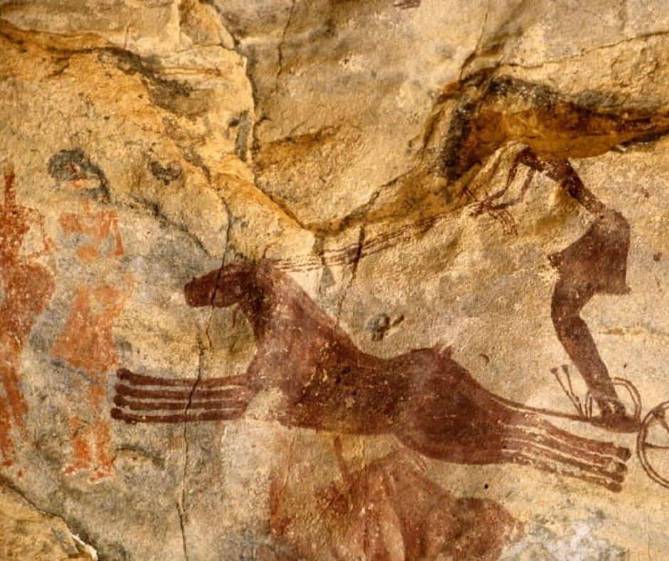
Later panels show horses, some pulling chariots, and finally camels, which took over as the land turned to desert. Where styles overlap, the newer is painted over the older, which is partly how the sequence was worked out.
The Forest of Rocks: Tassili's Sandstone Formations
The Tassili is a mixed natural and cultural World Heritage site, listed for its landscape as well as its art. Water and wind have cut the sandstone into pillars, arches and corridors, the “forests of stone.” Around Sefar they look so much like streets and houses that Sefar is called a “stone city.”
Walking the Sandstone Labyrinths
Inside the formations, paths mostly follow dry wadi beds. Slow down where the rock closes in: painted shelters hide in the corridor walls.
The sandstone is fragile and erodes into arches, towers and shapes like people or animals. Stay close to your guide: loose scree and sudden drops are the real hazards, and the corridors all look alike.
Finding the Best Panoramic Viewpoints
We like to alternate shaded corridors with a climb onto a ridge, where you see the wadis winding below and the dark, eroded plateau running to the horizon.
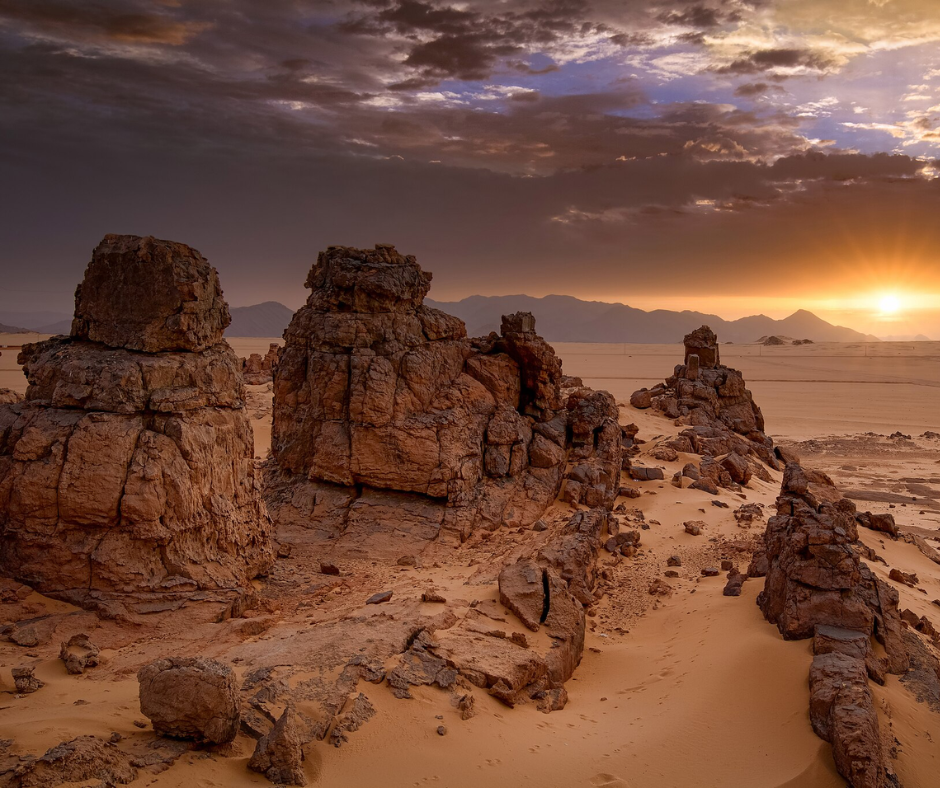
The best light is early and late, when the low sun picks out the texture of the rock; midday light is flat. To photograph the rock art, make sure the park's photo permit is part of your trip.
Trekking and Camping on the High Plateau
Treks here are long walks over rough ground, not mountaineering. The classic route climbs the Akba Tafilalet from near Djanet (600 to 700 m of ascent, three to four hours, donkeys carrying the gear) to Tamrit, then on to Sefar; treks to Sefar usually take 8 to 10 days there and back.
Jabbaren is reached by another steep pass, the Akba Aroum. Expect four to five hours of walking a day. The highest point is only 2,158 m (Adrar Afao), so altitude isn't the issue; heat, sun and footing are.
A sample 10-day trip: Tamrit and Sefar on foot
This is the shape of the classic trek, with about eight days on the plateau. Your agency adjusts it to the group's pace and to where the water is.
| Day | Plan |
|---|---|
| 1 | Fly to Djanet, meet your agency and crew, night near town |
| 2 | 4x4 to the foot of the Akba Tafilalet, climb 600 to 700 m to the plateau (three to four hours), camp near Tamrit |
| 3 | The tarout cypresses and rock shelters around Tamrit |
| 4 to 6 | Walk to Sefar and spend two days in the stone city and its painted shelters, Round Head figures included |
| 7 to 8 | Walk back toward Tamrit, stopping at shelters on the way |
| 9 | Descend the Akba Tafilalet and drive back to Djanet |
| 10 | The Crying Cows engraving at Tegharghart, about 25 km from town, then fly out |
Expect four to five hours of walking on most plateau days. If you want Jabbaren too, add two or three days via the Akba Aroum.
The Tadrart Rouge: the 4x4 alternative
If a week of walking isn't for you, the Tadrart Rouge southeast of Djanet is the easier option: you travel by 4x4, camp each night among red dunes and rock towers, and walk only short distances to its engravings and painted shelters. You miss the giant Round Head figures of Sefar and Jabbaren, but the season and agency rules are the same, and some travelers do a few days there before the climb to Tamrit.
Packing for Desert Treks
Bring broken-in boots with ankle support: the terrain runs from soft sand to sharp, abrasive sandstone. Poles help on the descents from the passes. Your daypack needs 2 to 3 liters of water, sun protection and a warm layer; the donkeys carry the rest.
Dress in layers, with a fleece or down jacket and a windproof shell. Djanet's average January low is about 3.5°C, and the plateau can drop below freezing in December and January, so bring a sleeping bag rated to around freezing.
Daily Rhythm and Best Season
Walk early and rest through midday in the shade of an overhang. The season runs from late October to April; we'd aim for November or late February to March. From May to September, average highs in Djanet are 36 to 38°C, too hot for trekking.
Flora and Fauna of the Tassili
UNESCO describes the plateau as an island of Sahelian plants and animals in the middle of the Sahara, kept going by its gueltas, rock pools that hold water long after the rare rains.
The Saharan Cypress (Tarout)
The best-known plant is the tarout, or Saharan cypress (Cupressus dupreziana), one of the rarest trees in the world. It grows in the wadis around Tamrit, on the classic route. Most trees are thought to be over 2,000 years old, relics of a wetter climate, and almost none have regenerated for decades. Surveys in 1997 to 2001 counted 233; drought has killed some since, and the IUCN lists the species as Critically Endangered.
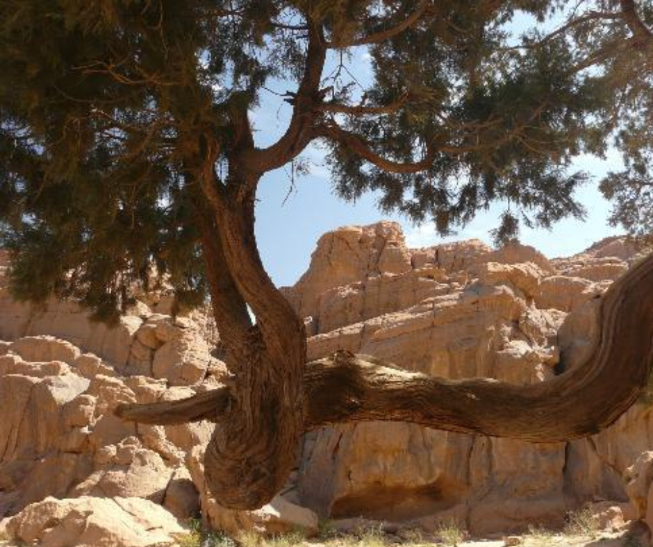
Don't climb the trees, break branches or camp on their roots.
Spotting Desert-Adapted Wildlife
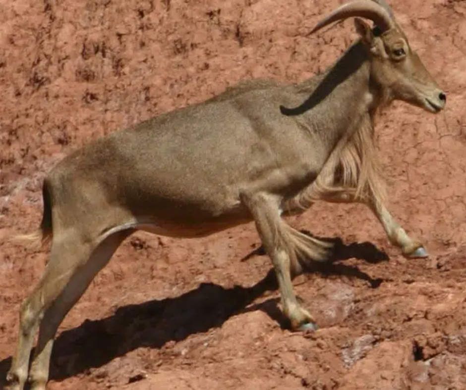
Wildlife is shy and spread thin, but at dawn and dusk you may see Barbary sheep or dorcas gazelles. BirdLife lists the Tassili as an Important Bird Area, home to sandgrouse, eagle-owls, larks and wheatears.
Leave binoculars at home: the UK FCDO says bringing binoculars, telescopes or drones into Algeria without authorization is illegal, and customs can confiscate them. Keep your distance from animals, and pack out all trash, food scraps included, because they draw animals into camp.
Trekking with Tuareg Guides
Your guide, cook and donkey handlers will almost certainly be Tuareg from Djanet, the main town of the Kel Ajjer, the Tuareg of this region. They are sometimes called the “Blue Men” for the indigo-dyed veil (tagelmust) men wear.
The Importance of Local Expertise
A good guide does more than find the way: they'll spot engravings you'd miss, read the weather and know which gueltas hold water. Guides usually speak Arabic, French and Tamahaq; ask your agency if you need English.
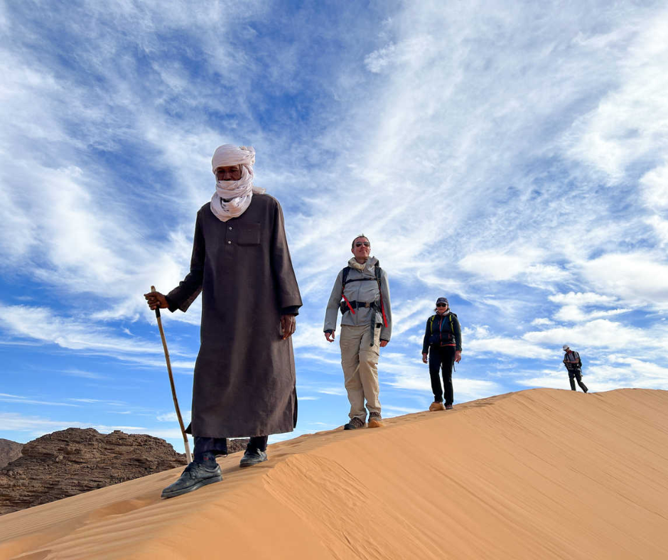
Booking through a Djanet agency keeps more of your money with the families who work the trekking season. Evenings in camp are the time to ask about life in town today.
Saharan Tea in Camp
Evenings in camp center on tea: green tea boiled with plenty of sugar on the embers, then poured from a height between glass and pot until it foams, in three rounds.
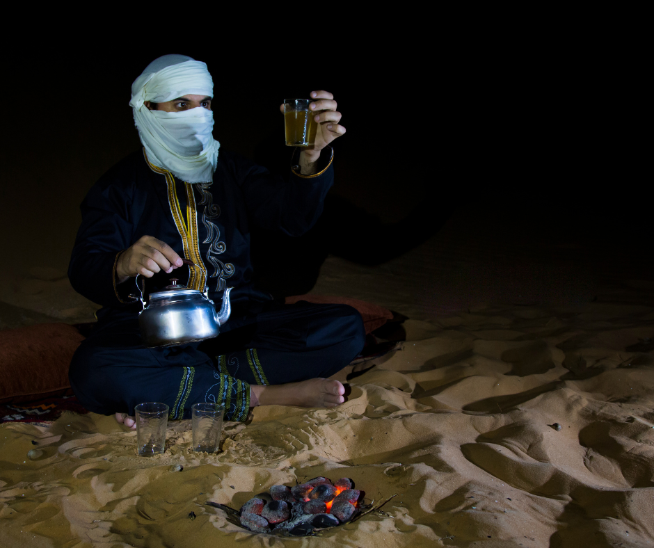
Each round has its meaning, so the saying goes: bitter like life for the first glass, sweet like love for the second, gentle like death for the third. Accept all three: leaving before the third can seem rude.
Preservation Rules for Visitors to a UNESCO Site
The art has survived thousands of years in the open and can be damaged in minutes. The rules are simple.
Protecting the Rock Art
Look, don't touch: skin oils break down the pigments. Never wet a painting or chalk an engraving for a photo. In the 1950s Lhote's team sponged walls with water to copy the paintings, a practice now blamed for fading some of them. Leave flints and potsherds where they lie: smuggling antiquities out of Algeria can mean prison, and old-looking souvenirs may be confiscated at the airport.
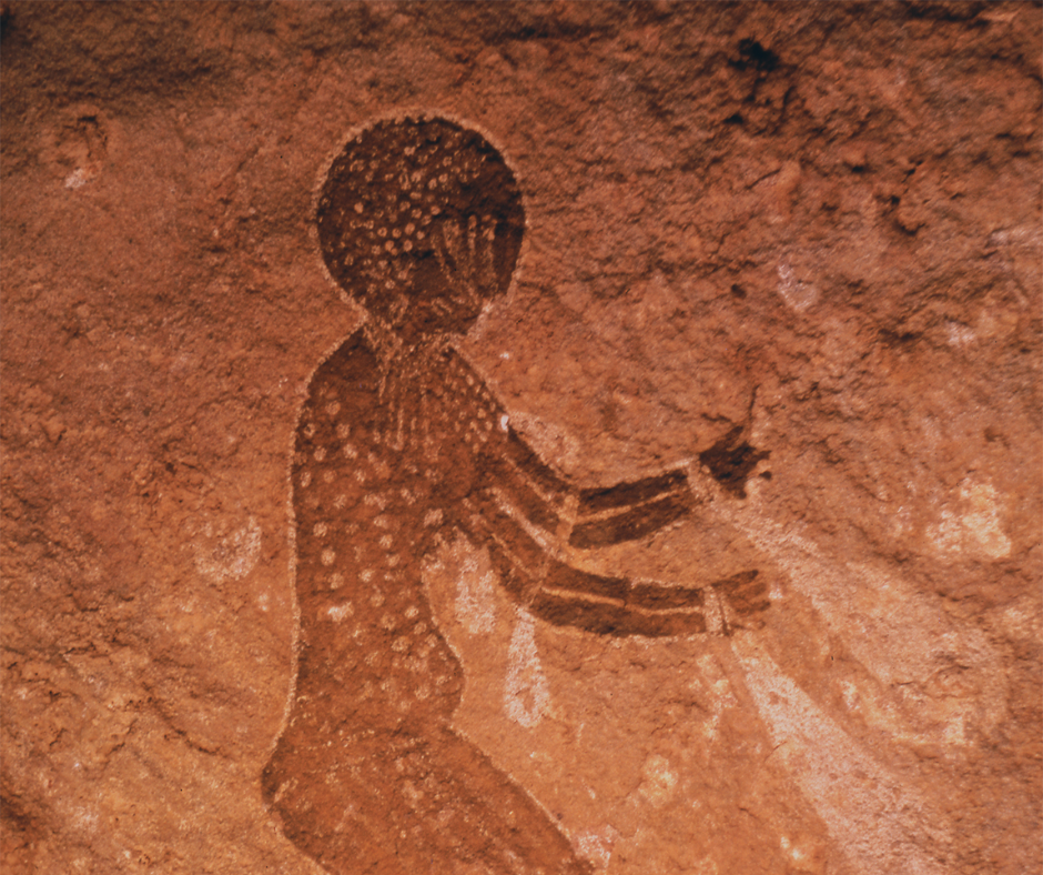
Near the shelters, keep to your guide's paths, and don't lean bags or poles against painted rock.
Sustainable Camping Practices
Camp where camps have been made before, keep fires small and well away from the trees, and leave each site as you found it.
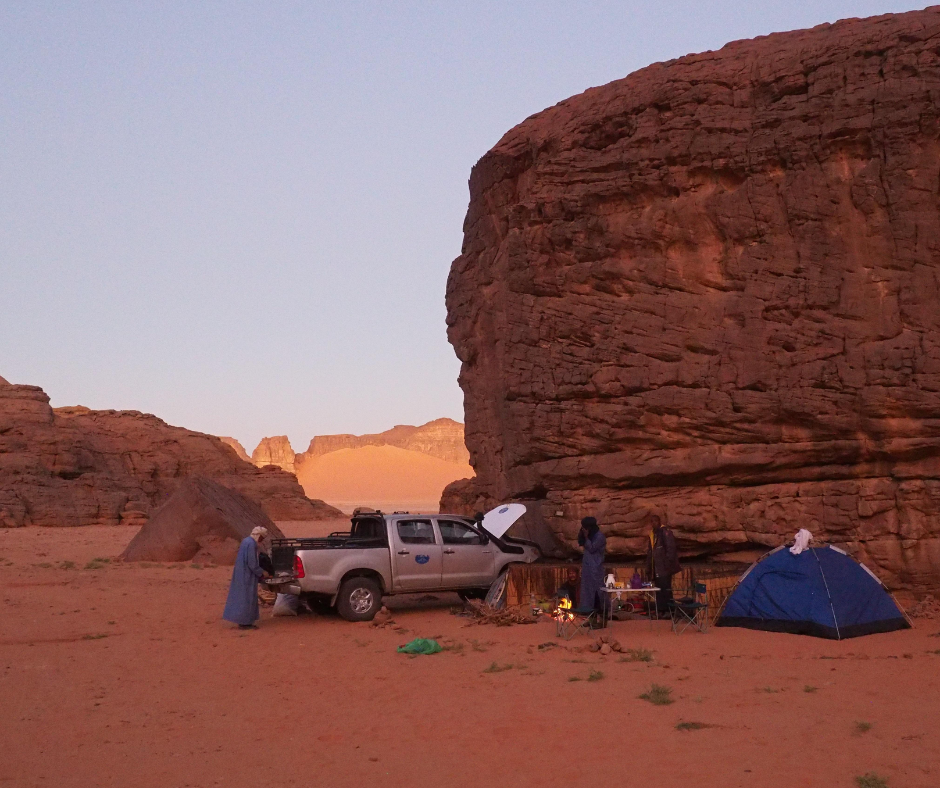
Pack out all waste, food scraps and hygiene products included, to Djanet. Little breaks down in this dry air.
What trekkers ask us about the Tassili
Where is Tassili n'Ajjer National Park? In Algeria's far southeast, on the sandstone plateau above the oasis town of Djanet, toward the Libyan and Nigerien borders; you fly in from Algiers (a little over two hours) or, in some seasons, direct from Paris CDG.
Can you visit Tassili n'Ajjer without a guide? No. The rock art sites are open only to visitors with an official guide, and the park and photo permits come through approved Algerian agencies. In the south, foreigners are expected to travel with such an agency anyway, and it can also handle the Sahara visa on arrival.
How old is the Tassili rock art? For the main traditions, UNESCO gives roughly 10,000 BC to the first centuries AD. The sequence runs from engraved wild fauna through the Round Head paintings and the Pastoral cattle scenes to horses and, last, camels. You'll often read “12,000 years old”, but that fits only the earliest work, and even that dating is debated.
Why is Tassili n'Ajjer a UNESCO World Heritage site? It was listed in 1982 as a mixed site, for culture and nature together: rock art counted among the world's most important prehistoric groupings, plus the sandstone “forests of rock” and an island of Sahelian plants and animals that includes the rare Saharan cypress.
How hard is the Tassili trek? Moderate. The climb up the Akba Tafilalet (600 to 700 m in three to four hours) is the hardest part; after that it's four to five hours a day over sand and rough sandstone, camping every night. Altitude doesn't matter at 2,158 m. Heat, sun and footing do.
Read also: Camping in the Algerian Sahara: Seasons, Gear, Rules and Safety
Plan on walking four or five hours a day, sleeping in a tent for a week and going without signal; the reward is rock art with few other visitors. It suits you less if you want a hotel every night.
Tell us your dates and how much walking you want, and we'll suggest a trek that fits the season; we arrange the Tuareg guide, cook and donkey team, the park permits and the visa-on-arrival request through licensed local partner agencies. All you have to do is send us your trip details.
For more tips, read Algerian Sahara Travel Guide: Routes, Visas & Safety Tips


