

Algiers to Djanet is about 2,150 km by road, five long days of daylight driving, or about 2 hours 15 minutes on an Air Algérie flight. For most foreign visitors the flight is the realistic choice: it saves those five days, and in the deep south foreigners travel with an approved Algerian agency anyway, which also arranges the police or gendarmerie escort assigned on some desert roads.
Tamanrasset, the other big gateway to the deep south, is about 1,920 km straight down the N1, tarmac all the way: three to four long days at the wheel, or about 2.5 hours by air. Whichever you aim for, go between October and April, and keep to the one rule we never bend: no driving between towns after dark.
Below are the overland legs with distances and drive times, what the vehicle needs, the western loop through Taghit and Timimoun, and the Tassili n’Ajjer around Djanet. Distances, fuel prices and safety advice were checked in October 2026.
Fly south or drive it?
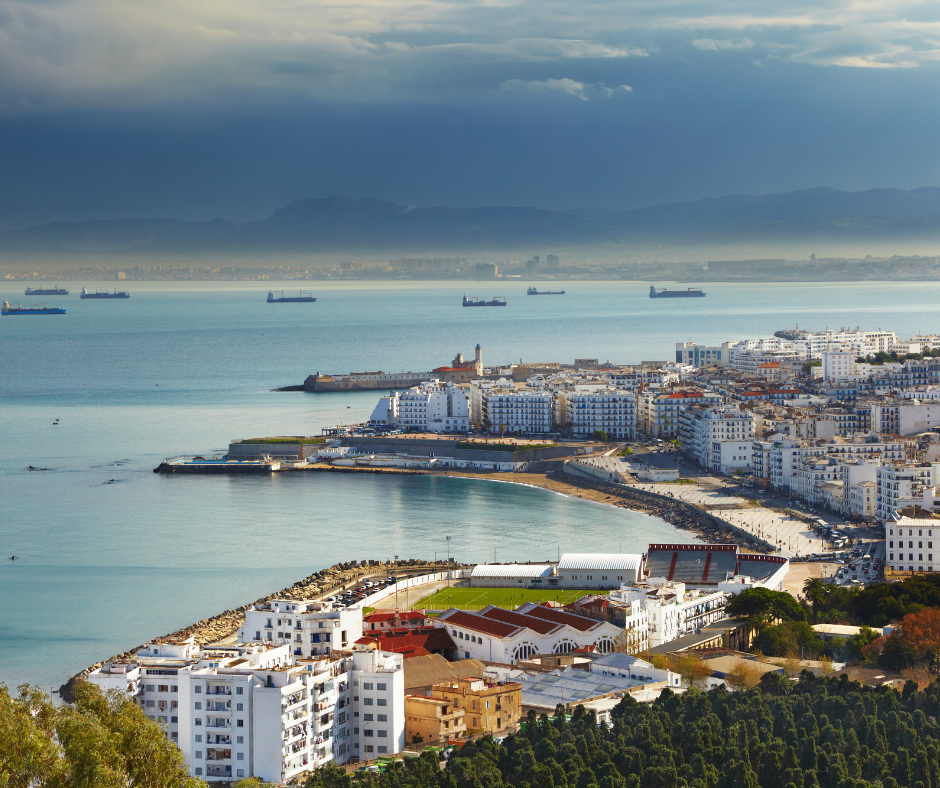
Use Algiers to get organized
Algiers is where you sort out the things that get harder further south, so give it two days before you leave for the Sahara. Get a Mobilis SIM there (you register it with your passport, and no network covers the south better), stock up on any prescription medicine, and carry enough cash for the south, which runs almost entirely on it. If you have booked an agency, it handles the paperwork for the southern leg, including the Sahara visa on arrival if you are using it.
Pack sand-proof bags for your phone and camera, plus spare batteries; both are easier to find in Algiers than in Djanet.
For the city itself, see our15 Best Things to Do in Algiers.
By air in a morning, or by road in five days
The usual way down is the nonstop Air Algérie flight from Algiers to Djanet, about 2 hours 15 minutes, and in the Saharan season (roughly October to May) Air Algérie adds seasonal direct flights from Paris CDG. The second half of the flight crosses the sand seas and plateaus of the eastern Sahara, which gives you a sense of the distances. Domestic flights to the south, and how to book them, are explained in our Algeria public transport guide.
By road, Algiers to Djanet is about 2,150 km on the fastest line (via Biskra, Touggourt and Hassi Messaoud) and about 2,270 km if you stop in the M’Zab Valley. These are the legs via Ghardaïa, with drive times at a steady pace and no long stops. Checkpoints add time.
| Leg | Distance | Driving time | Surface | Overnight |
|---|---|---|---|---|
| East: Algiers to Ghardaïa (N1) | about 600 km | 7 to 8 h | Tarmac | Ghardaïa |
| East: Ghardaïa to Hassi Messaoud via Ouargla | about 280 km | 4 h | Tarmac | Hassi Messaoud |
| East: Hassi Messaoud to In Amenas (N3) | about 735 km | 9 to 10 h | Tarmac | In Amenas |
| East: In Amenas to Illizi | about 250 km | 4 h | Tarmac | Illizi |
| East: Illizi to Djanet | about 405 km | 6 h | Tarmac | Djanet |
| Hoggar: Ghardaïa to El Menia | about 265 km | about 3 h | Tarmac | El Menia |
| Hoggar: El Menia to In Salah | about 400 km | about 5 h | Tarmac | In Salah |
| Hoggar: In Salah to Tamanrasset | about 660 km | 9 to 10 h | Tarmac, rough in places | Tamanrasset |
| Hoggar: Tamanrasset to the Assekrem | about 80 km | 2 to 3 h | 30 km tarmac, 50 km piste (4x4) | Assekrem refuge |
| West: Algiers to Béchar | about 1,000 km | two days, or fly | Tarmac | Béchar |
| West: Béchar to Taghit | about 95 km | 1.5 h | Tarmac | Taghit |
| West: Taghit to Timimoun via Béni Abbès and Kerzaz | about 460 km | about 7 h | Tarmac | Timimoun (or Béni Abbès) |
| West: Timimoun to El Menia | about 365 km | about 4.5 h | Tarmac | El Menia |
| West: El Menia to Ghardaïa | about 265 km | about 3 h | Tarmac | Ghardaïa |
East is the route to Djanet, Hoggar the N1 to Tamanrasset, West the Taghit and Timimoun loop. Times marked "about" are our estimates at a steady pace with no long stops; checkpoints, fuel stops and roadworks add time.
That is five driving days if you follow our firmest rule, no driving between towns after dark, and the Hassi Messaoud to In Amenas day only works if you leave at first light. It is also why independent overland driving to Djanet isn’t realistic for most visitors.
In the deep south, foreigners are expected to be with an approved agency, and where the gendarmerie puts an escort on a stretch of road, that agency organizes it. Overlanders who bring their own 4x4 pay an agency to accompany them: Sahara Overland (July 2026) quotes about EUR 90 a day for an agency escort riding in your car and EUR 120 to 150 when they bring their own vehicle. Everyone else flies.
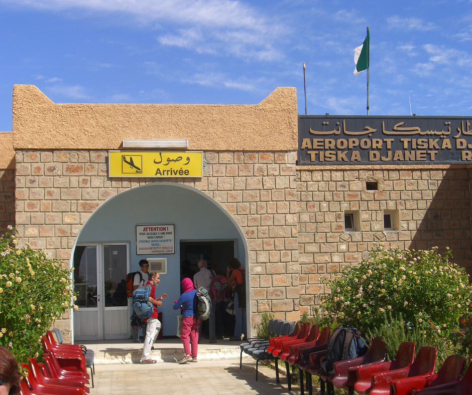
The airport sits about 30 km south of Djanet, and taxis are scarce when a flight lands, so arrange the transfer in advance (on an agency trip it is included). Spend the first afternoon in the palm groves along the wadi, where tens of thousands of date palms shade the gardens, and buy dates in the market.
What to do once you are there is in Djanet, Algeria: Things to Do and Tassili Treks.
Vehicle preparation for desert terrain
Mechanical checks and fuel
If you bring your own vehicle (some overlanders ship one over on the ferries from Marseille or Spain), it has to be ready for long gaps between towns. Before you leave the tarmac, check the tires, including two spares, and make sure the battery is clamped down for corrugated tracks.
Inspect the cooling system and the air filter, because fine Saharan dust clogs filters quickly. The speed limits are 100 km/h outside towns and 120 km/h on motorways, and the road code that came into force in May 2026 (Law 26-09) raised the fine for driving more than 30% over the limit to 25,000 to 80,000 DZD. There are no motorway tolls.
Fuel is cheap. Unleaded has cost 47 DZD a liter and diesel 31 DZD since 1 January 2026: counted at the official rate (about 150 DZD to the euro) that is about EUR 0.31 and EUR 0.21, and with dinars changed on the informal market (about 275) about EUR 0.17 and EUR 0.11. Distance is the problem, not price.
Stations thin out south of Ghardaïa, and Sahara Overland warns that fuel, lodgings and towns in the south can be hundreds of kilometers apart. Fill up at every station even when you are half full, carry reserve fuel in proper jerry cans, and pay in cash, since rural pumps don’t take foreign cards.
Recovery Gear and Emergency Kits
Sand catches out experienced drivers too. Carry a strong shovel, traction boards and a kinetic recovery strap, plus a compressor to reinflate the tires after you have let them down for sand. Keep the emergency kit where you can reach it, not under the luggage.
The kit should hold a first-aid bag, a headlamp and a multi-tool. Bring a paper map of the Tassili region as well. Phone GPS works without signal if you download offline maps, but mobile data is, in the UK Foreign Office’s words, "patchy or unavailable" in remote southern areas. Leave handheld GPS units and satellite messengers at home unless you have authorization: Algerian customs restricts geolocation devices.
Taghit and Timimoun: the western Sahara loop
The dunes of Taghit
Taghit and Timimoun are on the other side of the Sahara from Djanet (Timimoun to Djanet is well over 1,500 km by road), so treat them as a separate trip. Taghit is about 95 km, roughly an hour and a half, from Béchar, which is about 1,000 km from Algiers by road, or a domestic flight.
Right behind the old mud-brick ksar, the Grand Erg Occidental begins as a wall of dunes. Climb the nearest crest early, before the sand heats up, and watch the light move over the palm grove of the Oued Zousfana. In the afternoon, the narrow lanes of the ksar stay in shade.
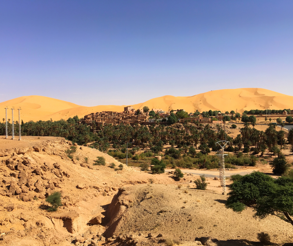
The rock engravings around Taghit are Neolithic, from a time when this part of the Sahara was savanna: giraffes, elephants, ostriches and antelope cut into the sandstone. The best-known site, Zaouia Tahtania, is about 18 km south of town, and Barrebi is another. Go with a local who knows where the clearest panels are, and be ready for some damage: the Algerian press has reported graffiti and degradation at the Taghit sites.
Read also: Algeria Off the Beaten Path: Sahara, M'Zab and Quiet Cities
Timimoun’s red architecture and ksour
From Taghit, Timimoun is about 460 km southeast on paved roads through Béni Abbès and Kerzaz, around 7 hours of driving. The town is built of red ochre earth, and the French laid out its center in a "neo-Sudanese" style in the early 20th century, with crenellated walls, pilasters and pointed wall tops borrowed from West African mud architecture. The oasis gardens still depend on foggaras, underground channels that carry groundwater by gravity. The thick earth walls keep houses noticeably cooler in the hottest hours.
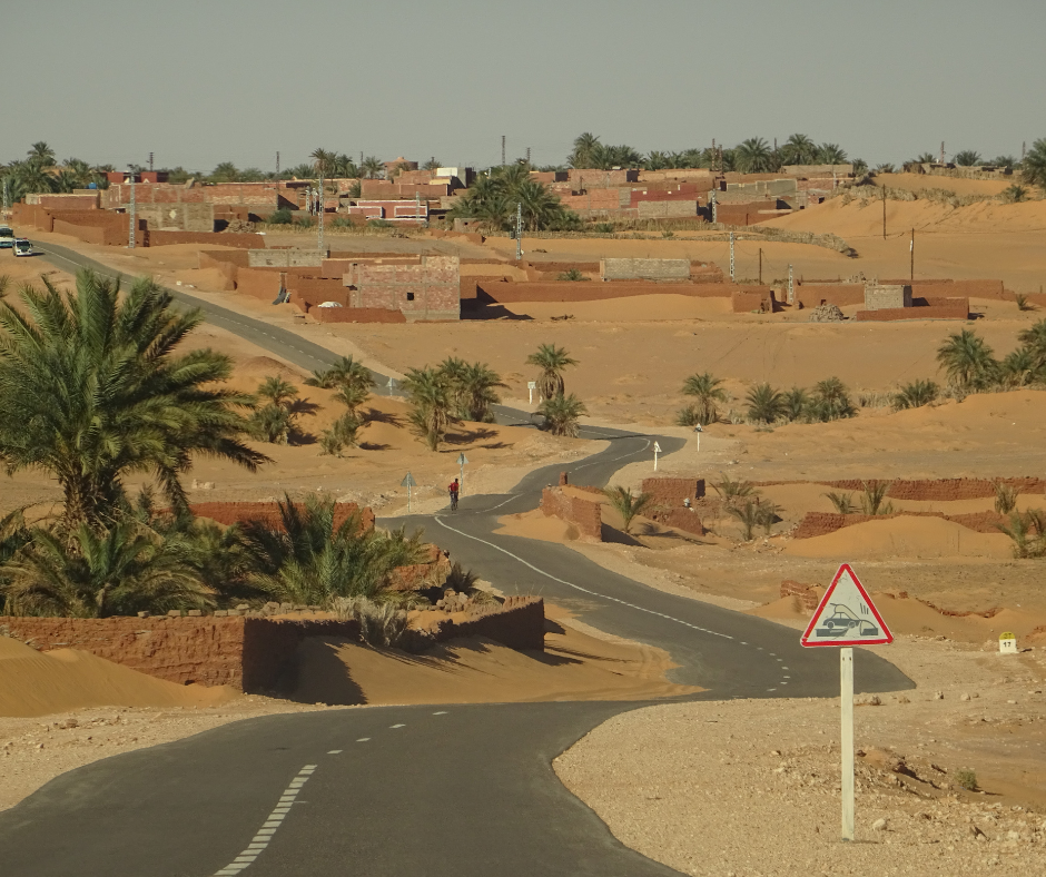
Smaller fortified ksour line the edge of the sebkha, the salt flat northwest of town, and make good sunset viewpoints. They belong to the Zenata-speaking communities of the Gourara, whose Ahellil chant has been on UNESCO’s intangible heritage list since 2008, and a local guide can tell you which ksour are still lived in.
The roads here are paved and foreigners do drive them, though checkpoints will ask about your route. To close the loop, Timimoun to Ghardaïa via El Menia is about 630 km, and Ghardaïa to Algiers another 600.
The Tassili n’Ajjer around Djanet
The painted and engraved sites
The sandstone plateau above Djanet is a national park, and Tassili n’Ajjer has been on the UNESCO World Heritage list since 1982. By UNESCO’s count it holds more than 15,000 paintings and engravings. The oldest are usually dated to around 10,000 BC (the dating is debated) and the most recent to the first centuries AD. Giraffes, elephants, cattle herds and hunters show that this was savanna before it was desert.
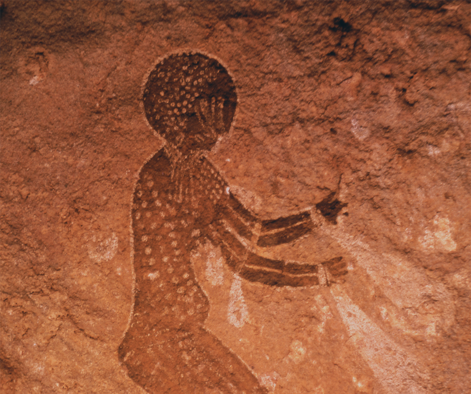
The sites are spread across rough terrain, and the ones on the plateau take several days of trekking, with donkeys carrying the gear, or 4x4 driving to reach. We’d plan at least a week in Djanet. For the Round Head paintings, one of the oldest painting styles, ask for Sefar or Jabbaren.
Periods, styles and trek options are in Tassili n'Ajjer National Park: Rock Art and Treks.
Rock forests, arches and gueltas
Away from the art, erosion has cut the Tassili sandstone into "forests of rock": pillars, arches and narrow corridors. Camp among them and the night is completely silent. Some canyons hold gueltas, rock pools that keep water long after the rare rains.
These pools are the main water source for wildlife and the only patches of green in bare rock. The terrain is complicated, so go with a Tuareg guide who knows which gueltas hold water in which season and which routes are safe; in the park a guide is required anyway. If you are still choosing where to spend most of your time, we compare the main Sahara regions of Algeria in a separate guide.
The Hoggar loop: Ghardaïa to Tamanrasset and the Assekrem
The N1, the Algerian section of the Trans-Saharan highway, runs from Algiers straight south through Ghardaïa, El Menia and In Salah to Tamanrasset, about 1,920 km in all. It is paved the whole way, but the stretch south of In Salah is long, hot and rough in places, and the In Salah to Tamanrasset day of about 660 km is the hardest of the trip.
From Tamanrasset, the classic trip is the Assekrem plateau (about 2,726 m), where Charles de Foucauld built his hermitage in 1911. It is about 80 km away: 30 km of tarmac, then about 50 km of mountain piste that needs a 4x4.
Most groups go up in the afternoon, sleep at the basic refuge and walk the last stretch for sunrise over the peaks of the Atakor, where Mount Tahat (usually given as 2,908 m) is Algeria's highest point. The setup is the same as around Djanet: a licensed agency runs the trip, with local Tuareg guides.
Tamanrasset and Djanet are far apart, so most travelers treat them as two separate trips, each reached by air from Algiers.
Sample itineraries
10 days: the western loop
- Day 1: fly from Algiers to Béchar, then drive to Taghit (1.5 h).
- Days 2 and 3: Taghit, the dunes at sunrise, the ksar and the rock engravings at Zaouia Tahtania and Barrebi.
- Day 4: drive to Béni Abbès (about 3 h).
- Day 5: on to Timimoun via Kerzaz (about 4 h).
- Days 6 and 7: Timimoun, the ksour around the sebkha and the foggara gardens.
- Day 8: Timimoun to El Menia (about 4.5 h).
- Day 9: El Menia to Ghardaïa (about 3 h), afternoon in the M'Zab Valley.
- Day 10: Beni Isguen with a local guide in the morning, then fly back to Algiers or drive the 600 km over a long day.
12 to 14 days: fly-drive to Djanet
- Days 1 and 2: Algiers, then fly to Djanet (about 2 h 15). Transfer and an afternoon in the palm groves.
- Days 3 to 9: seven or eight days with the agency's 4x4, driver, cook and Tuareg guide: the Erg Admer dunes, the rock forests and gueltas, and a trek on the Tassili plateau to Sefar or Jabbaren with donkeys carrying the gear. Expect two to four hours of driving on most days.
- Day 10: back in Djanet, market and rest.
- Day 11: fly back to Algiers; add a day or two there, or a few days in the M'Zab, if you have them.
Where to sleep along the route
Ghardaïa, Béchar, El Menia and Ouargla have ordinary hotels and a few guesthouses. In Ghardaïa, Hôtel M'Zab and El Djanoub are established hotels, and in Taghit, Bladi Palace is the best-known hotel, with fixed camps by the dunes. Further south, in In Salah, Illizi and In Amenas, choice is thin and basic, so book ahead or let the agency arrange it.
In Djanet and Tamanrasset most visitors sleep in guesthouses or desert camps organized by their agency, and on the Assekrem there is only the refuge. In the northern towns a basic room runs to about 4,000 to 7,000 DZD a night (autumn 2026), and Christmas and New Year, the busiest weeks of the Sahara season, fill up early.
What a desert road trip costs
Fuel is the smallest item. A loaded diesel 4x4 using about 12 liters per 100 km burns roughly 270 liters between Algiers and Djanet (2,270 km). At 31 DZD a liter (2026) that is about 8,400 DZD, around EUR 56 at the official rate or EUR 30 at the informal rate.
Most of the money goes elsewhere: the agency escort or crew (about EUR 90 a day in 2026 for an escort riding in your car), town rooms at 4,000 to 7,000 DZD a night, park and guide fees in the Tassili, and crew tips of 1,500 to 2,000 DZD per traveler per day.
Renting a 4x4 or bringing your own
In the deep south the agency rule decides it for you: the 4x4 comes with the agency's driver, so self-drive rental is not really an option there.
Overlanders bring their own vehicle on the ferries from Marseille or Spain. At the port, customs issues a temporary import permit (valid 90 days in the 2026 rules) and you buy Algerian car insurance. You also need an International Driving Permit in the 1949 Geneva format. In the south, you still pay an agency to accompany you.
Scenic roads on the way south
- El Kantara gorge and the Ghoufi canyon: between Batna and Biskra, the road squeezes through the El Kantara gorge, the traditional gateway to the Sahara. A detour leads to the Ghoufi balconies, a troglodyte village above the Oued Abiod canyon.
- The Tikjda pass, Djurdjura: a mountain road through cedar forest below Lalla Khedidja (2,308 m), sometimes blocked by snow in winter.
- The descent into the M'Zab: the N1 crosses the bare rocky Chebka plateau before dropping into the valley, with the five ksour of Ghardaïa rising on their hills.
Sand driving and navigation basics
Tire Pressure and Traction Strategies
On most trips the agency’s driver handles the sand, but if you are driving, the Grand Erg Occidental around Taghit is where you meet real dunes. The first step is to lower tire pressure, so the tire spreads a longer footprint and floats on the sand instead of digging in. Keep steady momentum on the way up a dune, and come down straight, never at an angle, to avoid a rollover.
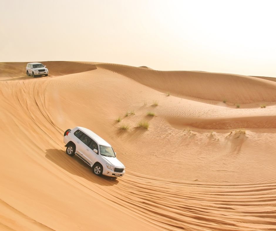
If the vehicle starts to bog down, stop at once. Spinning the wheels only digs you deeper and makes the recovery harder.
Read also: Driving in Algeria: Rules, Permits & Road Tips
Route Finding and Waypoints
Phone GPS with offline maps works in the Sahara, but visual landmarks still matter. Learn to read dune shapes and the direction of the wind ripples on the sand.
Mark waypoints such as wells and known campsites before each leg, and track fuel use per kilometer, since soft sand burns far more fuel than tarmac. Before you leave the road, give a local contact in Djanet or Taghit (your agency or guesthouse) your route and expected arrival time. Sahara Overland points out that there is no dedicated desert rescue service in Algeria, so that message is your safety net.
Packing for Saharan temperatures
Layering Systems for Temperature Swings
Desert temperatures swing hard between day and night. Wear light-colored, breathable clothes by day. Long sleeves and trousers beat shorts because they keep off UV and blowing sand, and they are what people expect in the south anyway. After sunset the temperature drops quickly, and in December and January nights get close to freezing, colder still up on the plateau.
Bring a fleece or down jacket for evenings in camp, and a cheche (the Tuareg head wrap) or a long scarf. It shades your head by day, keeps you warm at night and goes over your face in a sandstorm.
For the rest of the bag, see What to Wear in Algeria.
Water and food
In dry heat you lose water before you feel thirsty, so sip all day and add electrolytes. Count on five to seven liters per person per day for drinking, plus a reserve in the vehicle in case of a breakdown. For food, take nuts, dried fruit and canned sardines.
Nuts, dried fruit and sardines keep in the heat and pack small. Djanet’s market sells fresh dates and bread, and on an agency trip meals are normally part of the package, so ask what is included.
Guides, agencies and safety
Hiring Local Tuareg Guides
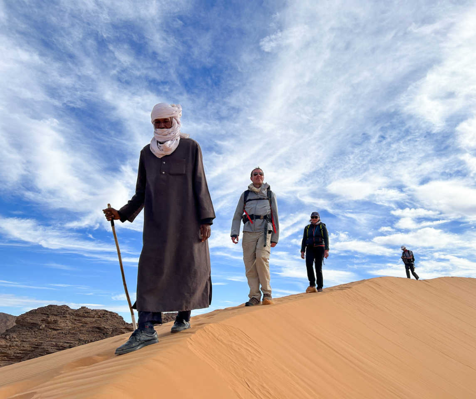
A local guide is there for your safety and for knowledge no map gives you. Tuareg guides from Djanet know the plateau routes and the rock-art panels that appear on no map, and how to greet the nomadic families you may meet along the way.
Book through an agency licensed by Algeria’s Ministry of Tourism. Only an approved agency can arrange the Sahara visa on arrival, and it is the arrangement the authorities expect for foreigners in the south. A good team also runs the camp, keeps the vehicles going and explains Tuareg life as you travel.
Read also: Tuareg Desert Trek in Algeria: Nomad Life
Permits and Legal Requirements
The Tassili and the Tadrart are some of the most striking country in the Sahara, and the Tuareg welcome in Djanet is a big part of the trip: travelers on our trips are often surprised by how relaxed the town feels compared with what they had read before coming. Our southern trips stick to routes we know well, run with a licensed Algerian agency and local Tuareg guides, and have not had a single incident.
Ahead of booking, read the official travel advice that currently applies to your route and check that your insurance covers it. Inside the Tassili park, entry and the guide are arranged through your agency.
Carry your passport and visa, plus several photocopies. Expect frequent checkpoints on the main roads.
In the Sahara you will be with an approved agency anyway, and where the authorities put a police or gendarmerie escort on a desert route, the agency deals with it; our Algeria travel guide has more on this, along with the emergency numbers: police 17 or 1548, ambulance 1021, fire 14. The checks are routine: slow down, wait to be waved forward and have your documents ready. For a long off-road route, let the agency file the paperwork in advance to avoid delays.
Entry rules and the visa on arrival are covered in Algeria Visa: Requirements and Visa on Arrival.
Escorts, ferries and the best month for the drive
Can I drive myself through the Algerian Sahara?
On the main paved roads of the northern Sahara, to Ghardaïa, Taghit or Timimoun, foreigners do drive, though checkpoints will ask about your route. In the deep south the authorities expect you to travel with an approved agency, so overlanders with their own car pay an agency to accompany them.
Will a police car follow us the whole way?
Only on some desert routes, mostly in the deep south, where the authorities attach a police or gendarmerie escort to foreign travelers. Your agency requests it, and you drive at the escort's pace, so allow extra time.
Can I bring my own car to Algeria on the ferry?
Yes. Ferries from Marseille and Spanish ports carry vehicles in the summer season. At the port you get a temporary import permit, valid 90 days in the 2026 rules, and buy Algerian car insurance. Bring an International Driving Permit (1949 format) and expect an agency escort in the south.
Which month would you pick for the drive?
November or March: warm days without the cold desert nights of December and January. The workable season is October to April; in July, oasis towns average around 45°C in the afternoon.
Final checks before you leave
The night before you set off, check the spare tires one last time and charge your power banks, because after Djanet the phone signal comes and goes. Go between October and April: from May to September the heat makes most desert trips impractical. With one to two weeks, pick one side of the Sahara, Djanet and the Tassili or Taghit and Timimoun.
The full Algiers to Djanet drive suits overlanders with time to spare and an agency escort. Everyone else should fly and spend those five days in the desert instead of on the N3.
WildyNess organizes guided trips and custom itineraries in Algeria, including the Sahara. For a desert trip we put together the crew (local guides, cooks and drivers), meet you at Djanet airport and file the visa-on-arrival request through our licensed Algerian partner agencies, and we can plan a route that pairs Algiers with Djanet or with the Taghit and Timimoun loop.
Questions about road conditions or equipment? Write to us through our contact page, or send us your dates and we’ll suggest a route.


