
Navigating a new city's public transportation system can be confusing, especially when local rules and customs differ from what you're used to. Dubai has developed a modern and efficient network of buses, metros, and taxis, but using it smoothly requires knowing a few key guidelines.
That is why our team at WildyNess created this guide to help you master the local transit networks like a seasoned professional.
But first, let's understand the Urbanlayout and transit zones and identfy the main transit corridors.
Understanding the Urban Layout and Transit Zones
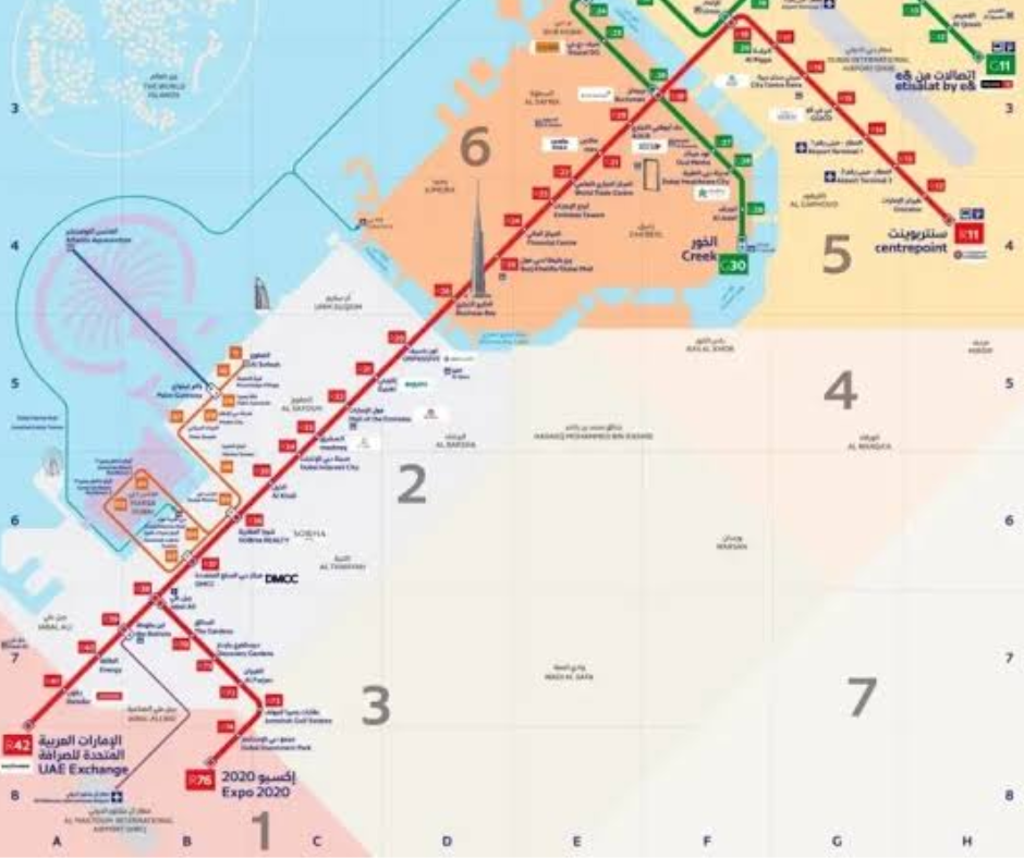
The geographic footprint of the city stretches long along the coastline, meaning distances between major hubs require a clear transit strategy. The government divides the entire municipality into seven distinct transportation zones, and your fare calculates automatically based on how many zones you cross during a single journey.
You can transition between different modes of transport, such as moving from the underground rail to a surface bus, within a thirty-minute window without triggering a completely new base charge. This integrated setup makes it highly economical to combine different systems if you map your path correctly before setting out.
Identifying the Main Transit Corridors
The primary transportation spine runs parallel to the coast along the multi-lane highway known as Sheikh Zayed Road. The heavy rail system tracks this corridor directly, serving as the fast backbone for any long-distance travel across the northern and southern halves of the city.
Secondary networks, including surface trams and marine vessels, loop through concentrated coastal communities to manage local traffic.
Recognizing that the city is built in clusters helps you choose the fastest options, allowing you to use rail for long straight distances and public buses or boats for localized neighborhood movement.

Mastering the Dubai Metro Rail Infrastructure
The automated rail network serves as the fastest method to bypass highway congestion, operating completely driverless across elevated tracks and underground tunnels.
The system relies on two primary lines that intersect at key geographic junctions, making it straightforward to map your route across the main commercial districts.
Navigating the Red Line Route and Major Hubs
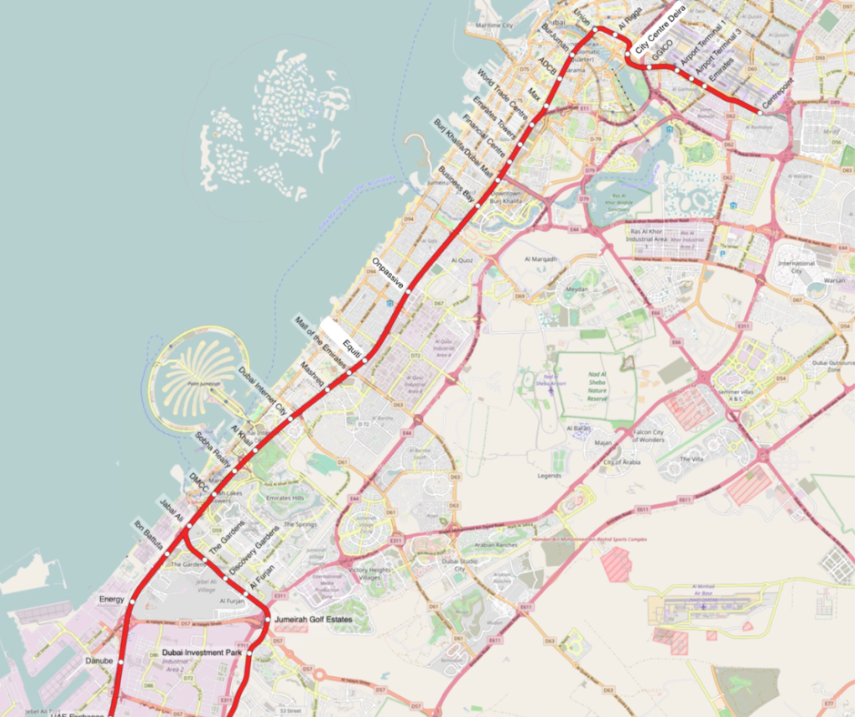
The Red Line functions as the primary transit artery, spanning from Centrepoint near the airport all the way south to the industrial hub of Expedition City. This line connects major arrival points including Airport Terminal 1 and Terminal 3 directly to prominent commercial centers such as the Downtown district, the financial center, and the marina.
Trains arrive at intervals of less than four minutes during morning and evening rush hours, making it incredibly reliable for time-sensitive travel.
When boarding, always check the final destination listed on the platform screens because certain trains terminate early at intermediate yards rather than running to the end of the line.
Utilizing the Green Line for Historic Neighborhoods
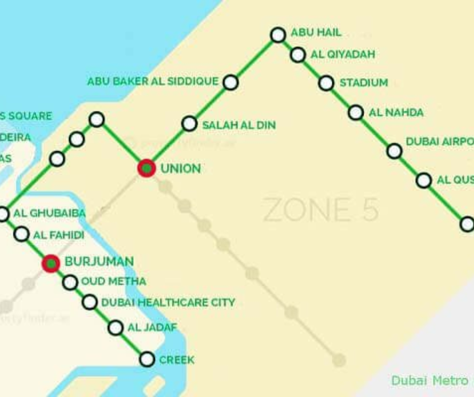
The Green Line forms a specialized loop around the historic core of the city, focusing heavily on the neighborhoods flanking the historic saltwater creek.
It begins at Etisalat and terminates at the historic creek area, providing direct access to traditional market districts, cultural museums, and municipal administrative buildings.
Travelers looking to explore traditional textile marketplaces or gold trading centers will find this line far more useful than the Red Line.
To transfer between the two rail systems, you must disembark at either Union Station or BurJuman Station, which are large multi-level interchange hubs equipped with clear directional signage and floor markings.
Understanding Cabin Classes and Rail Rules
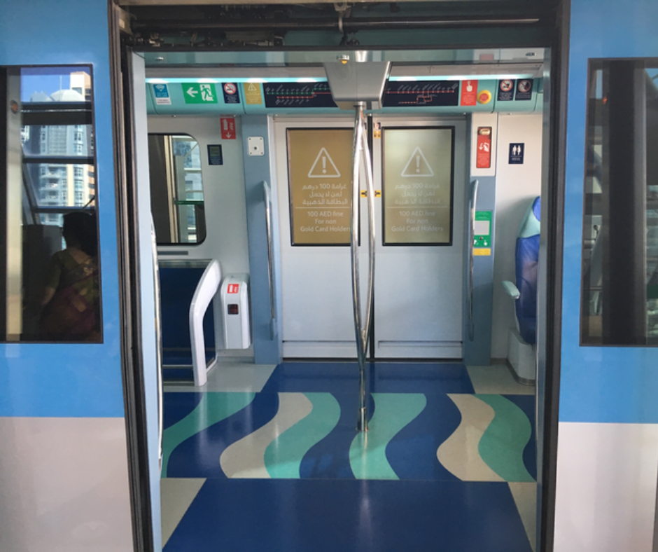
Every train on the network features distinct cabin configurations designed to cater to different passenger preferences and regulatory requirements. The standard compartments are open to all ticket holders, but each train also contains a dedicated Gold Class cabin at one far end which requires a premium fare for entry.
This premium section offers wider leather seating, clearer panoramic views through the front or rear glass, and significantly more space for personal luggage.
Additionally, every train includes a clearly labeled section reserved exclusively for women and young children, marked by pink signs on the platforms and inside the cars.
Entering these restricted zones or consuming food and beverages anywhere on the train can result in immediate fines from transit inspectors.
Coastal and Specialized Marine Transit Networks
Surface rail and marine vessels provide essential connectivity along the specialized beachfront and waterfront developments where traditional buses would face severe traffic delays.
These systems offer highly practical transit functions while delivering excellent views of the modern waterfront infrastructure.
Riding the Dubai Tram Along the Marina Coast
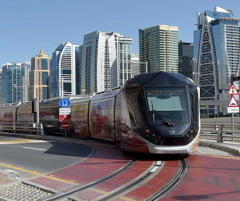
The coastal tram system operates as a surface loop through the dense residential and commercial towers of the marina district and the beachfront promenade. This low-floor rail system links directly to the Red Line of the metro at two specific points, which are the Sobha Realty Station and the DMCC Station.
The tram provides a highly efficient way to reach beachside shopping complexes and dining districts without walking long distances in the high summer humidity. The platforms feature fully enclosed glass doors that sync perfectly with the arriving tram cars, maintaining a fully air-conditioned environment from the street to the vehicle interior.
Elevating Travel with the Palm Jumeirah Monorail
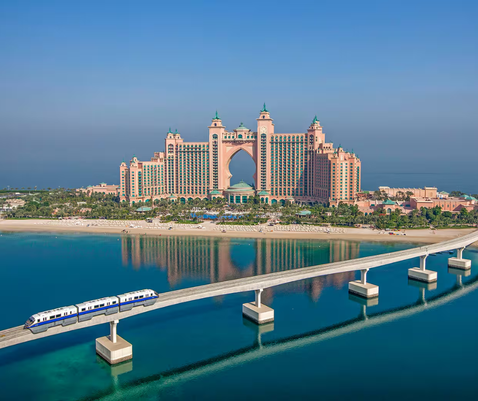
The elevated monorail system provides the only public rail connection to the massive man-made archipelago extending into the sea. This independent transit line connects to the broader tram network at the Palm Gateway station, requiring a separate ticket purchase since it operates outside the standard municipal tariff zone.
The train travels along the central trunk of the palm structure, stopping at key retail centers and residential developments before terminating at the water park resort at the outer crescent. Securing a seat at the very front of the vehicle provides an unobstructed view of the coastal engineering layout, making it an essential route for architectural photography.
Crossing the Waterway in a Traditional Motorized Abra
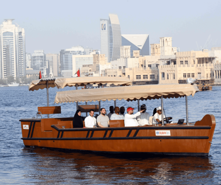
The oldest and most traditional form of public transit consists of small, open-air wooden boats known as abras that ferry passengers across the historic central creek. These vessels operate continuous point-to-point shuttle services between established docks in the historic quarters of Deira and Bur Dubai.
The classic motorized service charges a nominal fee collected in cash by the captain once onboard, moving you across the water in less than five minutes.
For travelers seeking greater comfort, the transport authority also operates modern, fully enclosed, air-conditioned versions of these water buses along expanded routes connecting to the canal district.
Operating the Surface Public Bus Infrastructure
The extensive municipal bus network serves as the ultimate last-mile transport solution, extending reach into residential communities, public beaches, and suburban zones untouched by the rail lines. Operating hundreds of distinct routes, the fleet consists of modern, low-emission vehicles equipped with dedicated lanes to ensure reliable timing.
Utilizing Metro Feeder Buses for Neighborhood Connections
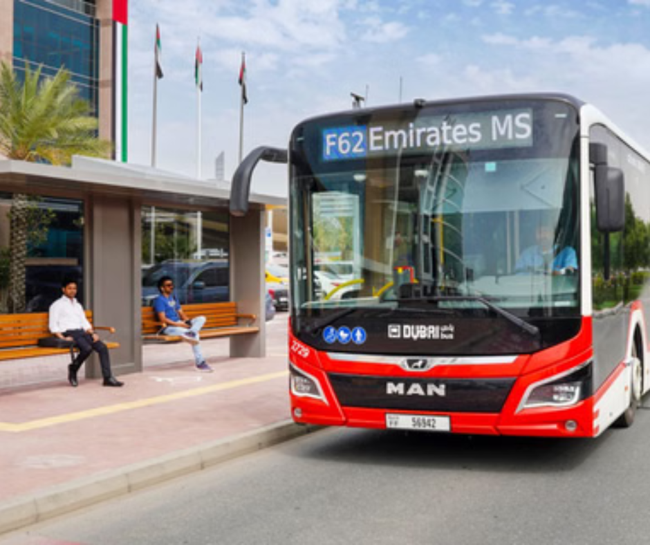
Every major rail station features an integrated bus terminal designed specifically to distribute passengers into the surrounding neighborhoods via feeder routes.
These specific routes are designated by the letter F preceding the route number, making them instantly recognizable on transit signage. Using these feeder networks allows you to exit the high-speed rail line and immediately board a bus that drops you within steps of your specific hotel or destination.
The bus timetables are synchronized electronically with train arrivals, drastically minimizing the time spent waiting on the outdoor platforms during peak travel hours.
Navigating Major Urban and Intercity Routes
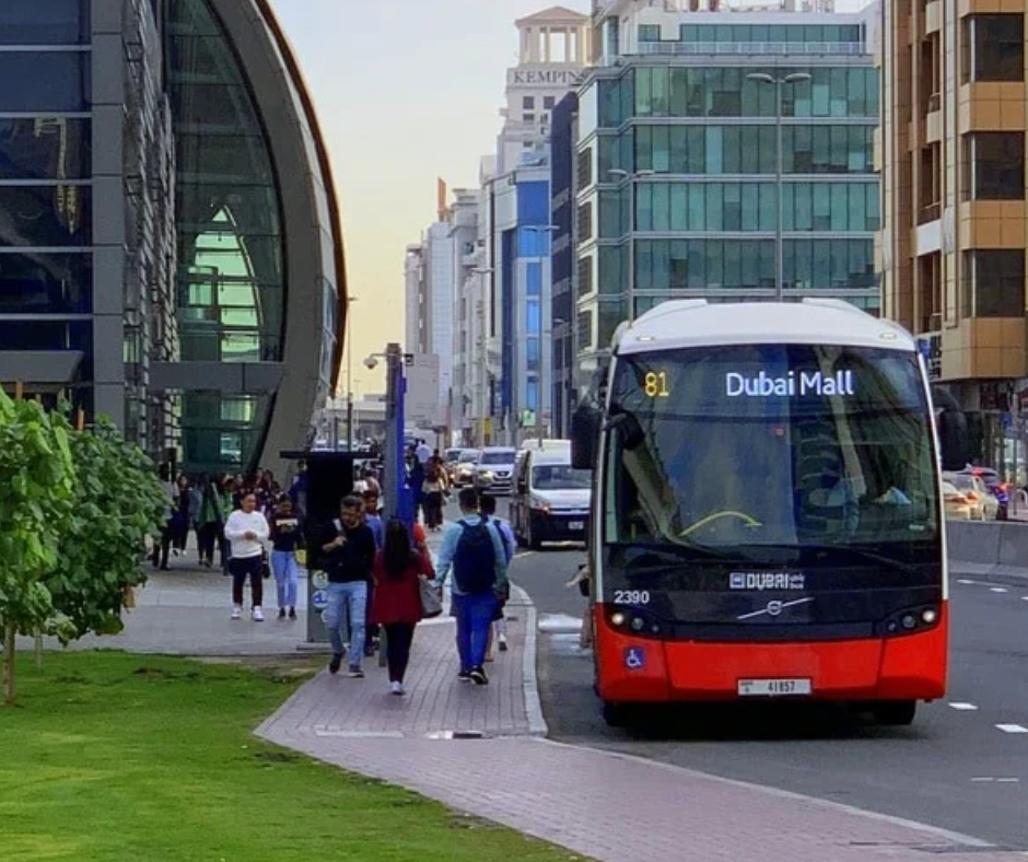
Beyond the localized feeder loops, the transport authority runs high-capacity trunk routes that traverse long distances across the city without relying on the metro line tracks.
For instance, Route 8 runs continuously along the coastal road, linking the historic quarters directly to the public beaches and distant resort zones. If you are looking to explore outside the immediate municipal borders, the central bus stations also operate heavy coaches that travel directly to neighboring emirates such as Abu Dhabi and Sharjah.
These intercity lines accept standard electronic transit cards, providing an exceptionally affordable option for regional exploration.
Understanding Station Amenities and Wait Logistics
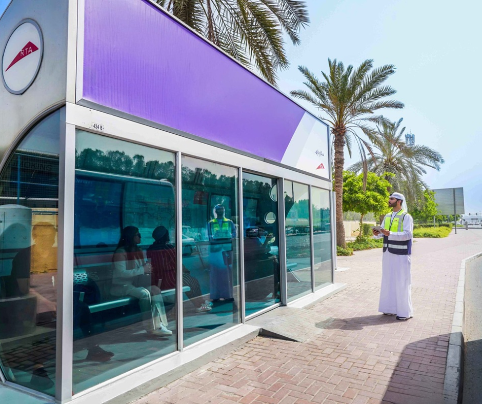
To combat extreme seasonal temperatures, the city features hundreds of fully enclosed, air-conditioned passenger shelters at major bus stops along every route.
These smart shelters provide digital displays showing real-time bus arrival countdowns, automated card recharging kiosks, and free public wireless internet access.
When waiting for a bus to arrive, you must remain inside the cooled shelter until the vehicle approaches, then step outside onto the designated boarding line to signal the driver clearly. Passengers must board through the front door and exit through the rear doors to maintain a smooth internal flow inside the vehicle.
Fare Management via the Unified Nol Card System
The entire multi-modal transit network operates on a completely cashless electronic payment system called the Nol card. Acquiring this card before boarding your first vehicle is absolutely mandatory, as individual drivers and conductors cannot accept cash or issue paper tickets.
Choosing Between Silver and Gold Card Tiers
The transport authority issues four distinct categories of transit smart cards, but international travelers generally only need to consider two main choices.
The Silver Card is the standard option, pre-loaded with a set balance and valid for immediate use across all standard cabins on the metro, buses, and trams.
If you prefer to travel in the premium cabins, you must purchase a Gold Card, which deducts the higher premium tariff automatically whenever you tap through the station gates. Both card variants remain valid for five years from the date of purchase, allowing you to reuse the exact same card on subsequent regional trips.
Procedures for Tapping In and Maintaining Balances
To ensure accurate fare calculation, you must physically tap your card against the electronic reader gates at the exact moment you enter a station and tap again when you exit.
For surface buses and trams, the readers are positioned directly adjacent to the vehicle doors rather than at station gates. Forgetting to tap out at the end of your journey results in the system charging the maximum possible zone fare, which quickly drains your card balance.
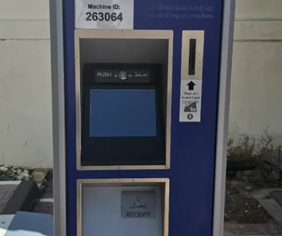
You can easily check your remaining funds on the digital screen of any gate or use the automated vending machines found inside every station concourse to top up your balance using cash or international credit cards.
Integrating Official Municipal Taxi Services
When public rail lines or bus schedules do not align perfectly with your daily destination targets, the regulated municipal taxi network provides a reliable door to door alternative.
Managed directly by the Roads and Transport Authority, these vehicles operate on standardized meters that calculate fares transparently based on distance and specific toll crossings.
Catching a Premium Airport Taxi from Terminal Ranks
Landing at a major international terminal presents immediate transport choices, and the most direct ground solution is located at the official airport taxi ranks.
These dedicated premium airport vehicles are easily found lined up outside the arrival halls of Terminal 1, Terminal 2, and Terminal 3. They feature a higher base fare compared to standard street vehicles, reflecting their capacity to handle large volumes of passenger luggage and their immediate convenience.
The drivers operating from these specific terminal ranks are highly familiar with major hotel developments and regional highways, ensuring a swift exit from the airport infrastructure.

Hailing a Standard Cream Coloured RTA Street Taxi
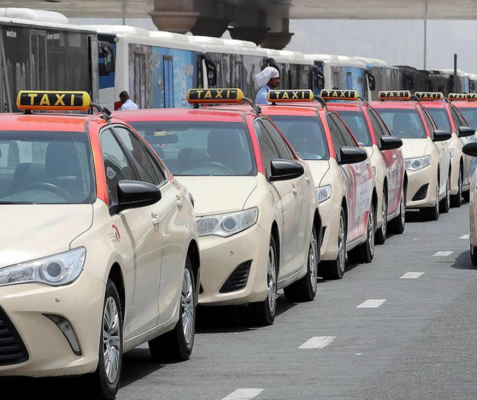
Once you are inside the city proper, you can easily hail a standard cream coloured RTA street taxi from almost any curb or public shopping corridor. These standard vehicles are easily identifiable by their corporate cream livery, though their roof colors vary to indicate different franchise operators under municipal regulation.
You can wave to a passing vehicle with a lit roof sign, locate a designated taxi bay outside a major commercial center, or book one digitally through a local ride hailing application.
They accept payments via cash, international credit cards, or your standard electronic Nol transit card, making them highly versatile for quick neighborhood jumps.
Navigating Commuter Currents and Security Protocols
Managing your movement through heavy pedestrian crowds requires a solid understanding of local corporate schedules and general platform etiquette. Being fully aware of how the stations operate during high-traffic windows ensures you maintain personal comfort while respecting local spatial norms.
Managing Travel Around Peak Commuter Hours
The transit system experiences heavy surges in passenger volume twice daily, corresponding directly with standard office and school hours.
The morning peak runs from approximately seven in the morning until nine thirty, while the evening rush develops between five and eight in the evening.
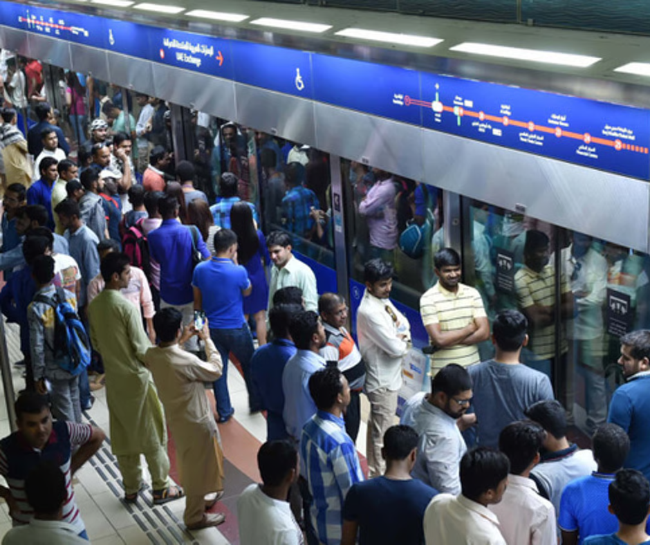
During these specific windows, platforms can become exceptionally crowded, and you may need to wait for multiple trains to pass before finding space to board a standard cabin safely.
If you are traveling with large items of luggage or looking to capture scenic photographs, we highly recommend scheduling your travel during the mid-day hours when the trains are significantly quieter.
Observing Safety Measures and Station Etiquette
The transportation network maintains an exceptionally high standard of safety and cleanliness through continuous electronic monitoring and strict enforcement of code compliance.
It is critically important to stand completely clear of the platform edge doors, allowing arriving passengers to exit the vehicle completely before you attempt to step inside.
The stations feature distinct directional lanes painted onto the floor to organize pedestrian traffic near escalators and elevators, and remaining on the correct side ensures everyone moves efficiently. Keeping your personal belongings zipped and close to your body inside crowded cars is a standard smart practice that helps prevent accidental losses during sudden stops on the elevated tracks.